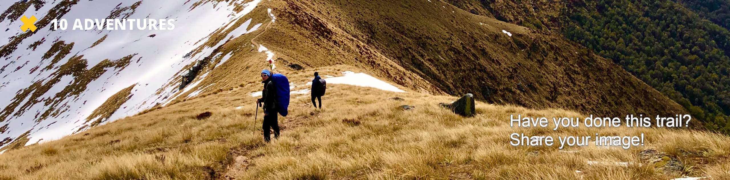
Mount Si Trail
View Photos
Mount Si Trail
Difficulty Rating:
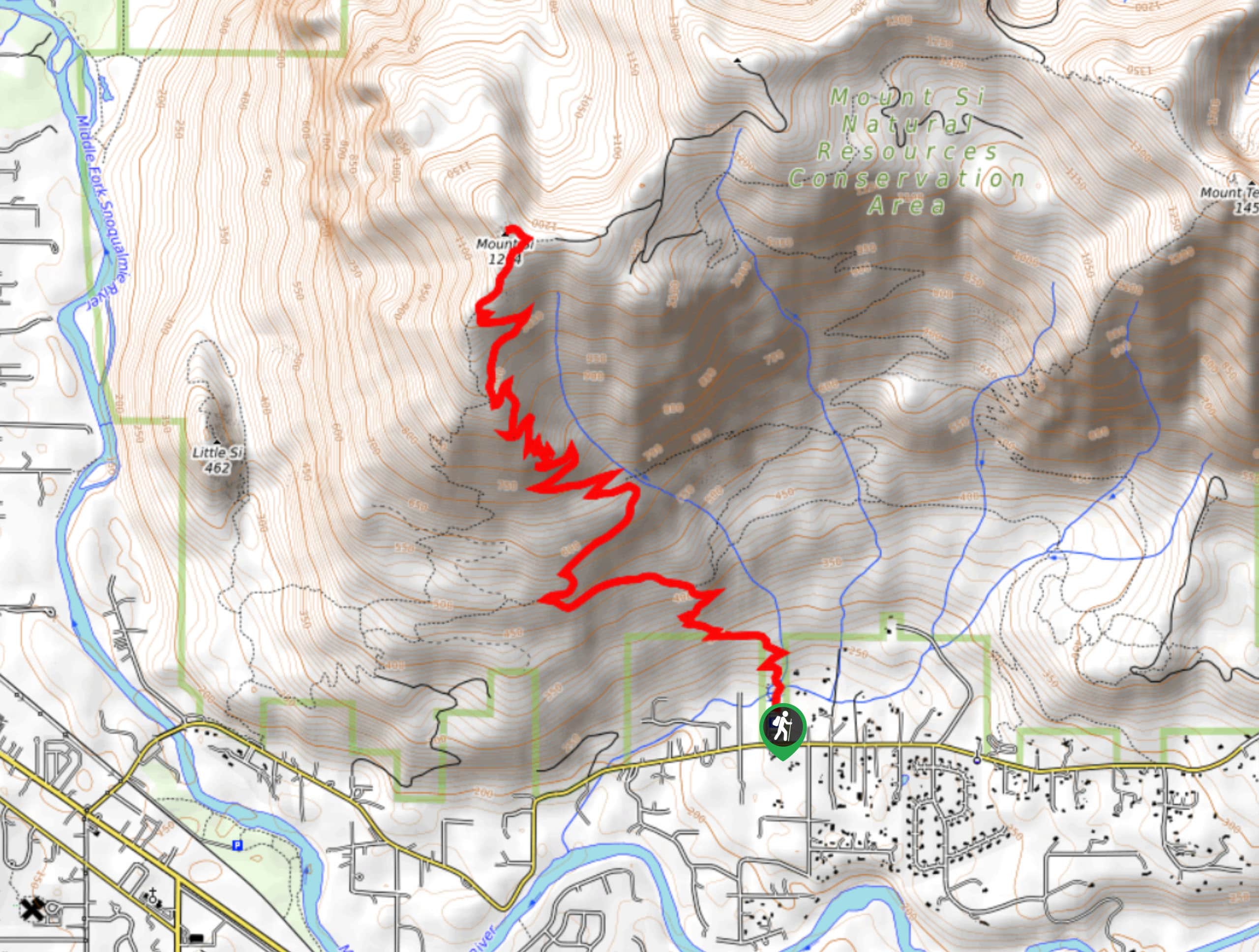
The Mount Si Trail is a 7.5mi out and back trail that sees heavy traffic and is rated as hard. This hike is completed by upwards of 100,000 people per year, partly because of its proximity to Seattle and partly because of its wild beauty. On a trail this well-used, exercising good trail etiquette is essential.
The hike itself is fairly demanding, not just for the elevation or length, but because of the Haystack, a scramble that leads to the mountain’s true summit. While it’s worthwhile to climb the Haystack if you feel comfortable doing so, many hikers enjoy the great views just below the true summit, making this a somewhat easier hike.
Getting there
The trailhead for the Mount Si Trail is located on SE Mt. Si Road, 2.4mi past the turn onto the road. The trailhead is on your left.

About
| Backcountry Campground | No |
| When to do | May-October |
| Pets allowed | Yes - On Leash |
| Family friendly | No |
| Route Signage | Average |
| Crowd Levels | High |
| Route Type | Out and back |
Mount Si Trail
Elevation Graph
Weather
Mount Si Trail Description
A truly staggering number of people hike Mount Si Trail every year, and for good reason- it’s beautiful, and it’s reasonably close to Seattle. This hike is a solid workout, gaining 3100ft in just under 4.0mi. It’s enough of a challenge for stronger hikers, but many novice hikers choose Mount Si as their first “hard” hike. Very experienced hikers often bring weighted packs to Mount Si to train for their ascents of Mount Rainier. It’s said that if they can reach the summit in less than 2 hours, they’re ready for Rainier.
Some hikers stop just below the true summit, known as the Haystack. Climbing the Haystack is very possible, but just involves some hands-on scrambling, which may or may not entice all hikers. That’s fine! The views from below are still spectacular.
The trail begins from the parking lot, immediately launching into switchbacks. The ascent is more gentle initially and even flattens out near Snag Flat, a group of old-growth trees. Take a moment to appreciate these trees, even if you’re eager to make good time.
The trail becomes steeper after Snag Flat, and you’ll likely start huffing and puffing. Take a breather at the break in the trees about 3.5 miles in.
Continue climbing, taking on a short, very steep section before reaching a talus slope about a 0.3mi past the lookout. The view to the southeast is amazing, and Mount Rainier stands proud in the distance. Some hikers call it a day here, and if you’re not out to conquer the whole mountain, this is a good spot to turn around.
If you ARE out to conquer the mountain, keep going. Take the stone steps to your right, ducking back into the forest before emerging to another great view. You’ll be able to see the Snoqualmie Valley, the Olympics, and Seattle from here.
From this spot, you’ll be able to see the Haystack and the lower false summit. You can either soak up the views from the lower summit or take the scramble up to the top of the true summit. Take care on the way down.
Once you’re ready, retrace your steps, taking care with your footing on the steep sections and remembering to yield to uphill traffic as you descend.
Hiking Route Highlights
Mount Rainier
The tallest mountain in the state is a dominant part of your view on the Mount Si Trail. This 14,409-foot stratovolcano is an iconic sight and the highlight of your view while hiking this route.
Frequently Asked Questions
Can you hike Mount Si in the winter?
Yes, this hike can be completed year-round. There is no significant avalanche risk on the mountain, but the steep trail may become slippery in cold conditions. Enjoy the winter solitude!
Is Mount Si Twin Peaks?
Yes! Mount Si is the twin peak in Twin Peaks.
What pass do I need for Mount Si?
Please have your Discover Pass ready for this hike.
Insider Hints
You can take the Trailhead Direct bus from Seattle to Mount Si to avoid issues with parking.
This trail is well-maintained, but you should still work to mitigate the effects of heavy foot traffic. Pack out what you pack in and try to stay on the trail to cut down on erosion and damage to the foliage beside the trail.
You’re quite likely to meet some mountain goats on this hike! Keep a respectful distance while you admire them.
Similar hikes to the Mount Si Trail hike

Lakes Dorothy, Bear, Deer, and Snoqualmie Hike
The Lakes Dorothy, Bear, Deer, and Snoqualmie Hike provides access to Lake Dorothy, Bear Lake, Deer Lake, and Snoqualmie Lake.…

Gold Creek Trail to Joe Lake
Gold Creek Trail to Joe Lake is not a hike for the faint of heart. This lightly trafficked trail is…

Basin Lake via Bullion Basin Trail
Basin Lake via Bullion Basin Trail is a 12.2mi hike that, with 2900ft of elevation gain,…
Comments