Wallace Falls via Woody Trail
View Photos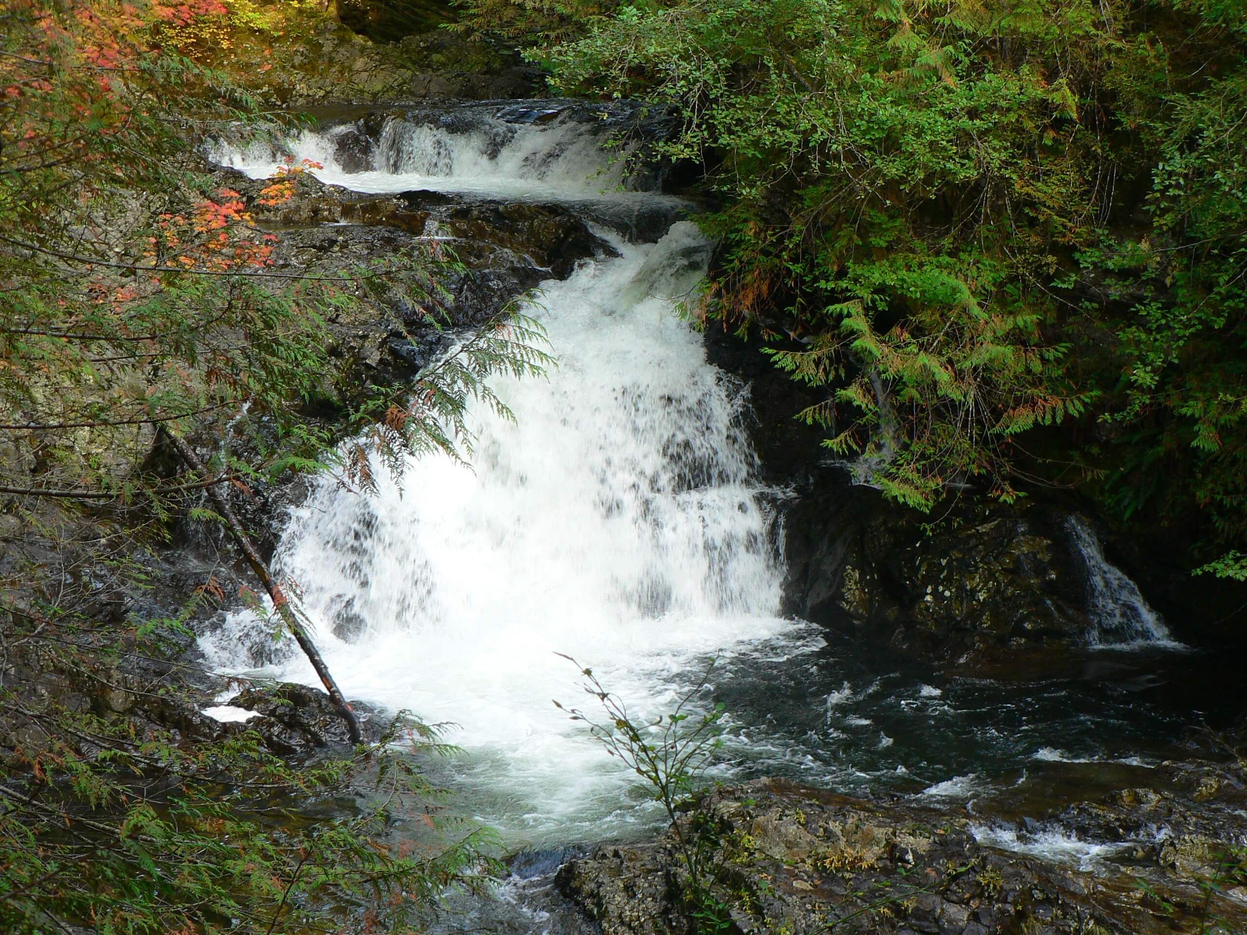
Wallace Falls via Woody Trail
Difficulty Rating:
The Wallace Falls via Woody Trail hike is a heavily trafficked out and back trail that is rated as moderate. Wallace Falls is one of Washington’s most popular attractions, and for good reason. Nine impressive falls cascade through the greenery, and the trail is enjoyable the entire way along. While presenting a moderate incline and fair length, the elevation gain is never strenuous, making this a fitting trail for families with adventurous children and newer hikers. The trail is well-maintained and marked, and the beauty of nature is on full display here.
We do recommend arriving at this trail early as it sees significant traffic on the weekends.
Getting there
The trailhead for the Wallace Falls via Woody Trail hike is near Wallace Falls State Park Campground. Take May Creek Road for 1.3mi to a Y-junction. Go left and park in the parking lot, which does fill up on weekends.

About
| Backcountry Campground | Wallace Falls State Park Campground |
| When to do | May-October |
| Pets allowed | Yes - On Leash |
| Family friendly | Older Children only |
| Route Signage | Good |
| Crowd Levels | High |
| Route Type | Out and back |
Wallace Falls via Woody Trail
Elevation Graph
Weather
Wallace Falls via Woody Trail Description
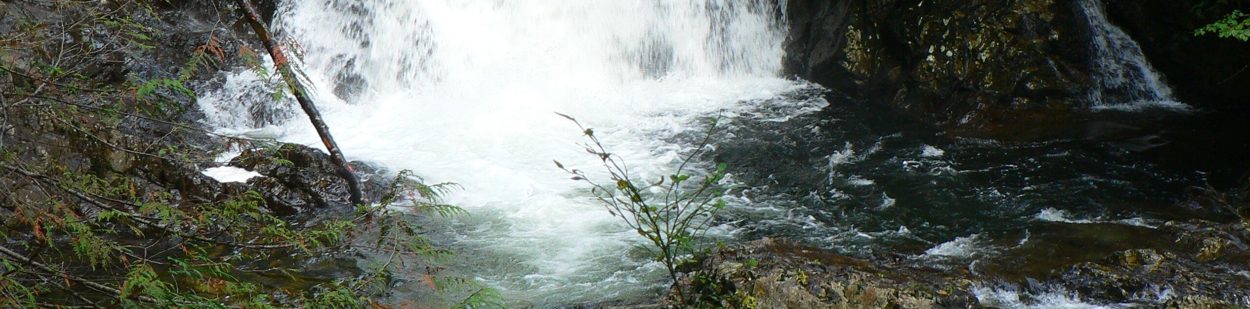
Wallace Falls is a gorgeous set of 9 waterfalls in the lush forest, offering a tranquil slice of paradise. The falls are a massively popular destination in the state, and they see plenty of visitors each week as a result. Don’t let this sway you- if you’re able to go outside of peak hours, you’re almost guaranteed to have a wonderful trip. The access to the falls on Woody Trail is moderate and very well maintained, making it a good fit for active families and strong beginner hikers. And of course, the star of the show is Wallace Falls, a true gem!
Since the trail’s most strenuous portion comes between the Middle and Upper Falls and the Middle Falls are considered the most beautiful, you can shorten your trip by turning around before the final push to the Upper Falls to make it easier if needed.
If the parking lot is full when you arrive, we don’t recommend parking along the road, as this can earn you a ticket. Midweek or early morning/late afternoon will give you the best chance at a less busy hike.
The trail begins just off the parking lot between the restrooms and information stand. You’ll hike underneath two power lines, with Mount Index in the distance. Head left into nature, enjoying the Wallace River and the hemlocks overhead.
A half-mile in, the trail splits. Take the trail on the right with the gate. You’ll be hiking alongside the river, where plenty of benches offer you a chance to sit and enjoy the scenery for a while. Continue up the trail, passing through the junction with Amphitheater and RailRoad Grade trails. The first falls are nice, but the true stunners are the Middle Falls, so keep going almost half a mile further to the best view on the trail.
If you’re feeling tired at Middle Falls, you could turn back and call it a day here, as the next stretch of trail is the most difficult, and you’re already enjoying some of the best views on the trail. If you’re feeling ready for more, continue up the next half-mile of steep switchbacks to the Upper Falls. This is the official end of the trail. After enjoying the cool mist and the stunning water, turn around and retrace your steps back to the parking lot.
Hiking Route Highlights
Wallace Falls State Park
Wallace Falls State Park is a 1,380-acre park with shoreline on the Wallace River, Wallace Lake, Jay Lake and Shaw Lake. The park offers frontcountry and backcountry camping. Located on the west side of the Cascades, the park features a 265-foot waterfall, old-growth forests and scenic rivers and streams. Adventurers can fish, swim, hike, camp, rock climb, and more at this fantastic destination.
Frequently Asked Questions
Are dogs allowed at Wallace Falls?
Yes, dogs are permitted, but they must be kept on leash the entire time you’re in the area. There are strict fines imposed for off-leash dogs, but these are for their safety! Several dogs have been swept away into the falls, so keeping your pets leashed here is very important.
Can I swim in the Wallace River?
Swimming access is at Big Eddy on the Skykomish River. The rivers near the falls can flow too fast for safe swimming.
Do you need a Discover Pass for Wallace Falls?
Yes, please bring your Discover Pass with you for this hike. You can buy your day pass at an automated pay station in the park.
Insider Hints
There is rock climbing in the area near Mount Index.
Some of the tent sites are first-come, first-served, or you can pre-book one of the cabins.
There is backcountry camping available at the two lakes 5.0mi and 6.0mi from the trailhead.
Similar hikes to the Wallace Falls via Woody Trail hike

Lakes Dorothy, Bear, Deer, and Snoqualmie Hike
The Lakes Dorothy, Bear, Deer, and Snoqualmie Hike provides access to Lake Dorothy, Bear Lake, Deer Lake, and Snoqualmie Lake.…

Gold Creek Trail to Joe Lake
Gold Creek Trail to Joe Lake is not a hike for the faint of heart. This lightly trafficked trail is…

Basin Lake via Bullion Basin Trail
Basin Lake via Bullion Basin Trail is a 12.2mi hike that, with 2900ft of elevation gain,…
Comments