Mailbox Peak Loop
View Photos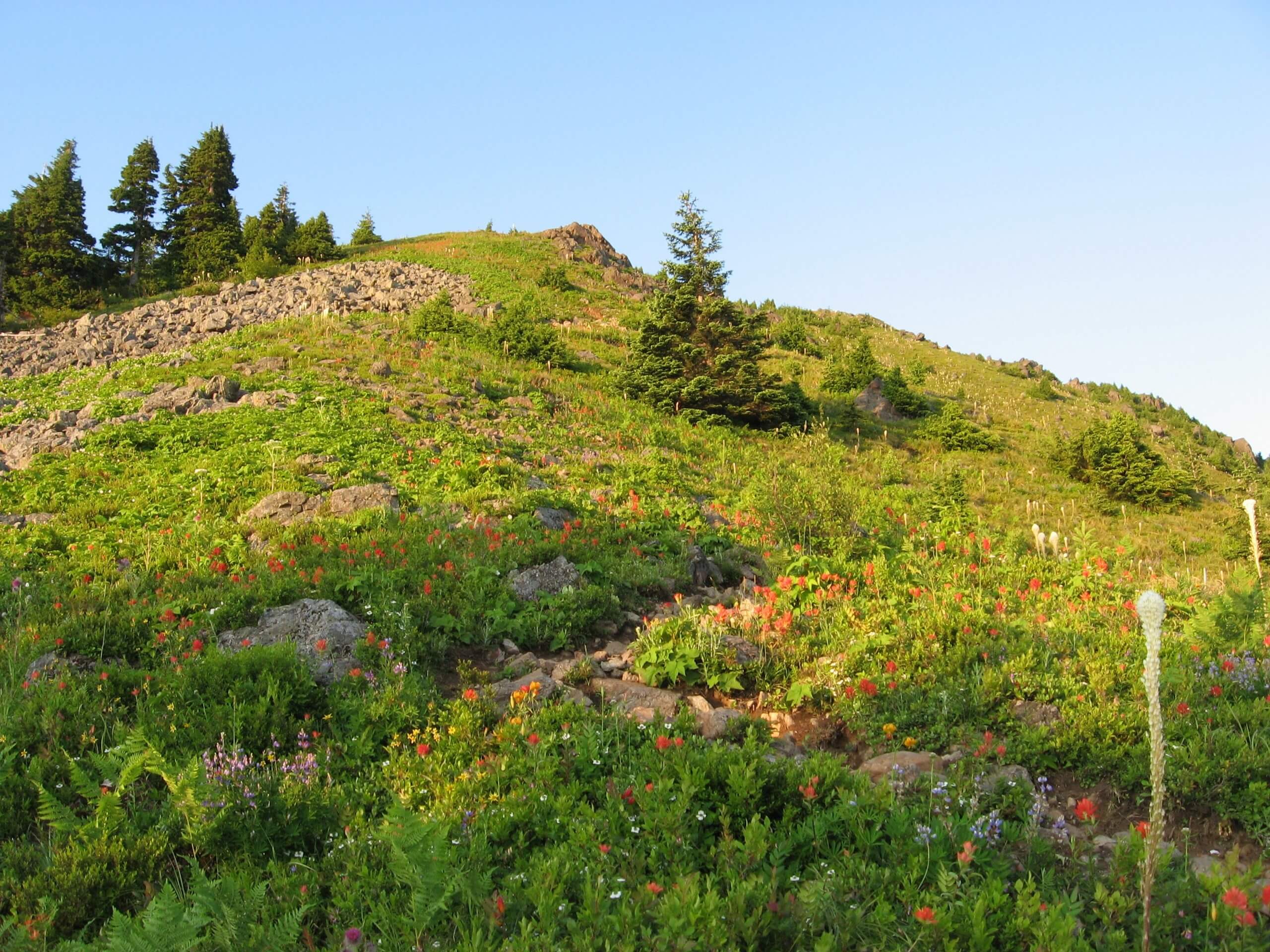
Mailbox Peak Loop
Difficulty Rating:
The hike on Mailbox Peak Loop is no small task, but it’s a popular pick for hikers feeling ready to take on more difficult trails. The views from the top are very rewarding, and yes, there is a mailbox to be found at the top! The old trail was fraught with injuries and rescues, so the Department of Natural Resources stepped in to create a new, safer trail to the top. Some hikers still choose to use the old trail, making a loop out of the old and new. This requires careful navigation of the old trail, which is very steep, not maintained, and rather difficult. Hey, if you want a challenge, you found it!
Once you make it to the top, see what else is in the mailbox beside the trail register- sometimes, interesting things get left in there for the next group up!
Getting there
The trailhead for the Mailbox Peak Trail is off Middle Fork Road. There is a turnoff on the right just after the merge with SE Dorothy Lake Road. There is a lot with room for about 40 cars.

About
| Backcountry Campground | No |
| When to do | April-October |
| Pets allowed | Yes - On Leash |
| Family friendly | No |
| Route Signage | Average |
| Crowd Levels | Moderate |
| Route Type | Loop |
Mailbox Peak Loop
Elevation Graph
Weather
Mailbox Peak Loop Description
What’s in the mailbox? Besides the trail register, sometimes it’s trinkets left by other hikers, snacks, or notes. The Mailbox Peak Loop leads you to a viewpoint adorned with a sticker-clad mailbox where hikers from all over leave goodies for the next groups up. The old trail for this hike was fraught with injuries and rescues, and a monumental effort built a new, safer trail. However, the old trail still exists, and bold hikes can link the two to make a loop. It’s not for the faint of heart, but it’s an adventure!
You can hike this loop either way, either ascending or descending the old trail. We recommend taking the old trail up as it’s a bit too steep to descend comfortably, particularly with a noticeable lack of switchbacks. Come prepared with lots of water- this trail is a real feat.
The hike begins along Middle Fork Road. You’ll walk for a bit along a paved path, skirting around a gate. A hundred yards past the gate, you’ll see the entrance to the new trail. Don’t go this way- stay right to take the old trail. You’ll soon walk past the old trailhead. Stay left here, as Grouse Ridge Way goes off to the right.
Start climbing! You’ll be gaining about 850ft of elevation per mile, and it doesn’t relent until the peak. Where the new trail has wide switchbacks, this trail does not. It’s much more direct, making the elevation gain more demanding. Watch your footing and take it slow if you need to.
The straight-up ascent goes on for about 4.0mi, at which point you rejoin the new trail for the summit ascent. This stretch is rockier, so watch your step. From now until the summit, you’ll gain closer to 960ft of elevation in 0.5mi. Keep going!
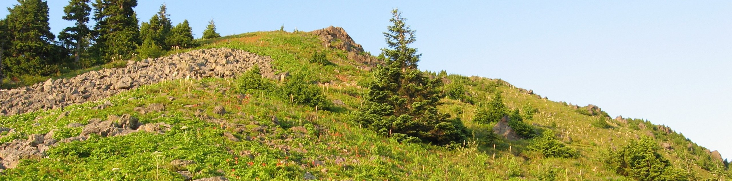
You’ll crest the peak, which sits at the end of a ridgeline. Mount Rainier is right there, and the Middle Fork valley lines the ground ahead in green.
Check the mailbox, sign the register, maybe leave a trinket, and then head down the rocky section to where the trails meet. Stay right onto the new trail, which is still quite steep, but offers some reprieve with the continual wide switchbacks. Near the bottom, you’ll cross a couple of creeks over bridges and then reach the point at which the two trails meet again, just a few steps from the trailhead.
Hiking Route Highlights
Mount Rainier
The tallest mountain in the state is a dominant part of your view on the Mailbox Peak Trail. This 14,409-foot stratovolcano is an iconic sight and the highlight of your view on this trail.
Frequently Asked Questions
Why is there a mailbox at Mailbox Peak?
Back in the ’60s, a postman named Carl Heine was working as the director of Valley Camp, a retreat near the base of the mountain. He had built a mailbox at the top and challenged the kids of the retreat to climb the summit and reach the mailbox.
What pass do I need to hike Mailbox Peak?
Please have your Discover Pass ready to go for this hike.
How bad is the old trail at Mailbox Peak?
The old trail was ditched for a reason! It’s very steep with no switchbacks and was a constant source of injuries and rescues back in its day. These days, it’s still hikeable, but the new trail provides a much more comfortable experience.
Insider Hints
Parking for this trail fills up quickly on the weekends. Get here early! The trail can also feel congested so we definitely recommend hiking on a weekday if you are able to.
The gates to this hike typically open an hour after dawn and an hour before dusk. Check current gate times at the trailhead so you don’t get locked out!
Similar hikes to the Mailbox Peak Loop hike

Lakes Dorothy, Bear, Deer, and Snoqualmie Hike
The Lakes Dorothy, Bear, Deer, and Snoqualmie Hike provides access to Lake Dorothy, Bear Lake, Deer Lake, and Snoqualmie Lake.…

Gold Creek Trail to Joe Lake
Gold Creek Trail to Joe Lake is not a hike for the faint of heart. This lightly trafficked trail is…

Basin Lake via Bullion Basin Trail
Basin Lake via Bullion Basin Trail is a 12.2mi hike that, with 2900ft of elevation gain,…
Comments