
Lake Dorothy Trail
View Photos
Lake Dorothy Trail
Difficulty Rating:
Lake Dorothy Trail is a moderately trafficked out-and-back trail in Mount Baker-Snoqualmie National Forest that is rated as moderate. This hike leads through the East Fork of the Miller River valley to Lake Dorothy. If you want to press on a bit further, you can also access Bear Lake and Deer Lake on this trail. This is also a popular choice for short backpacking trips.
Note that the last 4.0mi of the road to the trailhead has been washed out for long stretches of time in the past, necessitating an additional walk in. This adds a long, less exciting pre-hike to your day. We recommend bringing bikes if you have them to shorten this stretch.
Getting there
The trailhead for the Lake Dorothy Trail is at the end of National Forest Development Road 6412. If the road is washed out, park where it is safe to do so and walk to the trailhead.

About
| Backcountry Campground | Lake Dorothy Backcountry |
| When to do | June-October |
| Pets allowed | Yes - On Leash |
| Family friendly | No |
| Route Signage | Average |
| Crowd Levels | Moderate |
| Route Type | Out and back |
Lake Dorothy Trail
Elevation Graph
Weather
Lake Dorothy Trail Description
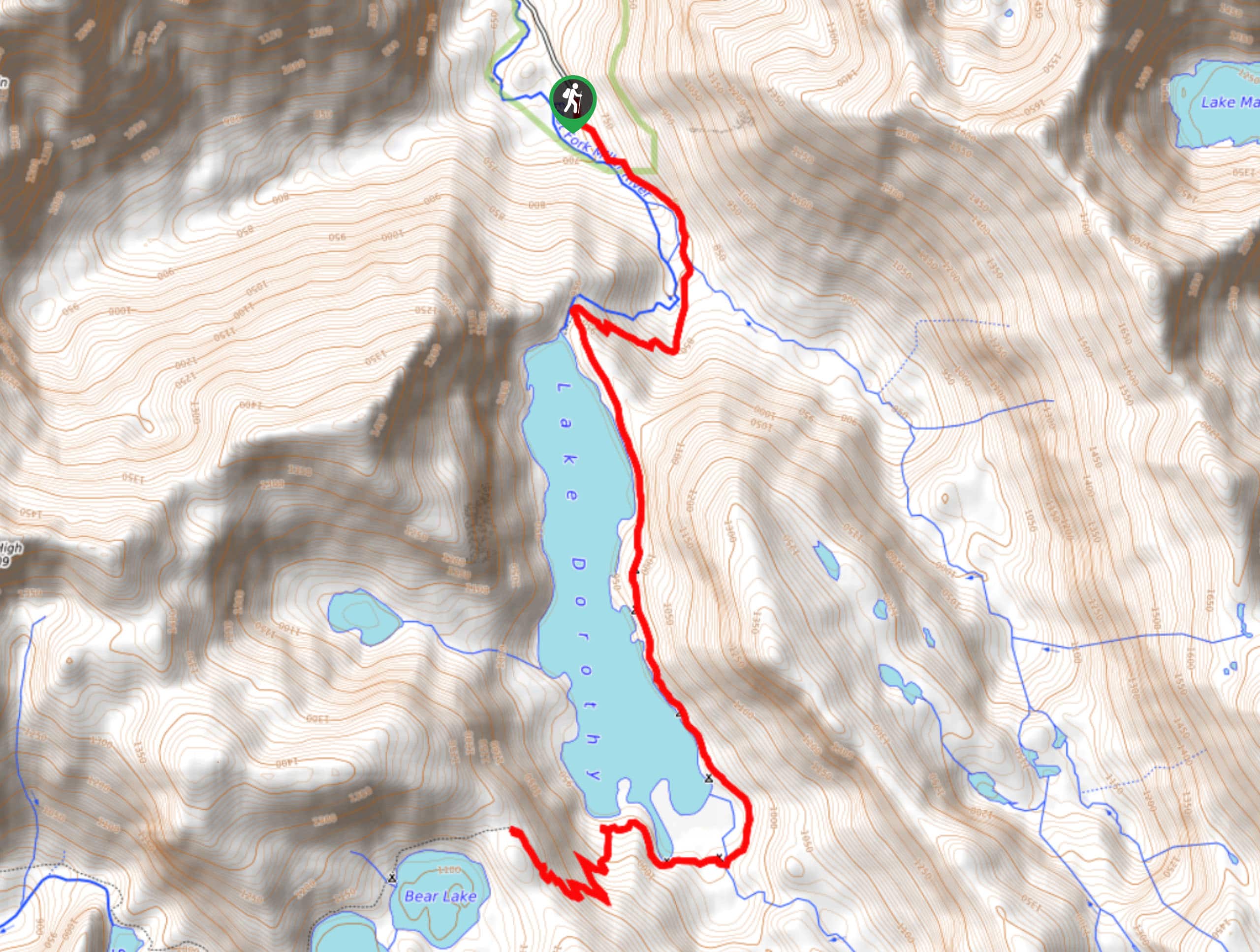
Lake Dorothy is a calm, tranquil alpine lake settled into a mountain valley, flanked by two smaller lakes to the southwest. This is a lovely day hike or short backpacking adventure, although the unpredictable maintenance of the road to the trail, which is subject to washout, may unexpectedly extend your hike by 4.0mi. Bring flip-flops if this is the case, as it tends to be wet!
The hike begins at the end of the road, following a well-maintained track along the East Fork of Miller River through the valley. The elevation gain is mild for the first stretch. There is a stream crossing before the trail wraps to the right near the foot of the lake.
A spur trail on your right leads to the lakeshore, but continue on the main trail to wrap around the eastern shore of the lake and around the southern end. You can end your hike anywhere along this section, but if you want to add some length, take the switchbacks that head up the ridge to Bear and Deer Lake. It’s a short, steep sprint to a nice vantage point over all three lakes.
When you’re ready, retrace your steps to the road.
Similar hikes to the Lake Dorothy Trail hike

Lakes Dorothy, Bear, Deer, and Snoqualmie Hike
The Lakes Dorothy, Bear, Deer, and Snoqualmie Hike provides access to Lake Dorothy, Bear Lake, Deer Lake, and Snoqualmie Lake.…

Gold Creek Trail to Joe Lake
Gold Creek Trail to Joe Lake is not a hike for the faint of heart. This lightly trafficked trail is…

Basin Lake via Bullion Basin Trail
Basin Lake via Bullion Basin Trail is a 12.2mi hike that, with 2900ft of elevation gain,…
Comments