Pratt Lake Trail
View Photos
Pratt Lake Trail
Difficulty Rating:
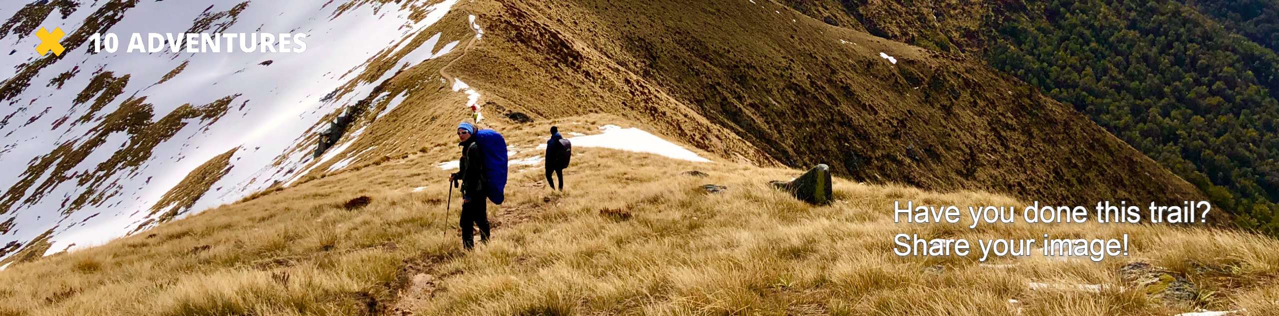
Pratt Lake Trail is a heavily trafficked out-and-back trail in Mount Baker-Snoqualmie National Forest that is rated as hard. This trail is often used for both day trips and backpacking adventures, and the trail can be hiked further or kept short while still being enjoyable.
There are several variations of how to get to Pratt Lake and different extensions to add, so check out our related route guides if you’re seeking another option.
Getting there
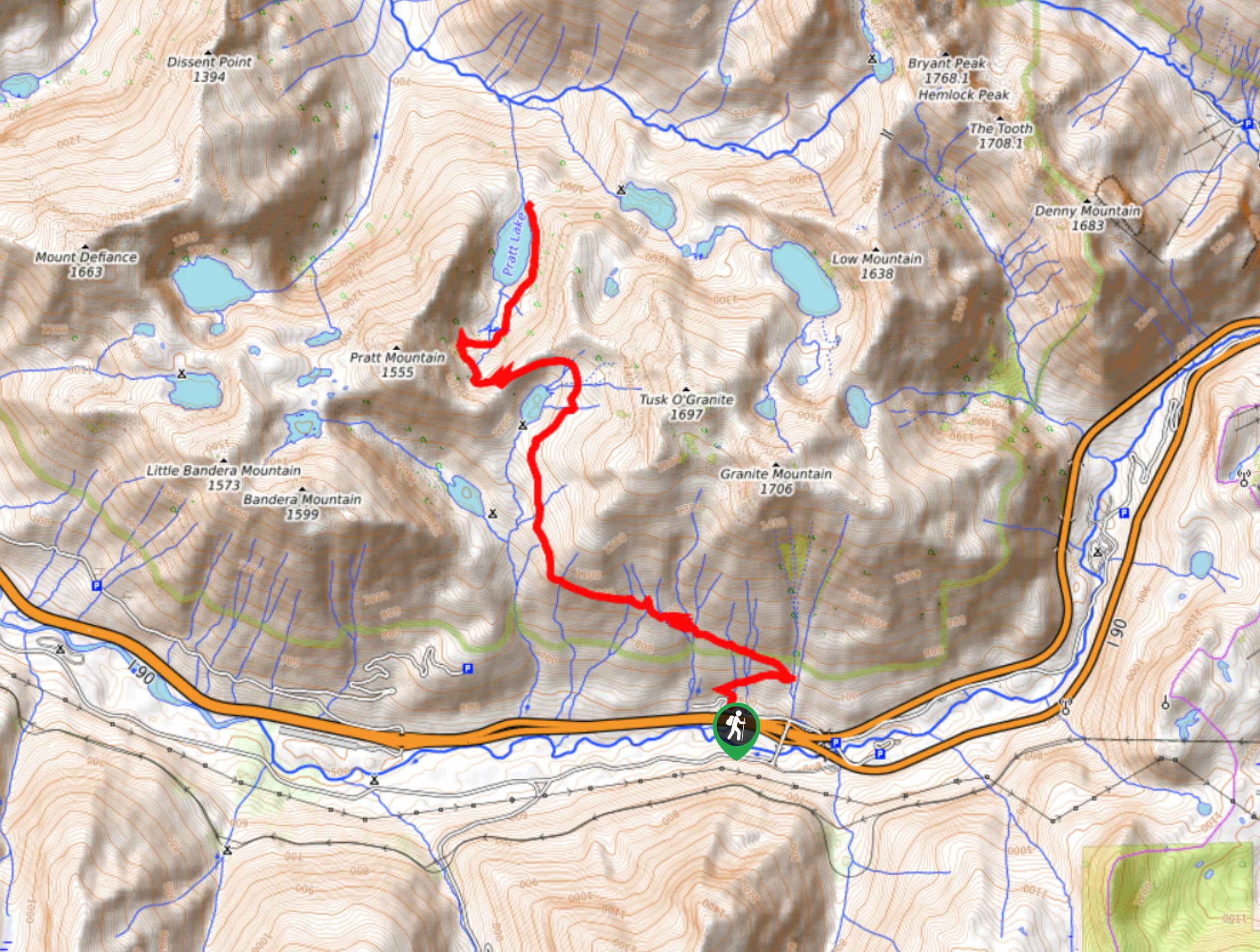
The trailhead for the Pratt Lake Trail is on National Forest Development Road 9034 off I-90.

About
| Backcountry Campground | Pratt Lake Backcountry Camping |
| When to do | June-October |
| Pets allowed | Yes - On Leash |
| Family friendly | No |
| Route Signage | Average |
| Crowd Levels | Moderate |
| Route Type | Out and back |
Pratt Lake Trail
Elevation Graph
Weather
Pratt Lake Trail Description
The hike to Pratt Lake is a wonderful breath of fresh air, with streams, lakes, and mountains peeking through the vibrant forest. This trail is a more direct out-and-back route to the lake, although there are many variations possible to enjoy this trail. If the full length is too much, you can shorten your trip, or keep going if you’re backpacking.
The hike begins from the Granite Mountain Trailhead. Take Pratt Lake Trail #1007 north, crossing the stream and then curving back to cross it again, then two more. This is a common theme: there are lots of water crossings on this hike!
After a wide left turn, you’ll traverse west, gaining elevation and crossing countless streams and creeks. The trail curves north again around the foot of the mountain beside you, and you should be able to see Talapus Lake below on your left.
Wrap around the north end of Olallie Lake, switchbacking to lose a bit of elevation into the valley that Pratt Lake sits in. Even more creek crossings bring you around the eastern shore of the lake, which is deep blue and surrounded by green forest.
You can either turn back here, settle in at the camp, or keep going on Pratt River Trail or Melakwa Lake Trail.
Similar hikes to the Pratt Lake Trail hike

Lakes Dorothy, Bear, Deer, and Snoqualmie Hike
The Lakes Dorothy, Bear, Deer, and Snoqualmie Hike provides access to Lake Dorothy, Bear Lake, Deer Lake, and Snoqualmie Lake.…

Gold Creek Trail to Joe Lake
Gold Creek Trail to Joe Lake is not a hike for the faint of heart. This lightly trafficked trail is…

Basin Lake via Bullion Basin Trail
Basin Lake via Bullion Basin Trail is a 12.2mi hike that, with 2900ft of elevation gain,…
Comments