
Rainbow Ridge Loop
View Photos
Rainbow Ridge Loop
Difficulty Rating:
The Rainbow Ridge Loop is an excellent adventure for intermediate hikers and families with older children. Open year-round, this route can be enjoyed in sunshine or snowfall, offering the same amazing views of Mount Shasta dominating the skyline.
Getting there
This hike departs from the trailhead off North Shore Road 40N27.

About
| Backcountry Campground | No |
| When to do | Year-round |
| Pets allowed | Yes - On Leash |
| Family friendly | Older Children only |
| Route Signage | Poor |
| Crowd Levels | Moderate |
| Route Type | Lollipop |
Rainbow Ridge Loop
Elevation Graph
Weather
Rainbow Ridge Loop Description
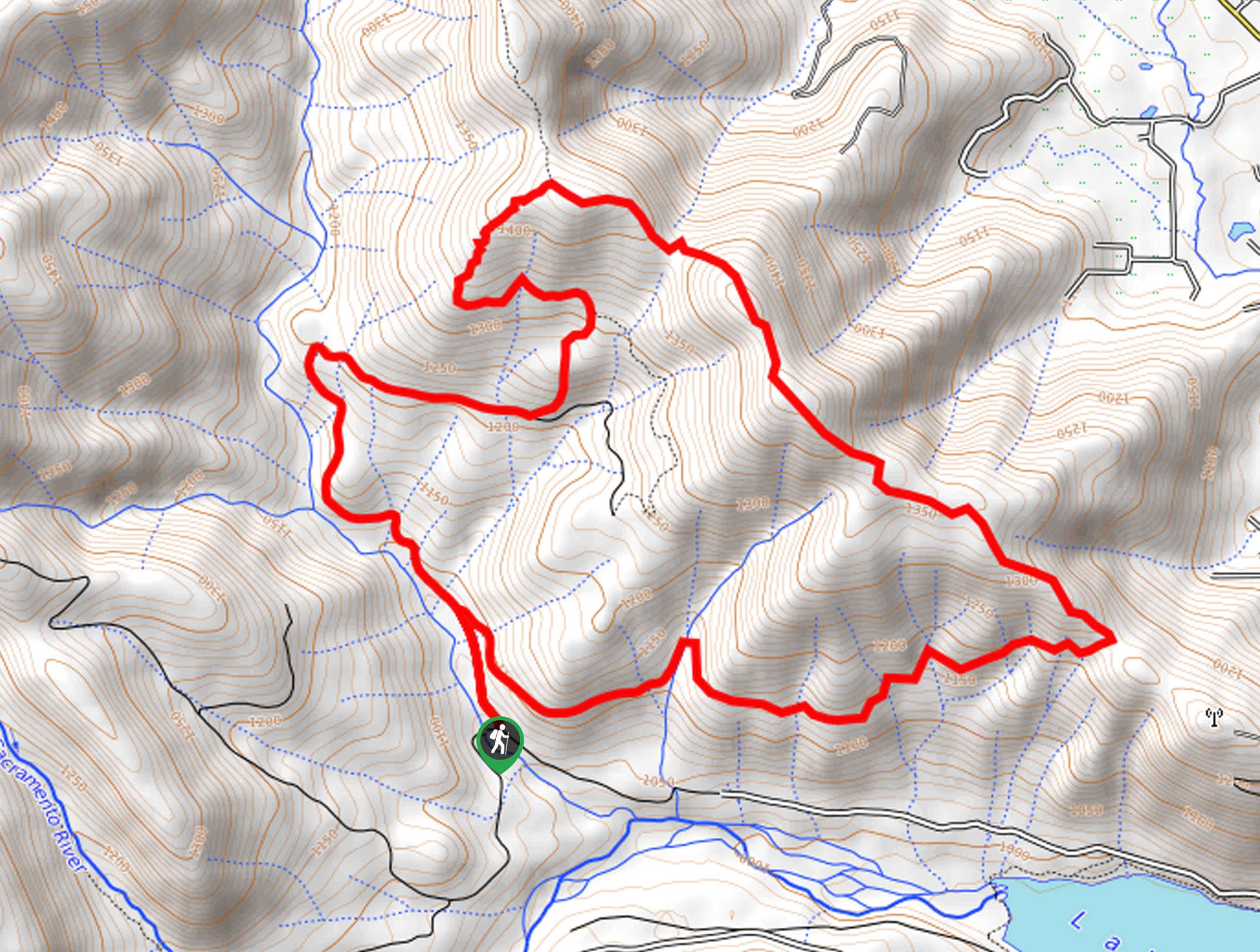
Immerse yourself in the wilderness and disconnect from the stressors of the real world along this scenic adventure. Traveling through lush woodlands and meadowlands, this dirt route attracts explorers of all sorts, from off-roaders to bikers and hikers. Though stretching through the forestlands, the wide route exposes adventurers to the effects of the sun, so be sure to wear SPF! The road itself is explicit, but the intersections are poorly signposted, so the trail GPS may prove useful.
Setting out from the trailhead, the Rainbow Ridge Loop travels along the Deer Creek- Rainbow Ridge Route. Soon after your departure from the trailhead, you will confront a junction, keep left here, wandering along the curves of Deer Creek. Let the soothing sounds of the gurgling waters relax you as you hike, and eventually, the path will divert east away from the picturesque creek. More intensely climbing, the Deer Creek- Rainbow Ridge Route will wind up to an epic overlook of Mount Shasta. Marvel in the beauty and grandeur of the volcano dusted in snow.
From here, merge onto the Rainbow Ridge Trail, heading southeast. Gradually descending, the path will ultimately redirect hikers west, leading them back to the trailhead.
Similar hikes to the Rainbow Ridge Loop hike

East Weaver Lake Trail
The East Weaver Lake Trail is a wonderful adventure on the boundary of the Trinity Alps Wilderness that features amazing…

Bluff Lake via PCT
The Bluff Lake via PCT is a secluded adventure in the Shasta-Trinity National Forest that offers wonderful scenery and makes…
Lover’s Leap Hike
The Lover’s Leap Hike is an awesome adventure up to the summit of a granite bluff overlooking the Cascade Range…
Comments