Hotlum Loop
View Photos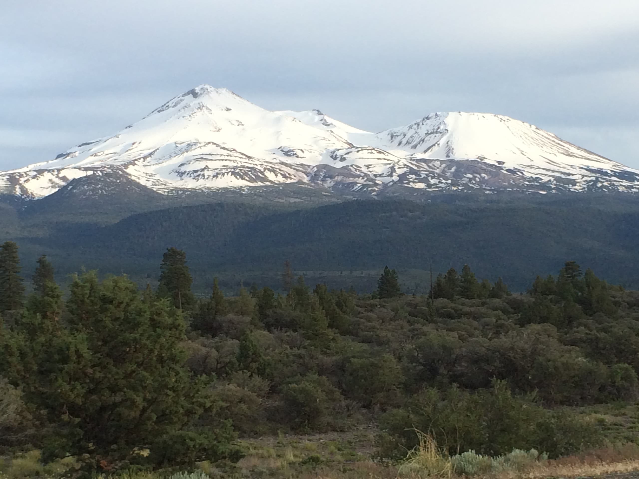
Hotlum Loop
Difficulty Rating:
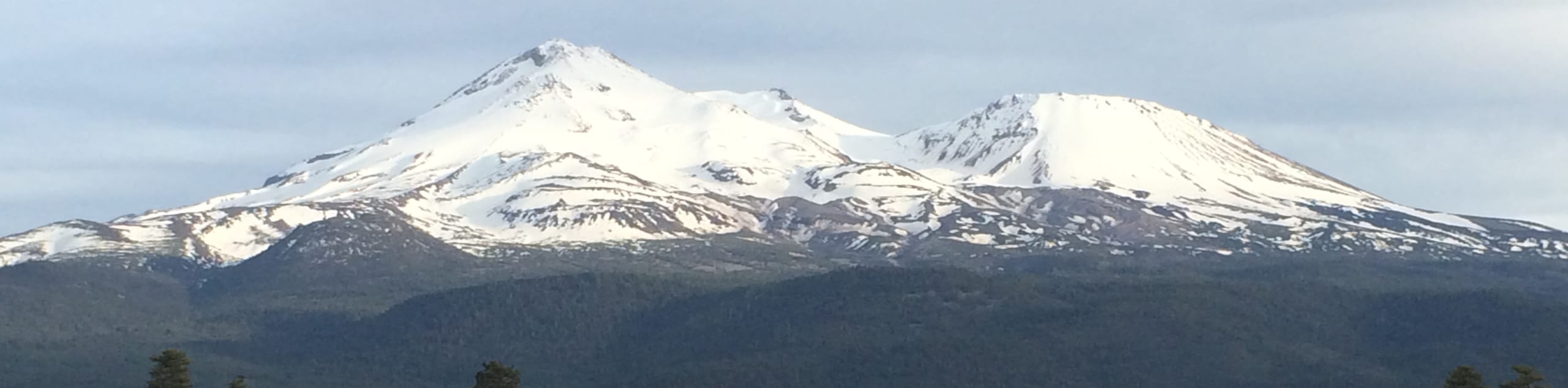
The Hotlum Loop is a wonderful adventure along the outskirts of Mount Shasta that outdoor enthusiasts of all sorts can enjoy. Hikers, bikers, and off-roaders can all indulge in the epic panoramas of the Klamath Mountains and the snow-capped volcano towering above.
Getting there
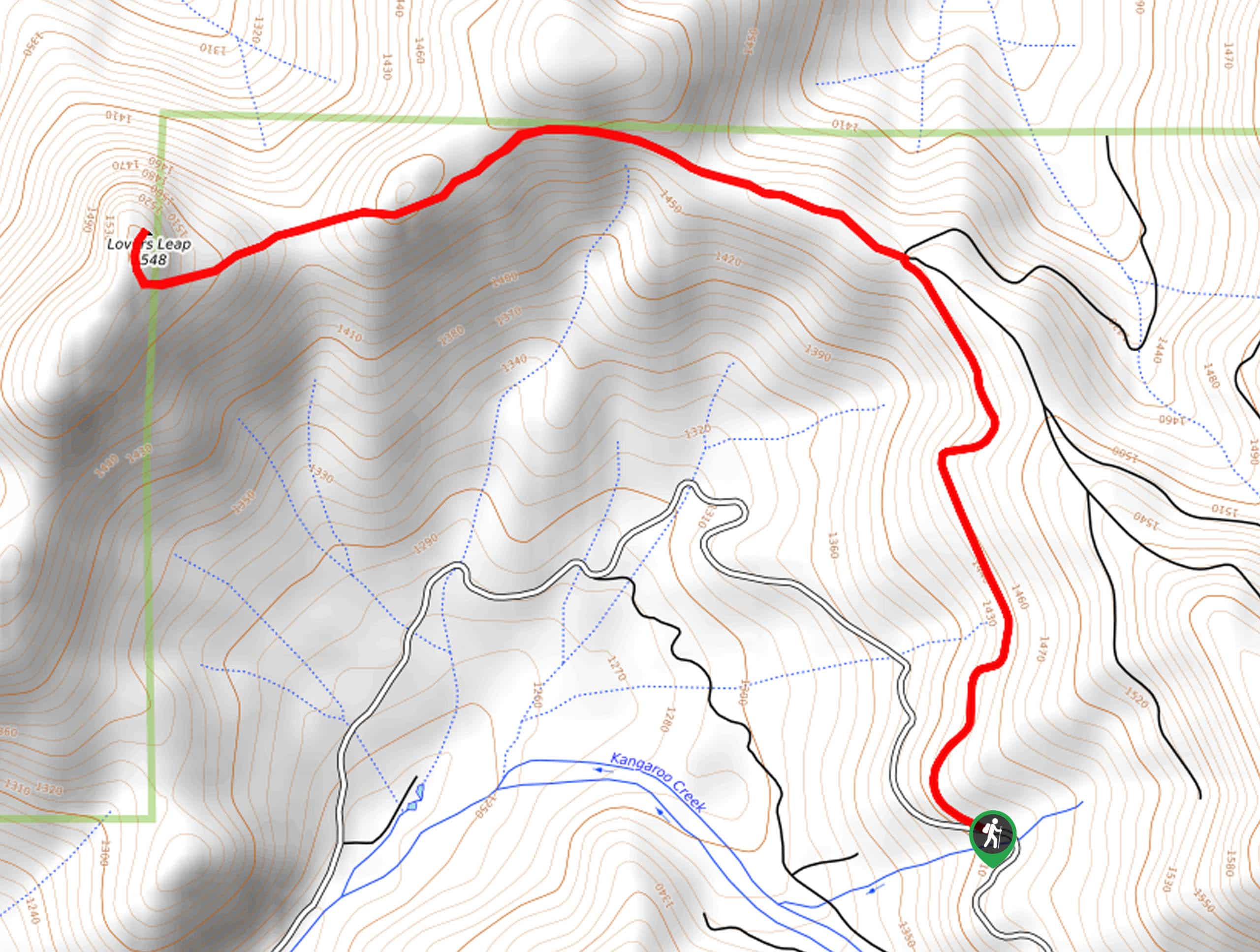
The Hotlum Trail departs from the trailhead off US Highway 97.

About
| Backcountry Campground | No |
| When to do | Year-round |
| Pets allowed | No |
| Family friendly | Older Children only |
| Route Signage | Average |
| Crowd Levels | High |
| Route Type | Circuit |
Hotlum Loop
Elevation Graph
Weather
Hotlum Loop Description
The Hotlum Loop is a high reward, low effort type of excursion in the Shasta-Trinity National Forest. Traveling through tree burn and meadowlands, the exposed terrain offers epic views while warranting extreme conditions, so check the forecast prior to departure and dress accordingly. Shared with off-roaders and bikers, it is important to be mindful of passers-by as you wander! Don’t forget to charge your camera; the views of Mount Shasta are unrivaled. Note the route is not well signposted, so we encourage you to download the trail GPS.
Your journey along the Hotlum Loop begins from the trailhead off US Highway 97. Here you will confront an intersection; veer left here. Heading northwest you will soon reach another trail split; keep right. Traveling to the trail’s end, you will cross a railbed before reaching a junction. At this point, you will be diverted southeast along the western slopes of Cinder Cone. At the following intersection, turn right, and you will be diverted onto Forest Route 42N15.
You can continue along this route or take a quick detour up to an overlook of the Klamath Mountains in the west. Reconnect with the Forest Route, which will ultimately lead you back to the trailhead, marking the end of your adventure.
Similar hikes to the Hotlum Loop hike

East Weaver Lake Trail
The East Weaver Lake Trail is a wonderful adventure on the boundary of the Trinity Alps Wilderness that features amazing…

Bluff Lake via PCT
The Bluff Lake via PCT is a secluded adventure in the Shasta-Trinity National Forest that offers wonderful scenery and makes…
Lover’s Leap Hike
The Lover’s Leap Hike is an awesome adventure up to the summit of a granite bluff overlooking the Cascade Range…
Comments