McCloud River Trail
View Photos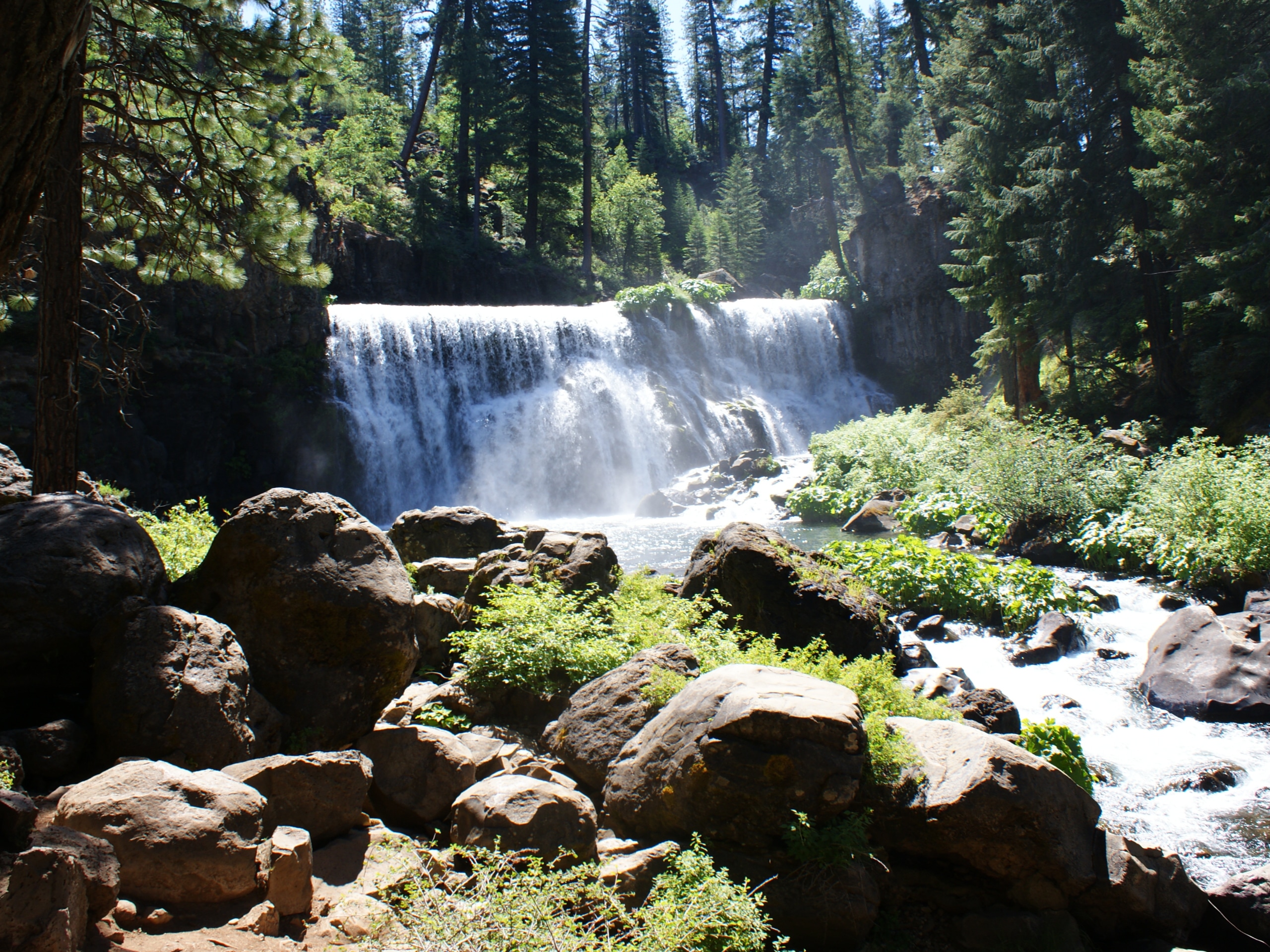
McCloud River Trail
Difficulty Rating:
The McCloud River Trail is an epic one-way adventure in the Shasta-Trinity National Forest that boasts wonderful scenery. Wander along the forested banks of the beautiful river that is decorated with several mesmerizing cascades for our enjoyment!
Getting there
The McCloud River Trail departs from the Middle Falls Trailhead off Upper Falls Road.

About
| Backcountry Campground | Several Camping Opportunities Along the Trail |
| When to do | Year-round |
| Pets allowed | Yes - On Leash |
| Family friendly | Older Children only |
| Route Signage | Average |
| Crowd Levels | Moderate |
| Route Type | One Way |
McCloud River Trail
Elevation Graph
Weather
McCloud River Trail Description
The McCloud River Trail is an awesome adventure that will not disappoint. Easy-going and impressively scenic, this route rewards its conquerors with hypotonic waterfalls and enchanting forestlands. The beauty of a one-way route is the diversity of scenery, and the McCloud River Trail delivers just that. Open year-round, intrepid spirits can explore this trail in the winter months alike with a pair of snowshoes! Just don’t forget to leave a car or arrange for pickup at the trail’s end!
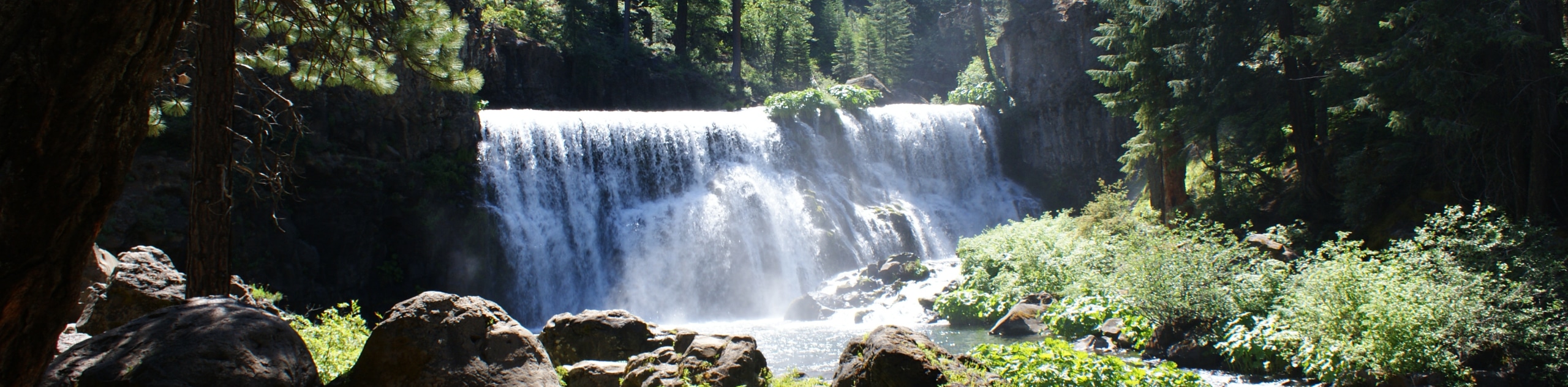
Setting out from the Middle Falls Trailhead, the McCloud River Trail travels south to the Middle McCloud Falls, which are arguably the most impressive cascades in the collection. From here, you will be guided to the Upper McCloud Falls, which is smaller, surging through a crevice in the granite cliffside. Enjoy the scenery, then continue trekking along the Upper McCloud River Trail, heading east along the forested banks of the beautiful river.
Follow the winding route along the curves of the river and through multiple campgrounds. Trekking the Upper McCloud River Trail, you will ultimately be delivered to the trail’s end at the Algoma Campground, marking the end of your adventure.
Similar hikes to the McCloud River Trail hike

East Weaver Lake Trail
The East Weaver Lake Trail is a wonderful adventure on the boundary of the Trinity Alps Wilderness that features amazing…

Bluff Lake via PCT
The Bluff Lake via PCT is a secluded adventure in the Shasta-Trinity National Forest that offers wonderful scenery and makes…
Lover’s Leap Hike
The Lover’s Leap Hike is an awesome adventure up to the summit of a granite bluff overlooking the Cascade Range…
Comments