McCloud Falls Trail
View Photos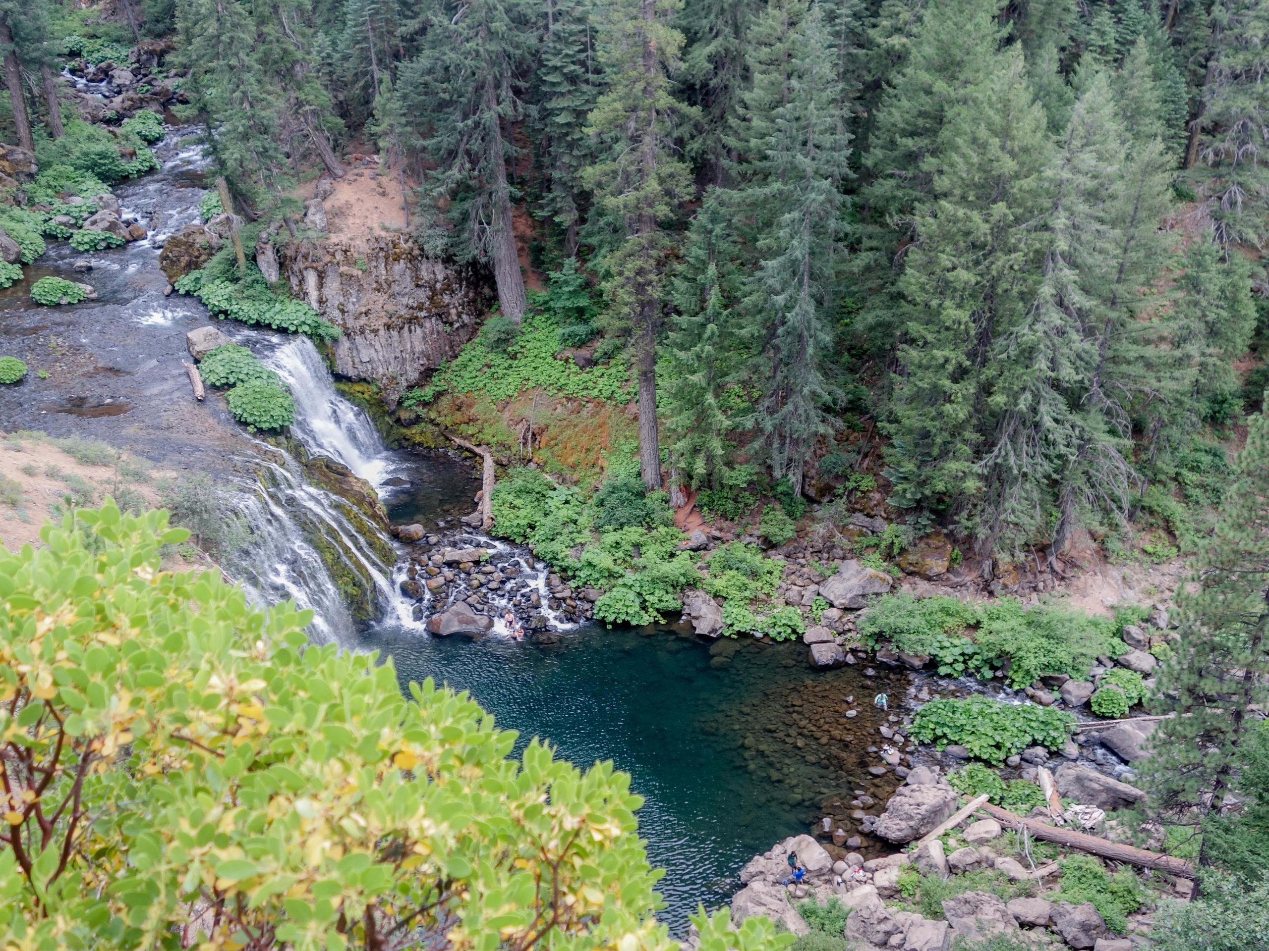
McCloud Falls Trail
Difficulty Rating:
The McCloud Falls Trail offers a collection of three cascades in one quick nature walk. Indulge yourself in the postcard perfect scenes of the cascades plunging through the basalt lava rock canyon. This epic expedition beckons the exploration year-round, enjoy!
Getting there
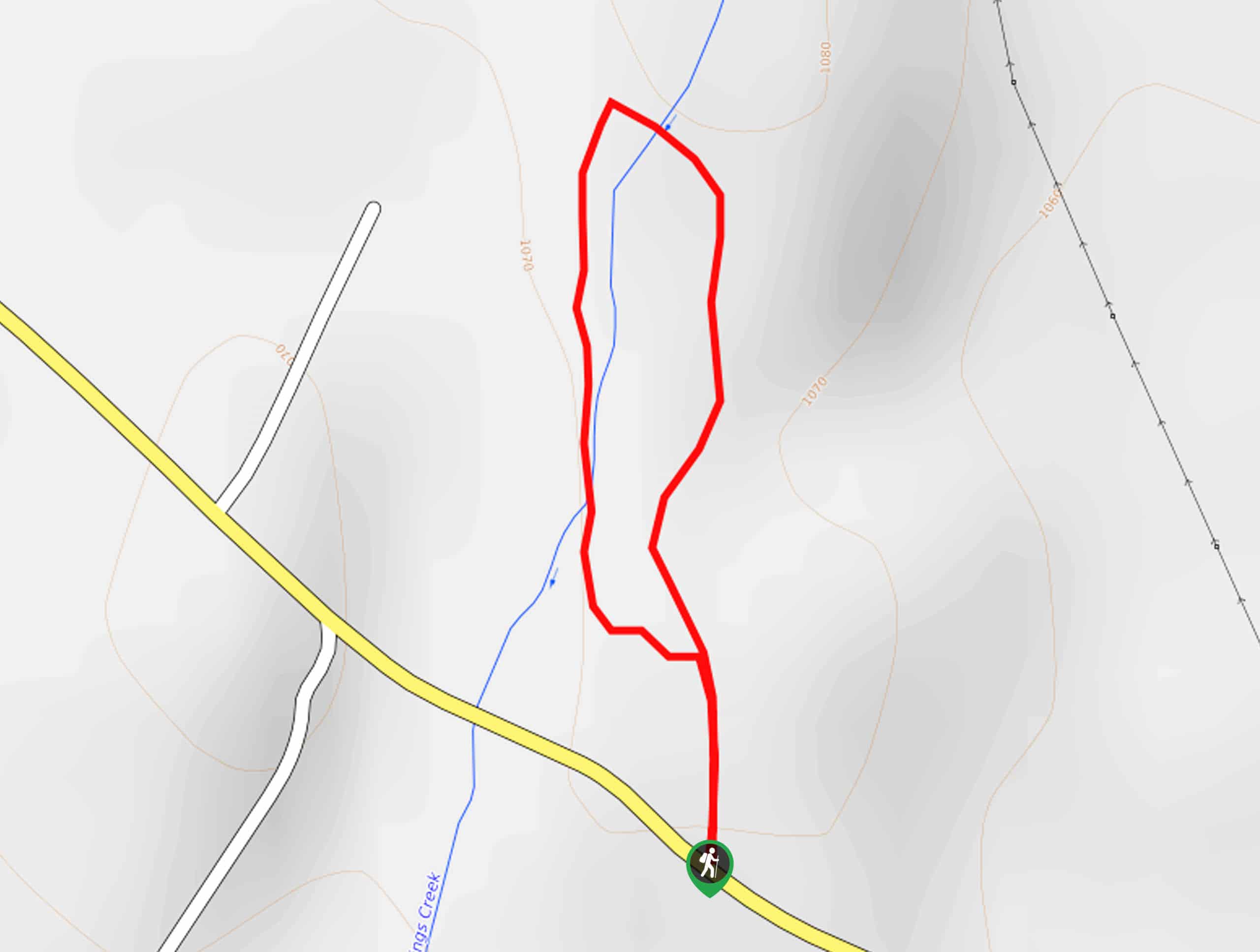
Access the McCloud Falls Trail from the McCloud Lower Falls Trailhead off Fowler Public Camp Road.

About
| Backcountry Campground | |
| When to do | Year-round |
| Pets allowed | Yes - On Leash |
| Family friendly | Yes |
| Route Signage | Average |
| Crowd Levels | High |
| Route Type | Out and back |
McCloud Falls Trail
Elevation Graph
Weather
McCloud Falls Trail Description
A hike along the McCloud Falls Trail boasts a more secluded but equally as scenic experience as the nearby Burney Falls. Head out in the early morning, and you may even get the trail all to your lonesome! Though this hike is open year-round, the access road to the trailhead is subject to seasonal closure; if the gates are closed, you can proceed on foot if desired! Additionally, the terrain is prone to icy conditions in the cooler months, so consider wearing a pair of microspikes. Unfortunately, the hiking trail is not wheelchair or stroller friendly, but the paths to each observation deck are paved, so everyone can indulge in the sight of the mesmerizing cascades.
There aren’t many things that top waterfall hikes, right? The McCloud Falls Hike is no exception; this beautiful route exhibits the beauty and diversity of the area’s flora and fauna and the grandeur of the falls. The path is bound with lush ferns and wildflowers in the warmer months, boasting an enchanting ambiance. Let the sounds of the cascades below soothe you as you wander. Assuming the water is calm in the summer months, take a dip in the inviting blue waters to cool off. If you are heading to the trails solely to enjoy the postcard-worthy scenes of the waterfalls, then we encourage you to head out in the late spring when the cascades are at their fullest! We love this hike, and we know you will too.
When you are ready, begin your journey along the McCloud Falls Trail from the Lower McCloud Falls Trailhead off Fowler Public Camp Road. Setting out from here, you will be guided down into the valley via switchbacks to an observation area overlooking the Lower McCloud Falls. Marvel in the scene of the small waterfall cascading through the volcanic valley. From here, the McCloud Falls Trail will guide you northeast, curving along the river banks and alongside Fowlers Campground. There is a stretch before reaching the next cascade.
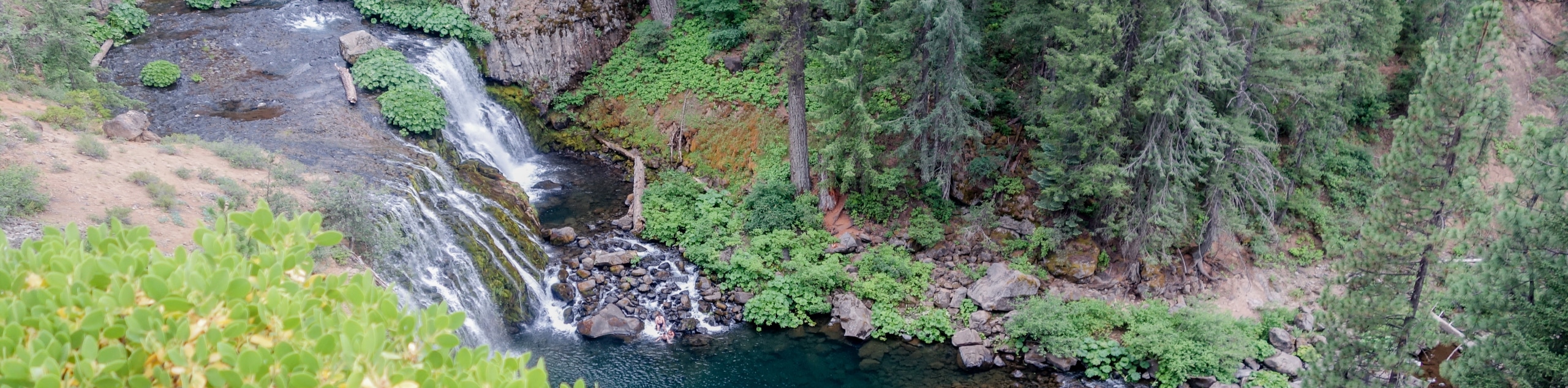
Diverting you east, you will wander beneath the tree canopy through lush flora before opening to the scene of the next cascades. Admire the view from below, then climb up the vertiginous valley walls to the next lookout. After navigating another set of switchbacks, you will be rewarded with a birds-eye panorama of the Middle McCloud Falls. These are the most impressive chutes in the collection of waterfalls—the wide curtain cascades into the rocky riverbed below. Here there exists a wonderful swimming hole for those hoping to take a dip—just head back down the cliffside to the valley floor.
Setting out from the Middle McCloud Falls observation deck, the path redirects hikers south. Meander this route along the river, and you will soon reach the last waterfall of the group. The Upper McCloud Falls flows through a narrow canyon in the basalt lava rock. Appreciate the charm of the small waterfall and when you are through enjoying the scene, begin your return. If time and weather permit, take a swim or sun along the rocks of the river before heading back. To get back to the trailhead, simply retrace your footing along the path back to your car, marking the end of your adventure.
Trail Highlights
McCloud Falls
The McCloud Falls are a collection of three cascades on the McCloud River. Located in the Shasta National Forest, a trip to these beautiful cascades boasts more of a secluded experience than the Burney Falls. Draining through the Cascade Mountain Range, the set of falls surge over basaltic lava rocks, offering picture-perfect scenes. Many people swim in the blue-hued pools beneath the chutes and kayakers often begin their journey down the McCloud River from beneath Lower McCloud Falls.
Frequently Asked Questions
How long is the McCloud Falls Trail?
The McCloud Falls Trail is a 3.6mi out-and-back hike in the Shasta National Forest.
Can you swim in McCloud Falls?
Yes, you can swim in McCloud Falls, although caution is advised.
Are dogs permitted along the McCloud Falls Trail?
Yes, dogs on leash are welcome along the McCloud Falls Trail.
Insider Hints
If the gates to the access road are closed, you can still hike into McCloud Falls
Though swimming is allowed, caution is advised
Charge your camera, the scenes are picture perfect
Do not jump or dive into the waters!
In the winter months, the path is often icy and snowy, so wear microspikes
Similar hikes to the McCloud Falls Trail hike

East Weaver Lake Trail
The East Weaver Lake Trail is a wonderful adventure on the boundary of the Trinity Alps Wilderness that features amazing…
Elsa Rupp Nature Trail
The Elsa Rupp Nature Trail is a wonderful escape from the hustle and bustle of the city. Reconnect with nature…

Bluff Lake via PCT
The Bluff Lake via PCT is a secluded adventure in the Shasta-Trinity National Forest that offers wonderful scenery and makes…
Comments