Burney Falls Loop
View Photos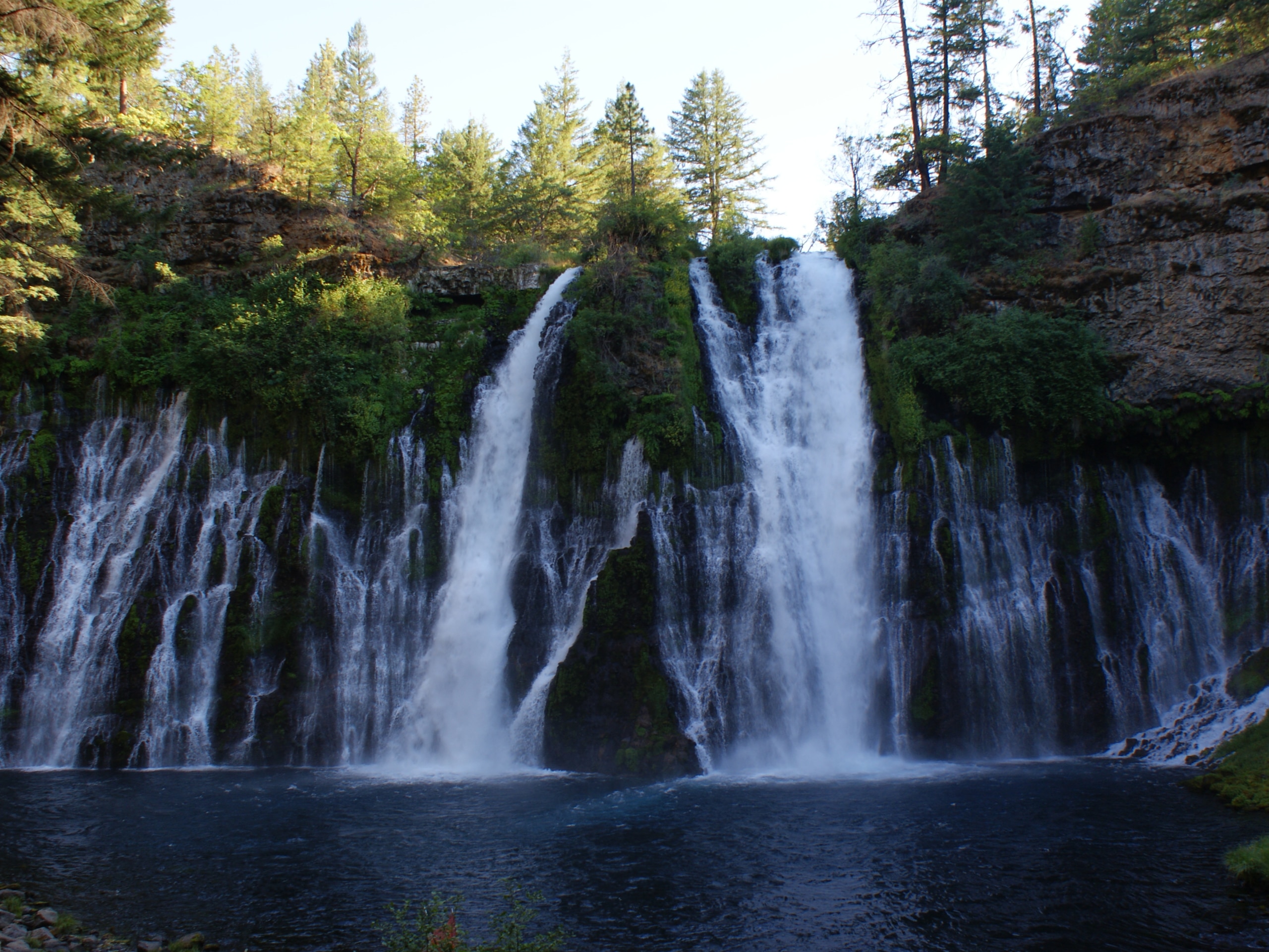
Burney Falls Loop
Difficulty Rating:
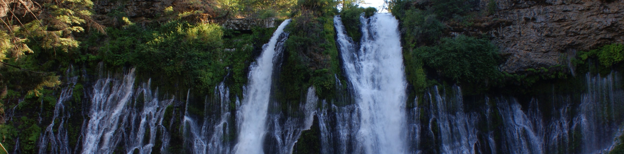
The Burney Falls Loop is a great adventure for hikers of all skill levels and abilities. Explore the famous waterfalls that surge over 129ft from the snowmelt of encompassing mountains and through underground springs of porous volcanic rocks. Boasting a postcard-worthy scene, this route is a must-add to your adventure itinerary.
Getting there
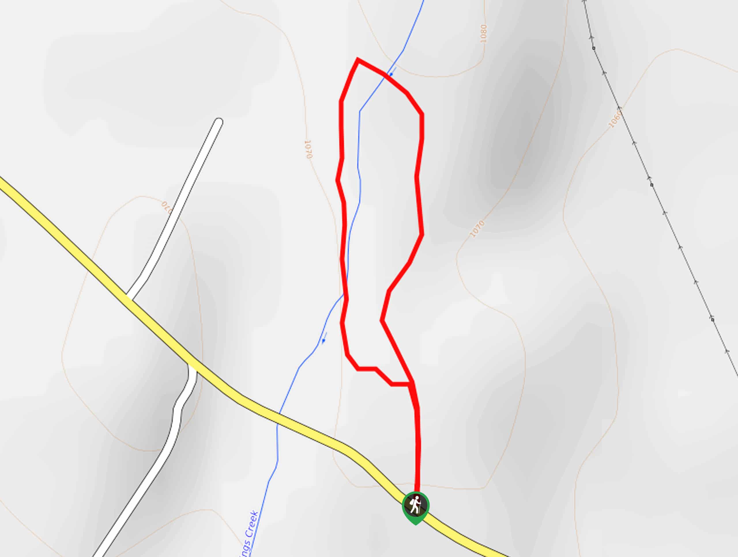
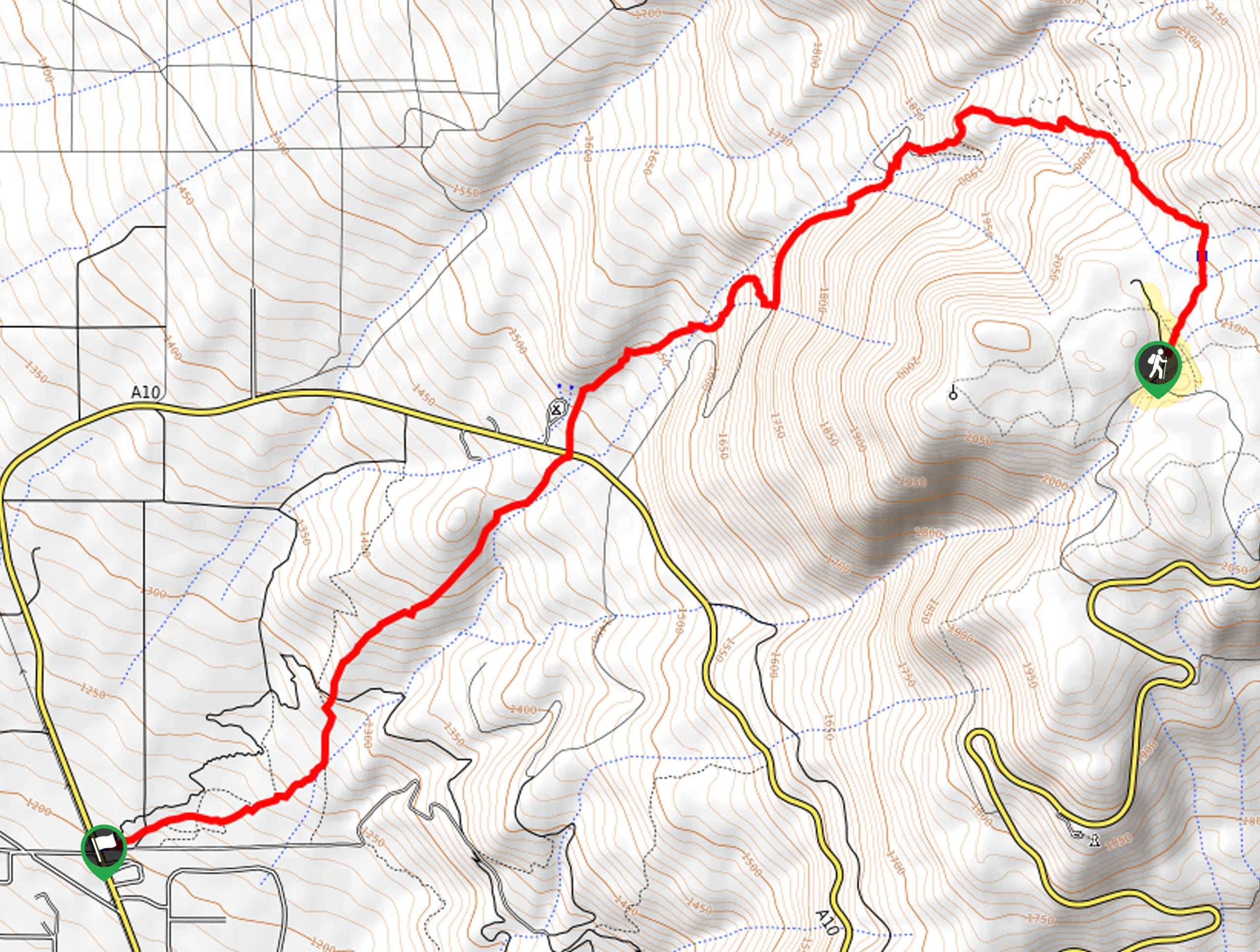
The Burney Falls Loop is accessed via the Visitors Center and Trailhead off State Highway 89.

About
| Backcountry Campground | No |
| When to do | Year-round |
| Pets allowed | No |
| Family friendly | Yes |
| Route Signage | Good |
| Crowd Levels | Extreme |
| Route Type | Circuit |
Burney Falls Loop
Elevation Graph
Weather
Burney Falls Loop Description
The popularity of the Burney Falls Loop is a testament to its beauty and grandeur. Hike amongst dozens of like-minded, eager explorers on any given day, year-round. Even during a drought, when every other waterfall in the state dries, the Burney Falls continue to pour. The summer months see the most traffic, but winter excursions are equally as scenic. When hiking in the winter, be mindful of your footing on the likely icy and snow-packed terrain—we encourage winter trekkers to strap on a pair of microspikes to navigate the trails safely. Note dogs are not allowed on the trail, and there is a $10USD parking fee to be paid at the kiosk.
Easy-going, well maintained, and unparalleled in its beauty, the Burney Falls Loop is a must-visit when exploring Shasta County. Hikers of all skill levels and ages can explore this picture-perfect hike— there is even a vantage point off the parking lot for those unable to track the trail to enjoy the mesmerizing sights of the waterfall. Wander through the forested valley and marvel at the sights of the cascades framed by lush greenery. Flowing through the stratum, the horizontal range of the waterfall is just as impressive as its height. Though inviting, swimming is prohibited in the blue-hued pool at the base of the surging waterfall. This amazing environment boasts incredible scenery that cannot be topped.
Before heading out, make sure your camera is charged! The short nature walk departs from the trailhead off of the parking lot when you are ready. Though you can venture the circuit in either direction, we opted to travel clockwise. Setting out from the trailhead, veer left onto the Burney Falls Loop, and almost immediately you will be granted sights of the falls. Admire the scene of the curtain falls bounded by trees and lush flora. As you continue, the soothing sounds of the surging water will intensify as you pass the profile of the cascades and make your way south to a footbridge over Burney Creek. After crossing the creek, you will encounter an intersection with the PCT; keep right onto the Burney Falls Loop.
Now meandering north, the path will gently descend to another epic overlook. Revel in the beauty of the crashing cascades fed by the underground streams that flow through volcanic rock and when you are ready, continue your adventure. The remainder of the hike will lead you through the forested valley abundant with a diversity of flora. The trail will divert you south after crossing the creek via Rainbow Bridge. As you hike, enjoy interrupted views of the falls before navigating a switchback out of the valley and back to the trailhead– marking the end of your adventure.
Trail Highlights
Burney Falls
Burney Falls, once described as “the Eighth Wonder of the World” by President Theodore Roosevelt, is a beautiful cascade located in the Cascade Mountains. Fed by the release of meltwater from the porous volcanic rocks through the underground springs, this is one of the few year-round waterfalls in the state. Surging over 129ft, the Burney Falls provides an approximate flow rate of 379 million liters per day, even during the dry summer months. This amazing waterfall is a must-see when in the Shasta National Forest.
Frequently Asked Questions
How long is the Burney Falls Loop?
The Burney Falls Loop Trail is a 0.9mi circuit hike in the Shasta National Forest.
Is the Burney Falls Loop easy?
The Burney Falls Loop is a family-friendly adventure in the Shasta National Forest. This easy-going route can be muddy or slippery in the off-season, so mind your footing.
Can you swim in Burney Falls?
No, swimming is prohibited in Burney Falls.
How much does it cost to hike the Burney Falls Loop?
The Burney Falls Loop requires a $10USD entrance fee.
Insider Hints
Arrive in the early morning for a more tranquil experience
In the spring the terrain is sometimes muddy, so don’t wear your new white runners!
In the winter, months strap on a pair of snowshoes or microspikes to safely navigate the terrain
Bring cash as the kiosk does not always accept cards
Similar hikes to the Burney Falls Loop hike
Elsa Rupp Nature Trail
The Elsa Rupp Nature Trail is a wonderful escape from the hustle and bustle of the city. Reconnect with nature…
Lower Hat Creek Trail
Hikers of all skill levels, ages, and ability levels can enjoy the Lower Hat Creek Trail. This wonderful nature path…
Sisson Southern Trail
The Sisson Southern Trail is a wonderful one-way expedition along the outskirts of Mount Shasta that connects the Sand Flats…
Comments