Panther Meadows Trail
View Photos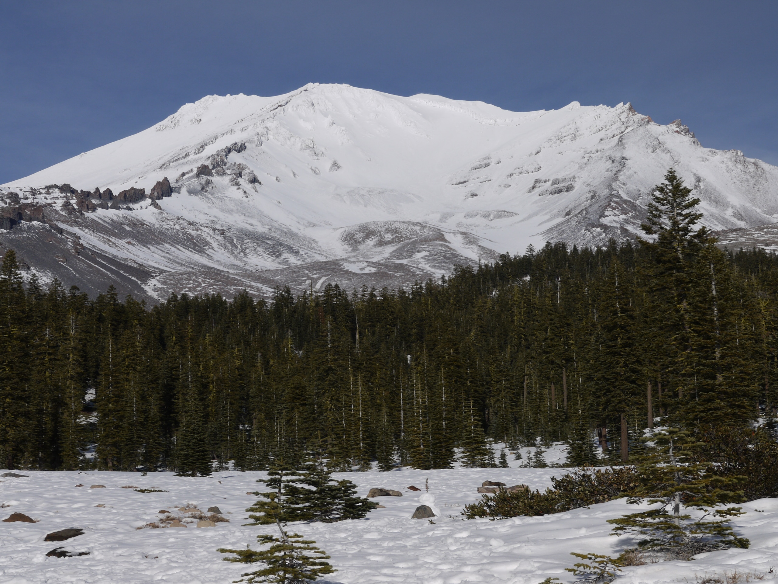
Panther Meadows Trail
Difficulty Rating:
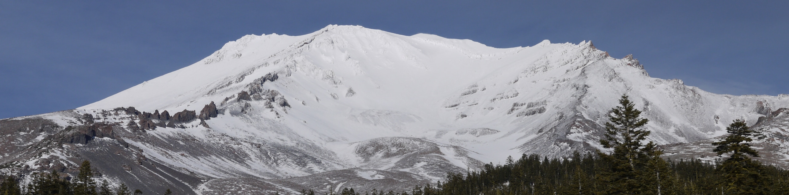
The Panther Meadows Trail is a scenic adventure through an alpine meadow abundant with vibrant flora and granite outcrops. Immerse yourself in the high country and marvel in the epic mountain views along the way.
Getting there
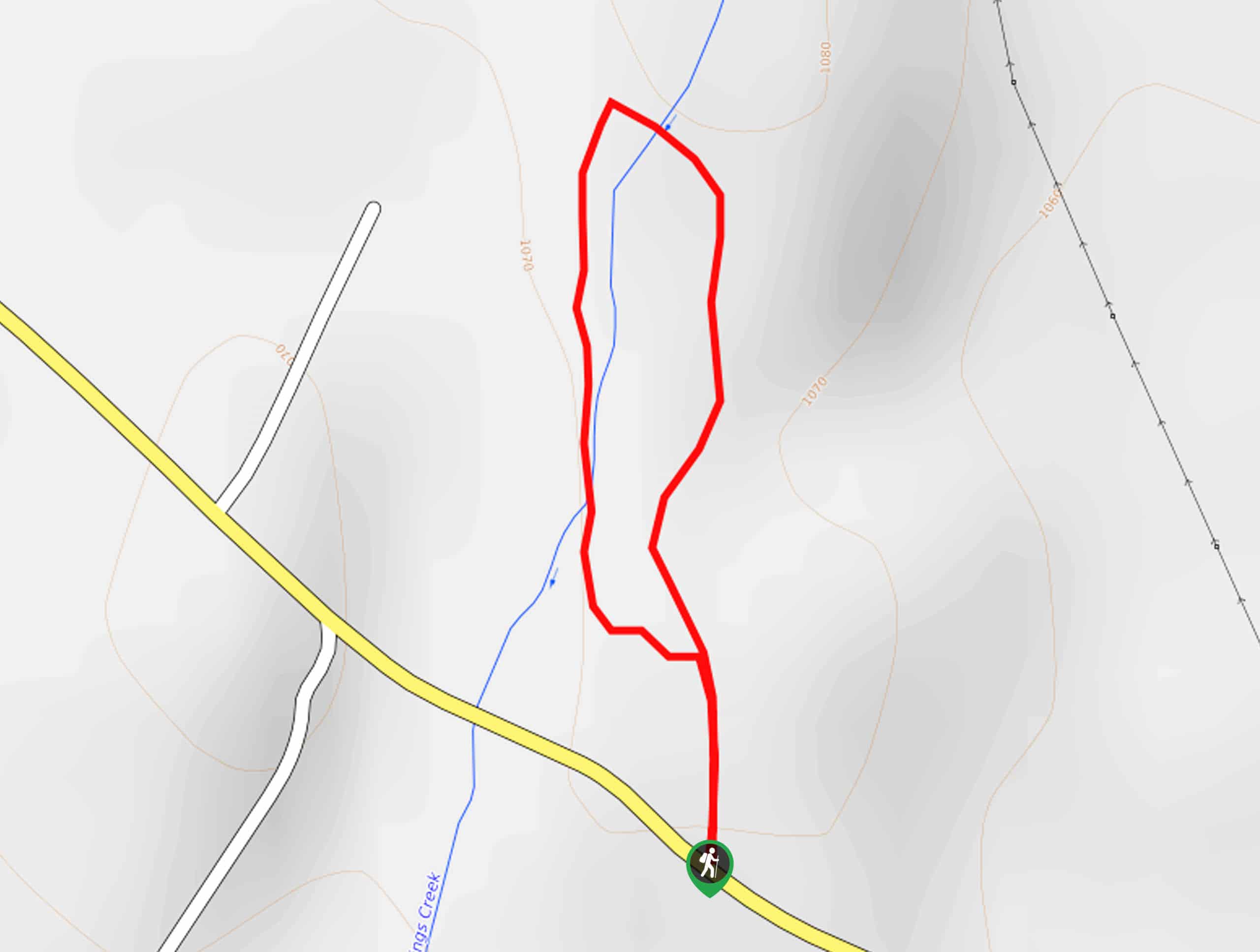
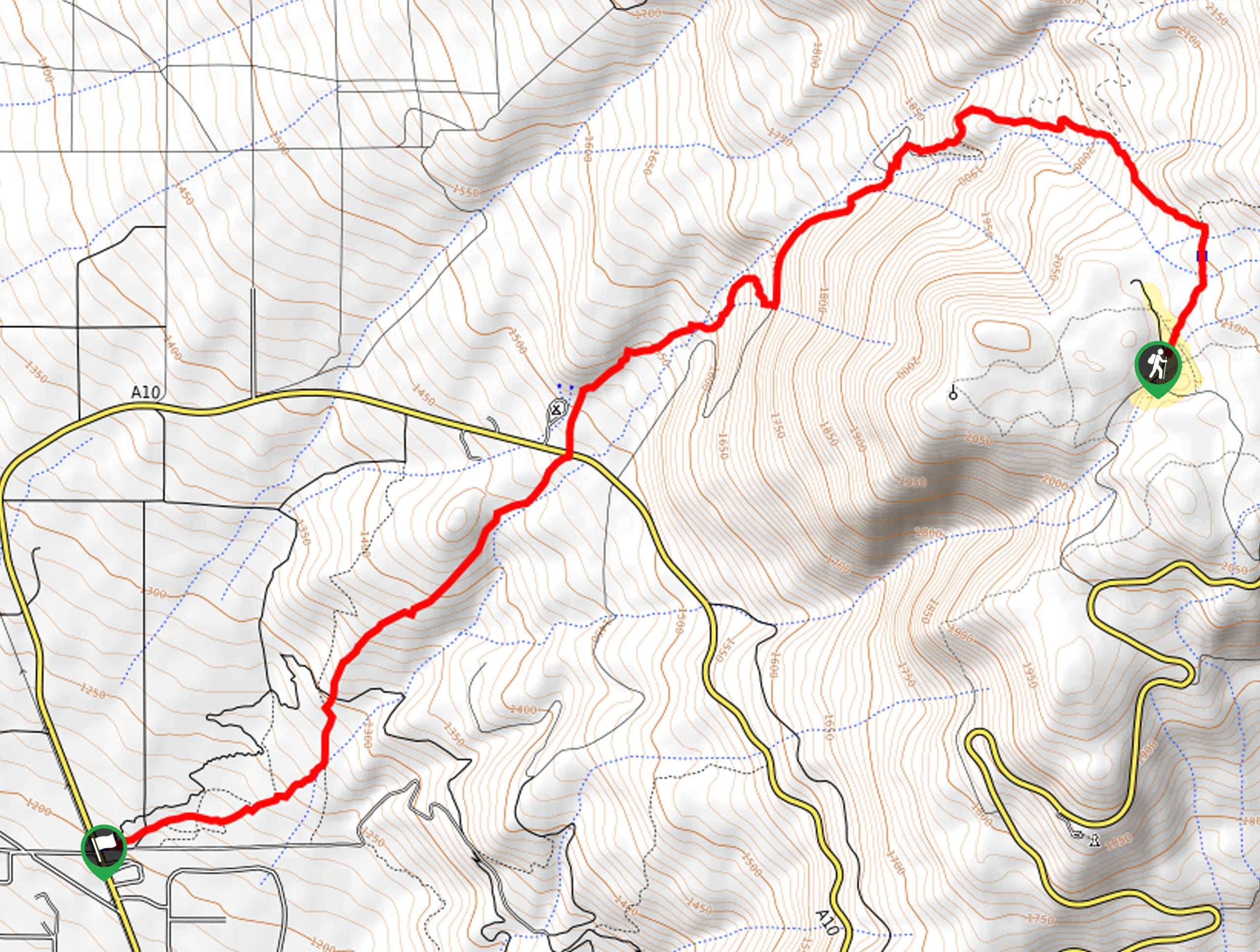
The Panther Meadows Trail departs from the trailhead and car park off Everitt Memorial Highway.

About
| Backcountry Campground | |
| When to do | Year-round |
| Pets allowed | Yes - On Leash |
| Family friendly | Yes |
| Route Signage | Average |
| Crowd Levels | Moderate |
| Route Type | Out and back |
Panther Meadows Trail
Elevation Graph
Weather
Panther Meadows Trail Description
Hikers of all skill levels and ages can enjoy this beautiful adventure through Panther Meadows. Indulge in commanding views of Mount Shasta dominating the skyline as you explore the tundra adorned with diverse flora and a snowmelt stream. Note this path is exposed, so check the forecast and dress accordingly! Note the terrain is rocky, so mind your footing to avoid a rolled ankle. Although this route is accessible year-round, we enjoy it most in the autumn when the fall colors are vibrant.
Embark on your adventure along the Panther Meadow Trail from the trailhead in the Panther Meadow Campground. From here, the Panther Meadow Trail will lead you to an intersection; keep left here. Now meandering northeast, the route will gradually climb through the meadowlands, and sparse tree stands. Admire the scene of the encompassing snow-capped summits, including Mount Shasta. Mind your footing as the trail intersects with the stream.
When you ultimately reach the trail’s end, turn around, and retrace your footing along the path back to the trailhead, marking the end of your adventure.
Similar hikes to the Panther Meadows Trail hike
Elsa Rupp Nature Trail
The Elsa Rupp Nature Trail is a wonderful escape from the hustle and bustle of the city. Reconnect with nature…
Lower Hat Creek Trail
Hikers of all skill levels, ages, and ability levels can enjoy the Lower Hat Creek Trail. This wonderful nature path…
Sisson Southern Trail
The Sisson Southern Trail is a wonderful one-way expedition along the outskirts of Mount Shasta that connects the Sand Flats…
Comments