
Toad Lake Trail
View Photos
Toad Lake Trail
Difficulty Rating:
Leading hikers through meadows and tree stands to a charming alpine lake, the Toad Lake Trail can be enjoyed by adventurers of all skill levels and ages. This route can be explored year-round, offering awe-inspiring views of the high-country for you to indulge in.
Getting there
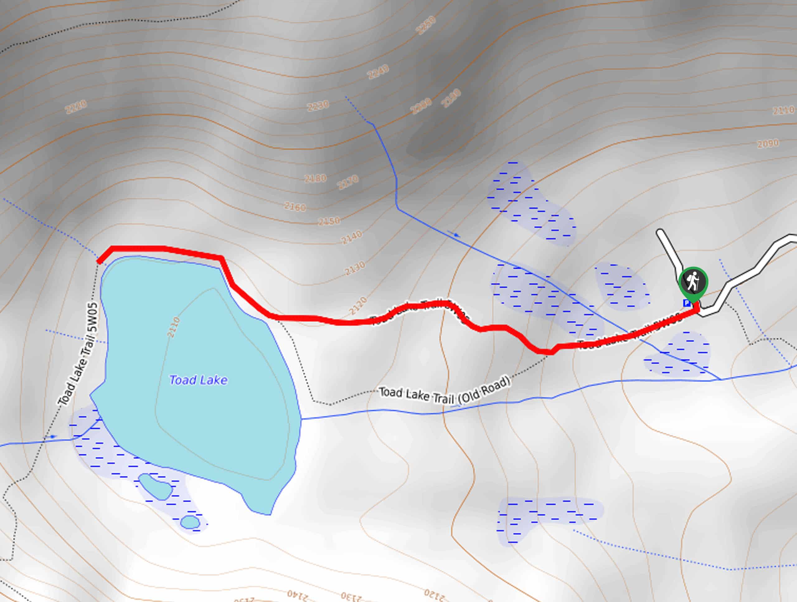
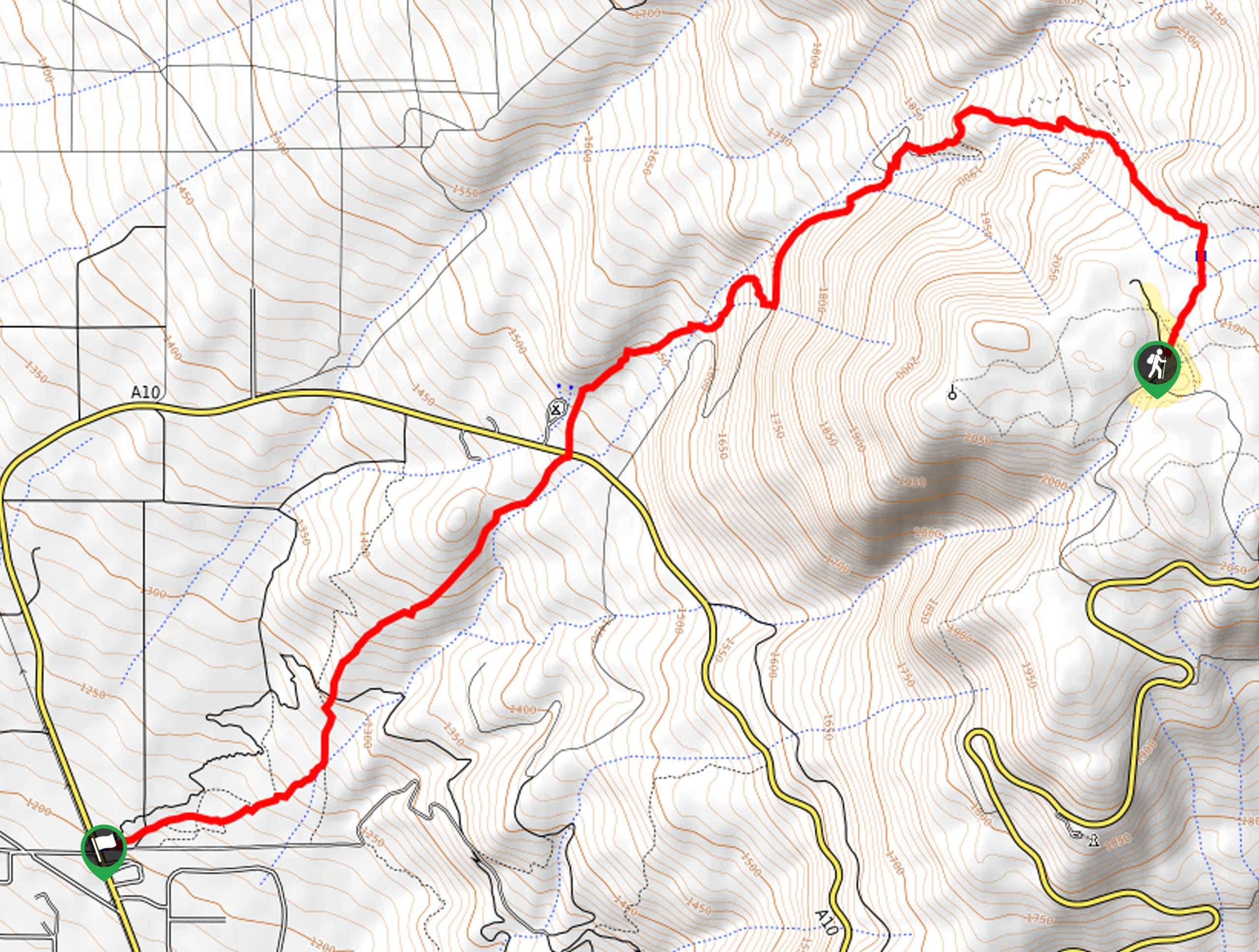
The Toad Lake Trail departs from the trailhead off Toad Lake Road.

About
| Backcountry Campground | No |
| When to do | Year-round |
| Pets allowed | Yes - On Leash |
| Family friendly | Yes |
| Route Signage | Average |
| Crowd Levels | Moderate |
| Route Type | Out and back |
Toad Lake Trail
Elevation Graph
Weather
Toad Lake Trail Description
The Toad Lake Trail is an excellent choice for your next city escape into the Shasta National Forest. This fun family adventure travels through a mountain basin through vibrant meadows, and sparse tree stands to a crystalline alpine lake. If you are daring enough, hop into the deceivingly frigid waters! Note the road to the trailhead is rough and rugged, demanding a vehicle with 4-wheel drive in the winter months.
Setting out from the trailhead, the Toad Lake Trail tracks west, climbing towards the lake. As you wander, the path will lead you through a meadowland abundant with vibrant flora before entering a tree stand. The path is obstructed with granite outcrops, so mind your footing as you hike.
Soon you will reach the shoreline of Toad Lake. Here you will find benches overlooking the water.
Enjoy the scene of the shimmering lake encircled by towering pines and impressive bluffs. Admire the beauty of the lake, and when you are ready, head back the way you came to the trailhead.
Similar hikes to the Toad Lake Trail hike
Elsa Rupp Nature Trail
The Elsa Rupp Nature Trail is a wonderful escape from the hustle and bustle of the city. Reconnect with nature…
Lower Hat Creek Trail
Hikers of all skill levels, ages, and ability levels can enjoy the Lower Hat Creek Trail. This wonderful nature path…
Sisson Southern Trail
The Sisson Southern Trail is a wonderful one-way expedition along the outskirts of Mount Shasta that connects the Sand Flats…
Comments