Castle Lake Trail
View Photos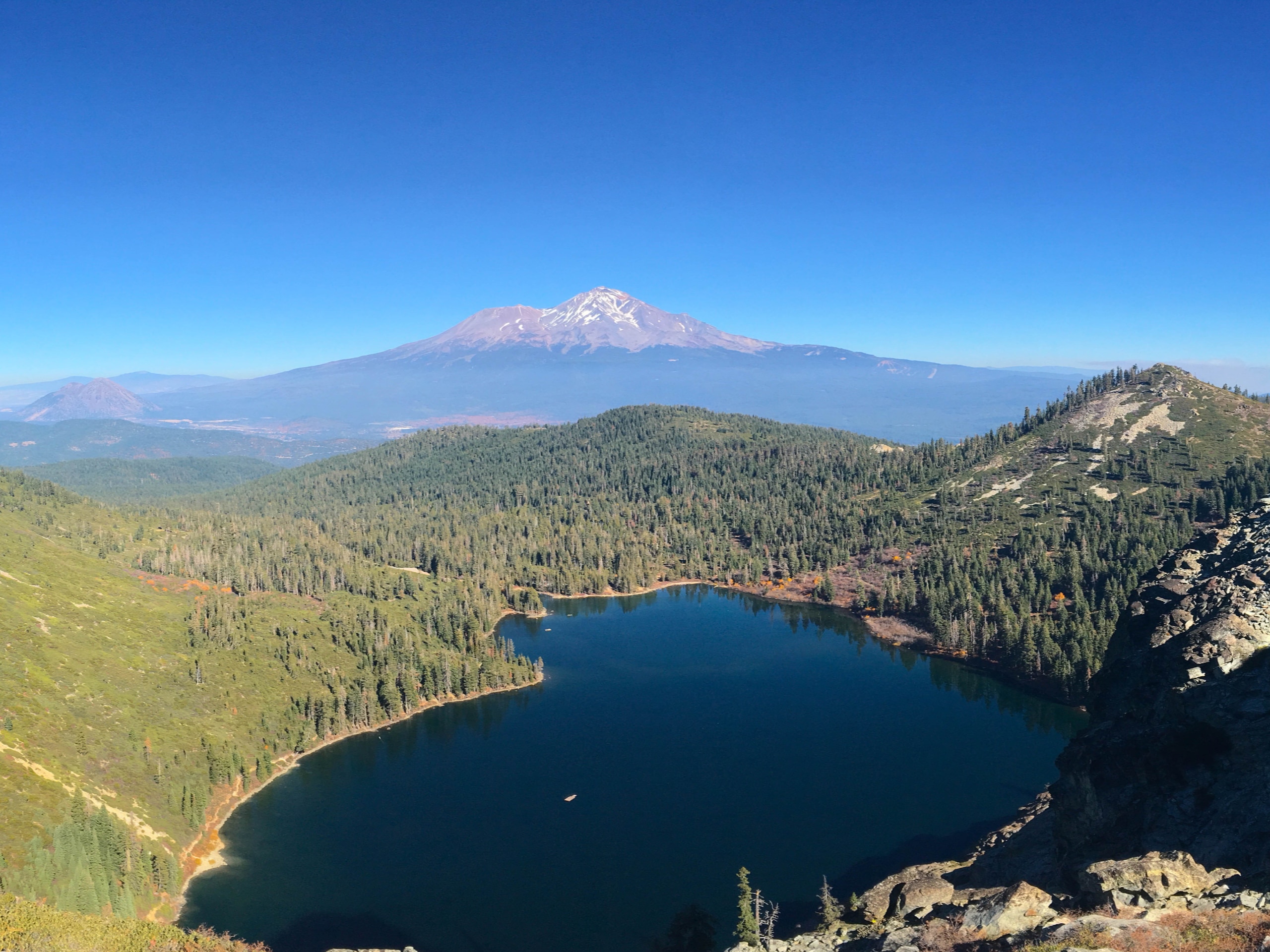
Castle Lake Trail
Difficulty Rating:
The Castle Lake Trail is a picturesque adventure in the Shasta-Trinity National Forest. This revered route travels along the shoreline of the glacial basin up to an exposed divide that boasts uninterrupted vistas of Mount Shasta and the Klamath Mountains. Beckoning intrepid spirits year-round, this trek is a must-add to your hiking itinerary.
Getting there
Access the Castle Lake Hike from the trailhead at the end of Castle Lake Road.

About
| Backcountry Campground | No |
| When to do | Year-round |
| Pets allowed | Yes - On Leash |
| Family friendly | No |
| Route Signage | Poor |
| Crowd Levels | Moderate |
| Route Type | Out and back |
Castle Lake Trail
Elevation Graph
Weather
Castle Lake Trail Description
Immerse yourself in the beauty of the Shasta-Trinity National Forests along the Castle Lake Trail. This incredible adventure offers unrivaled vistas of the Klamath Mountains and Castle Crags. The exposed terrain warrants extreme weather, offering epic alpine views, so hikers are encouraged to dress in layers as insurance against changing conditions. We also urge you to wear sturdy, ankle bracing footwear due to the rocky and uneven terrain. Offering magical scenery year-round, winter adventures boast more challenging circumstances, so make sure you are properly equipped if you are daring enough to head out in the snowy season. Note sections of the path are only marked by cairns, so download the trail GPS prior to your trek to
Get your heart rate up and indulge yourself in sweeping alpine views along this high-country adventure. Offering some of the best views in Northern California, the Castle Lake Hike is well worth a detour into the Castle Crags Wilderness. This trek is no walk in the park, reserved for experienced hikers and those seeking a challenge– though it is well worth the sweat! Head out in the morning for a more tranquil experience, and if you are an early riser, we encourage you to head out before dawn with a headlamp to watch the sunrise over the mountainous landscape. No matter the season or the time of day, the Castle Lake Trail will not disappoint.
Your journey along the Castle Lake Trail begins from the trailhead off Castle Lake Road. Setting out from here, you will be guided east over a small delta which may require you to get your feet wet when the water is high. After crossing Castle Lake Creek, the path will redirect you south, along the eastern shore of Castle Lake. Admire the picture-perfect scene of the blue-hued waters bound by craggy granite walls adorned with lush conifers. Now climbing up the bluff via switchbacks, you will eventually reach a saddle. Here you will confront an intersection, veer left. Before continuing your trek, admire the overlook of Castle Lake.
When you are ready, continue your hike—heading east along the Little Castle Lake/Mount Baldy Trail. Beyond this point, the trail is not well signposted, so adventurers will have to use the trail GPS or follow the rock cairns. From here, the path will gradually descend to Little Castle Lake. If the small lake is full, you will have to navigate another crossing over Ney Springs Creek. This is a great place to stop for a break and let your pup rehydrate before continuing on.
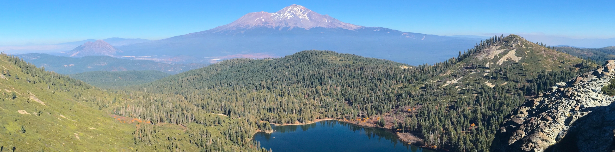
Now climbing, you will summit a ridge that boasts views of Mount Shasta in the northeast and neighboring Klamath Mountains. Wandering east along the ridge through delicate flora and mixed conifers, you will also be rewarded with impressive sights of the Castle Crags in the south. Marvel at the topographic diversity that encompasses you and continue wandering towards Mount Bradley. You will ultimately reach your turnaround point at the intersection with Mount Bradley Road. From here, head back and retrace your footing along the path all the way back to the trailhead, marking the end of your adventure.
Trail Highlights
Castle Lake
Castle Lake is a charming glacial pool nestled amongst the Klamath Mountains in Northern California. Encompassing roughly 50 acres, sitting at an elevation of 5440ft, the lake drains into Castle Lake Creek, a tributary of the Lake Siskiyou reservoir. The chilly alpine waters beckon adventurers seeking refuge from the heat in the summer months. Water recreation and hiking, camping, and fishing are popular outdoor pursuits in the area. The next time you find yourself in the Shasta-Trinity National Forest, this beautiful lake is well worth a visit!
Frequently Asked Questions
How long is the Castle Lake Trail?
The Castle Lake Trail is a 10.2mi out-and-back hike in the Shasta-Trinity National Forest.
Can you swim in Castle Lake?
Yes, Castle Lake offers great swimming opportunities in the warmer months.
Where is Castle Lake in California?
Castle Lake is a glacial basin in Siskiyou County in Northern California.
Insider Hints
In the winter months, be sure to strap on a pair of microspikes or snowshoes to safely navigate the snow-capped, icy terrain
Wear a pair of sturdy footwear to safeguard your ankles on the uneven, rocky terrain
Dress in layers as insurance against changing conditions
Charge your camera, this route warrants countless photo opportunities
Maintain on the marked path at all times—the flora is delicate
Similar hikes to the Castle Lake Trail hike

East Weaver Lake Trail
The East Weaver Lake Trail is a wonderful adventure on the boundary of the Trinity Alps Wilderness that features amazing…

Bluff Lake via PCT
The Bluff Lake via PCT is a secluded adventure in the Shasta-Trinity National Forest that offers wonderful scenery and makes…
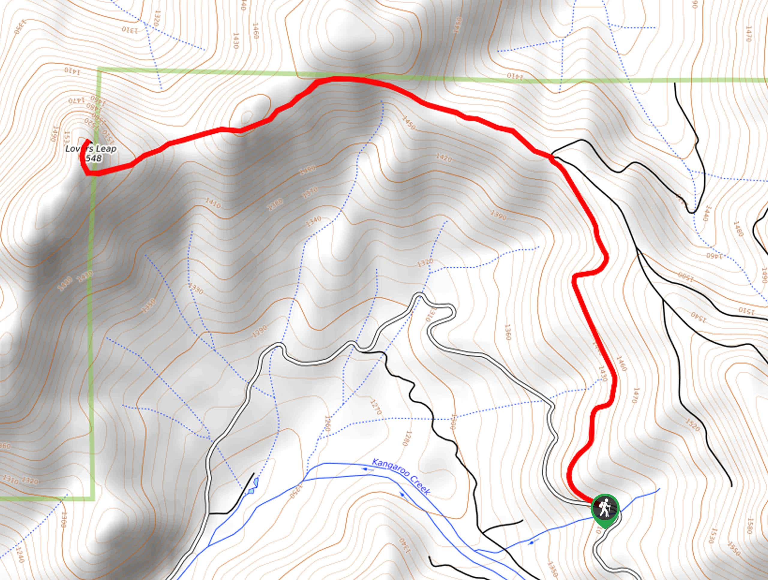
Lover’s Leap Hike
The Lover’s Leap Hike is an awesome adventure up to the summit of a granite bluff overlooking the Cascade Range…
Comments