Dog Trail via Bunny Flat
View Photos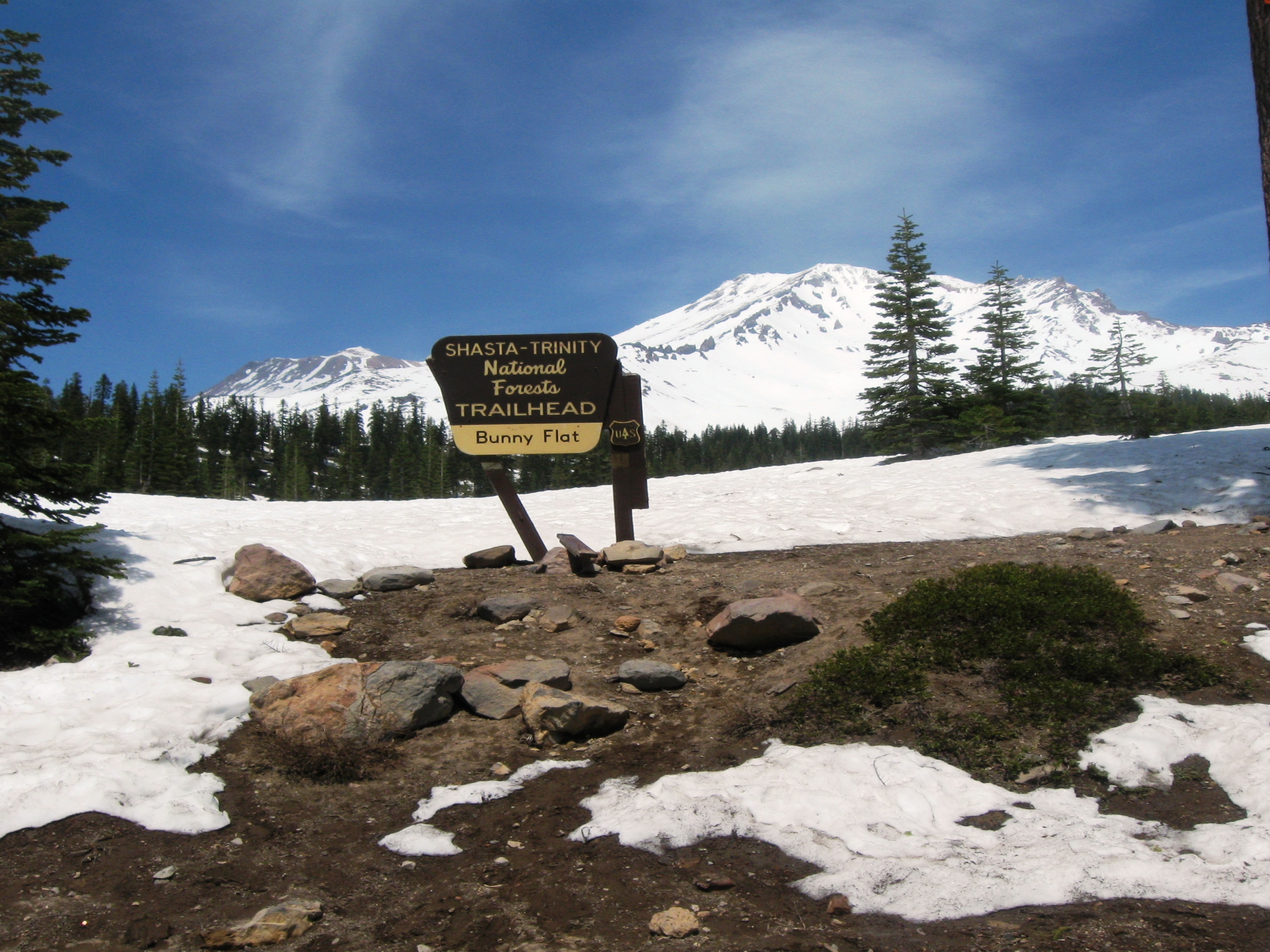
Dog Trail via Bunny Flat
Difficulty Rating:
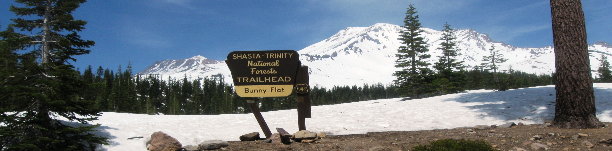
Seeking a taste of what Mount Shasta is all about? Well, the Dog Trail via Bunny Flat explores the southern slope of Mount Shasta, tracing the timberline, rewarding hikers with dumbfounding views of the Castle Crags, the Sacramento River, and the Klamath Mountains.
Getting there
The Dog Trail via Bunny Flat departs from the Horse Camp Trailhead off Everitt Memorial Highway.

About
Dog Trail via Bunny Flat
Elevation Graph
Weather
Dog Trail via Bunny Flat Description
The Dog Trail via Bunny Flat is an excellent addition to your Shasta-Trinity National Forest hiking itinerary. Easy-going, scenic, and manageable by hikers of most skill levels and ages, this route attracts eager explorers year-round. Visitors can enjoy a more sequestered experience when hiking in the early morning before the horseback riders and dozens of adventurers arrive. Note wintertime treks require a pair of snowshoes or crampons!
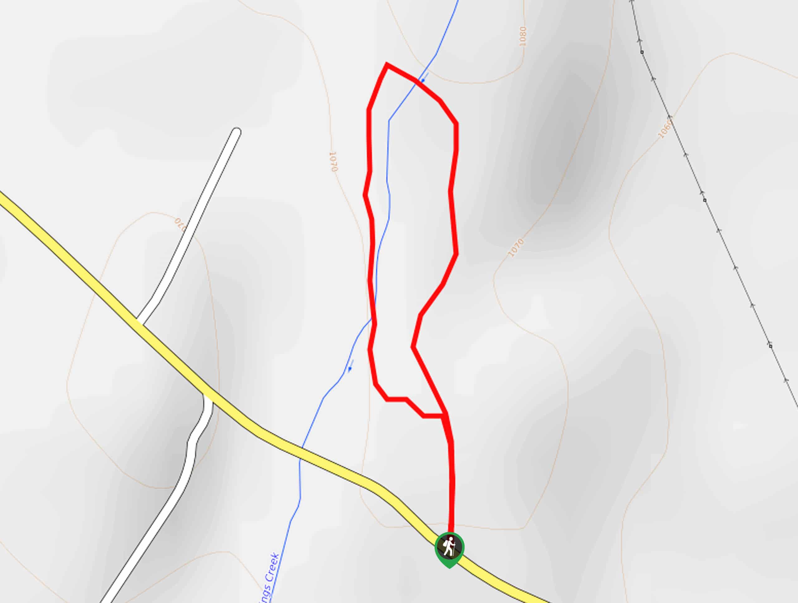
Setting out from the Horse Camp Trailhead, the Dog Trail via Bunny Flat follows the Horse Trail north to an intersection. Here, veer right, and you will be diverted onto the Snow Bunny Trail. This route travels eastwardly along the timberline. As you wander, you will likely be in the company of hikers with their pups, as this is one of the few hikes along the skirts of Mount Shasta that permit four-legged friends. Enjoy the view of Mount Shasta towering above and the Klamath Mountains in the southwest.
You will ultimately reach the trail’s end at the Green Butte Trailhead. From here, turnaround and retrace your footing along the path back to the trailhead.
Similar hikes to the Dog Trail via Bunny Flat hike

East Weaver Lake Trail
The East Weaver Lake Trail is a wonderful adventure on the boundary of the Trinity Alps Wilderness that features amazing…
Elsa Rupp Nature Trail
The Elsa Rupp Nature Trail is a wonderful escape from the hustle and bustle of the city. Reconnect with nature…

Bluff Lake via PCT
The Bluff Lake via PCT is a secluded adventure in the Shasta-Trinity National Forest that offers wonderful scenery and makes…
Comments