
Mount McConnel Trail
View Photos
Mount McConnel Trail
Difficulty Rating:
Lace those hiking boots and fill your water bottles because we are heading out on the Mount McConnel Trail. Hike through the diverse terrain that the Cache La Poudre Wilderness has to offer and summit the Mount McConnel peak.
Getting there
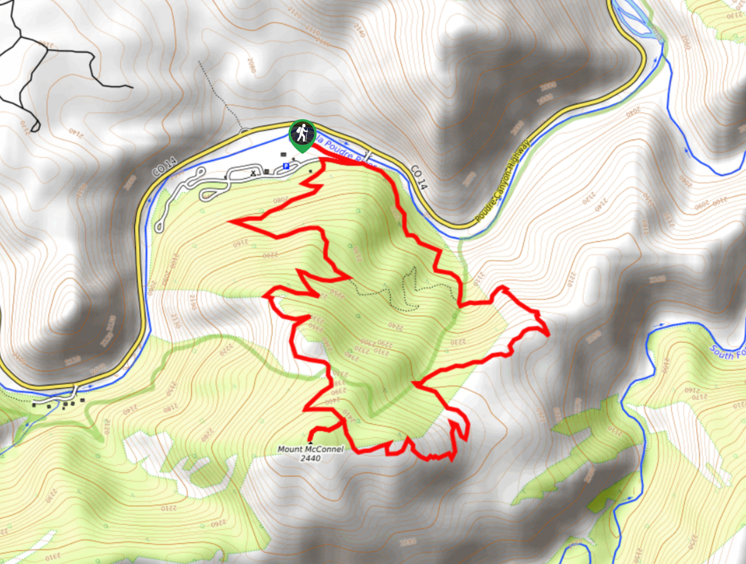
The Mount McConnel Trailhead is located within the Mountain Park Campground off Poudre Canyon Highway.

About
| Backcountry Campground | |
| When to do | April-September |
| Pets allowed | Yes - On Leash |
| Family friendly | Older Children only |
| Route Signage | Poor |
| Crowd Levels | High |
| Route Type | Circuit |
Mount McConnel Trail
Elevation Graph
Weather
Mount McConnel Hike Description
The Mount McConnel Trail is a unique adventure through the Front Range. This path will guide you through the eerie burn area blazed by a wildfire before guiding you through lush pine forestlands. Travelling through several types of terrain, this excursion will do anything but bore you. Note that in the winter and autumn months the ground is often layered with snow and ice, we recommend bringing microspikes to navigate these possibly icy sections. Due to the beetle kill in the area and burn damage, the path is hard to find in areas, bring along the trail GPS to avoid taking a wrong turn.
From the parking lot the trailhead is tucked behind a gate. From the gate you will confront a fork on the road, this adventure can be completed in either direction, but we went clockwise. Turn left onto the Mount McConnel Trail and trek through the dense tree coverage. As you hike the trail will gradually gain elevation. Soon the tree shade will become sparse as you walk through granite outcroppings. Continue trekking up the trail and you will soon near the base of Mount McConnell. As you climb up to the peak the path will be lined with towering granite cliffs and spires. Hike up the rocky terrain to the summit of Mount McConnel. Revel in the vistas of the mixed landscape below and the encompassing rolling mountains.
When you descend the mountain take the Mount McConnel Trail west and navigate rocky switchbacks down the ridge. Trek along the path and it will eventually lead you back to the parking lot.
Similar hikes to the Mount McConnel Trail hike

Hankins Pass Hike
The Hankins Pass Hike is a quintessential adventure across the Lost Creek Wilderness. The hike demonstrates the diversity of the…

Miller Gulch Loop Trail
The Miller Gulch Loop Trail is a scenic meadowland adventure in the Pike National Forest. Hike through grassy meadows laden…

The Castle Hike
The Castle Hike is an exciting adventure up the steep, forested terrain to The Castle Rock. From atop the summit,…
Comments