
Red Feather Falls
View Photos
Red Feather Falls
Difficulty Rating:
The hike up to the Red Feather Falls, otherwise known as Disappointment Falls, is a scenic nature walk. We know what you’re thinking, Disappointment Falls? The falls themselves are a little underwhelming, but the journey there makes up for the lack of grandeur. Hike through dense aspen forests, past grazing cattle and through granite outcroppings all before culminating at the Red Feather Falls.
Getting there
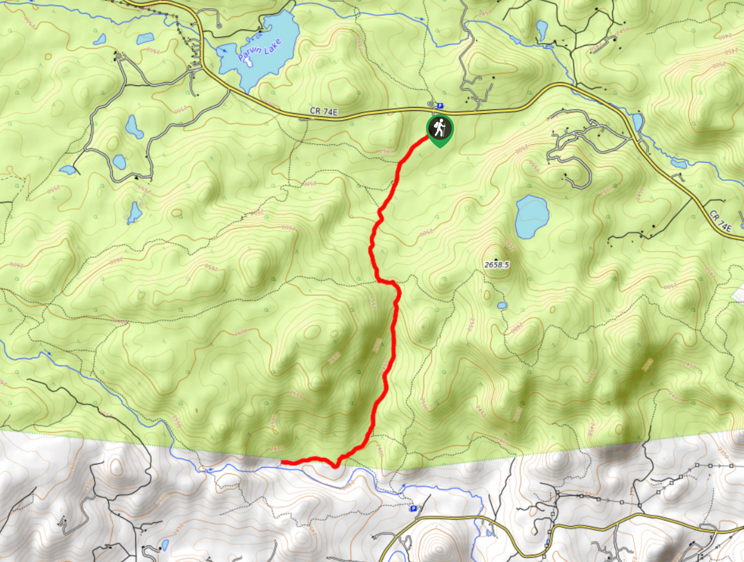
The Red Feather Falls Trailhead is in the Cache La Poudre Wilderness off County Road 74E.

About
| Backcountry Campground | No |
| When to do | February-October |
| Pets allowed | Yes - On Leash |
| Family friendly | Yes |
| Route Signage | Good |
| Crowd Levels | High |
| Route Type | Out and back |
Red Feather Falls
Elevation Graph
Weather
Red Feather Falls Hike Description
Though the thought of a hike up to “Disappointment Falls” may not be the most enticing adventure, the path up to the waterfall is stunning, especially in the fall. Though the Red Feather Falls trail can be completed year-round, we recommend hiking it in the fall when the aspens are a vibrant yellow. Note this path can be muddy after rainfall and snow melt, so consider leaving your new white runners at home for this hike. Add this hike to your Cache La Poudre itinerary so you can decide for yourself whether the falls are truly disappointing.
Begin your adventures up to the Red Feather Falls from the Lady Moon Trailhead. Track southwest along the forested Lady Moon Trail. Shortly after your departure from the carpark you will encounter an intersection. Ignore the intersecting paths and continue hiking the Lady Moon Trail. Track through the cattle field and notice Lady Moon Lake in the east. At the next junction, stay straight on the Lady Moon Trail and begin your descent down the aspen gully to the falls. Keep right past the merging paths and trek down the route to Red Feather Falls.
Explore the waterfalls and the surrounding rocky terrain. Decide for yourself if the falls are truly “disappointing” before beginning your return. When you are ready to roll, simply retrace your steps up the path, back to the trailhead and parking lot.
Similar hikes to the Red Feather Falls hike

Miller Gulch Loop Trail
The Miller Gulch Loop Trail is a scenic meadowland adventure in the Pike National Forest. Hike through grassy meadows laden…

The Castle Hike
The Castle Hike is an exciting adventure up the steep, forested terrain to The Castle Rock. From atop the summit,…

Rutherford Trail
The Rutherford Hike is a charming nature walk in Georgetown Colorado. This secluded trail is a wonderful adventure the whole…
Comments