
West Ridge Trail via Loveland Pass
View Photos
West Ridge Trail via Loveland Pass
Difficulty Rating:
You will feel as though you are on top of the world as when you summit the Continental Divide. The West Ridge Trail via Loveland Pass hike is a wonderfully manageable hike up the Divide that the whole family can experience. Albeit, it will still be extremely chilly and windy, but you won’t have to scramble up technical terrain to ascend the ridge.
Getting there
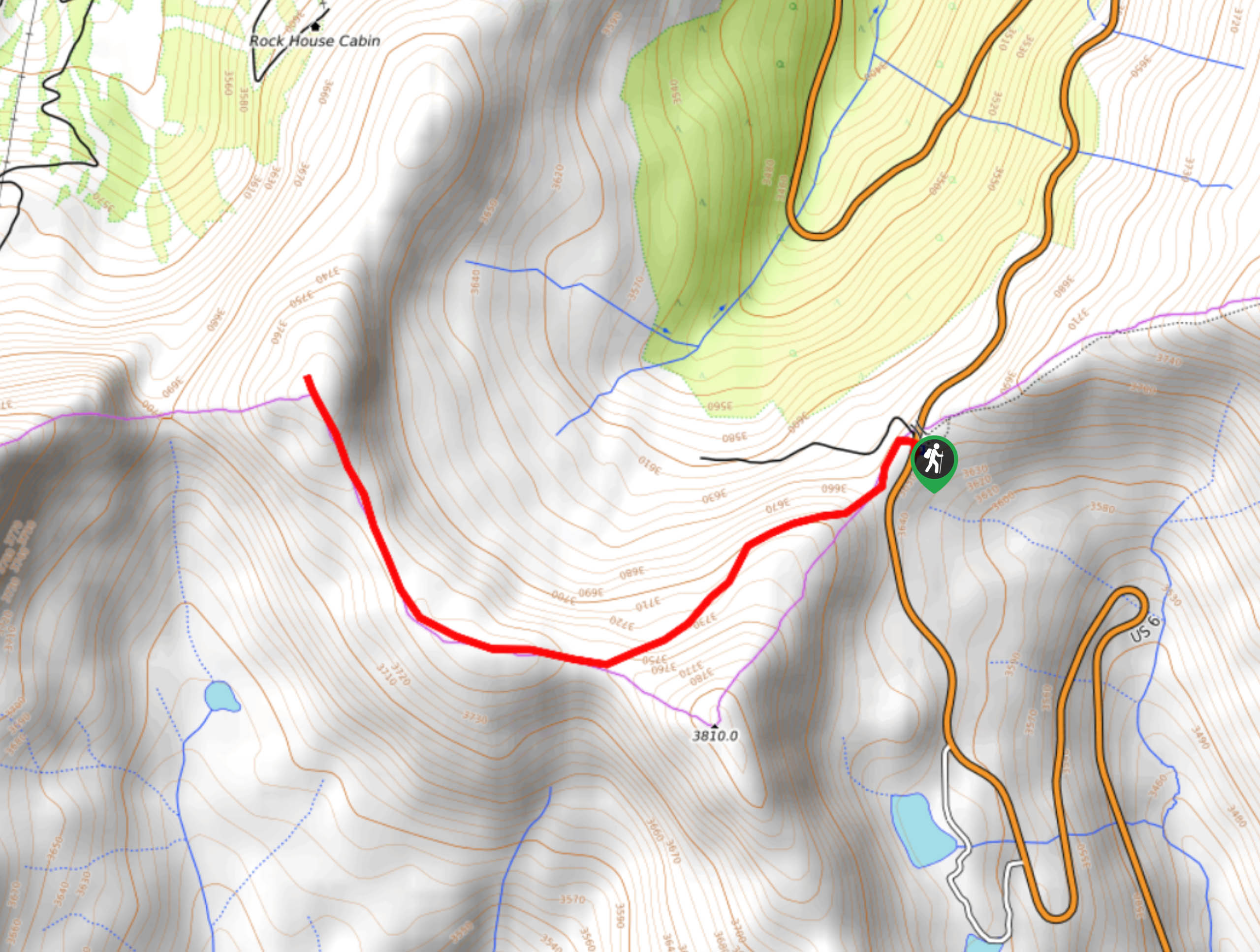
West Ridge Trail via Loveland Pass is off US Highway 6.

About
| Backcountry Campground | No |
| When to do | April-October |
| Pets allowed | Yes - On Leash |
| Family friendly | Yes |
| Route Signage | Average |
| Crowd Levels | High |
| Route Type | Out and back |
West Ridge Trail via Loveland Pass
Elevation Graph
Weather
West Ridge Trail via Loveland Pass Hike Description
Shockingly enough, there is a Continental Divide summit hike that even most children can complete. The West Ridge Trail via Loveland Pass adventure is short and sweet with gradual elevation gain. Make sure you are acclimated to the high altitude of the area prior to setting out, but hikers of most skill-levels should be able to manage this hike. Note that it will be extremely windy and cold as you climb, so wear plenty of layers and pack some water for the climb. As always, we recommend checking the weather prior to setting out to mitigate the chances of getting caught in an afternoon storm.
Begin your adventure up the West Ridge Trail via Loveland Pass from the West Ridge Trailhead. Begin climbing southwest up the exposed path. Notice the Loveland Pass Lake in the south. Hike up the rocky terrain and the route will begin to curve you north. Ascend the ridge, and you will eventually summit the West Ridge.
At the end of the trail, you will be rewarded with panoramic views. Notice Mount Sniktau in the northeast and Cupid Peak in the southeast. Admire the expansive vistas and take a breather before heading back. To get back to the trailhead simply retrace your steps along the path.
Similar hikes to the West Ridge Trail via Loveland Pass hike

Miller Gulch Loop Trail
The Miller Gulch Loop Trail is a scenic meadowland adventure in the Pike National Forest. Hike through grassy meadows laden…

The Castle Hike
The Castle Hike is an exciting adventure up the steep, forested terrain to The Castle Rock. From atop the summit,…

Rutherford Trail
The Rutherford Hike is a charming nature walk in Georgetown Colorado. This secluded trail is a wonderful adventure the whole…
Comments