
Mount Sniktau Trail
View Photos
Mount Sniktau Trail
Difficulty Rating:
The Mount Sniktau Trail is a demanding hike up the east side of the Continental Divide near Clear Creek County, Colorado. Leave the city in the rear-view mirror and head out into the wilderness as you climb up the Mount Sniktau Trail. The expansive mountainous views from the summit will make you forget all about your tired feet.
Getting there
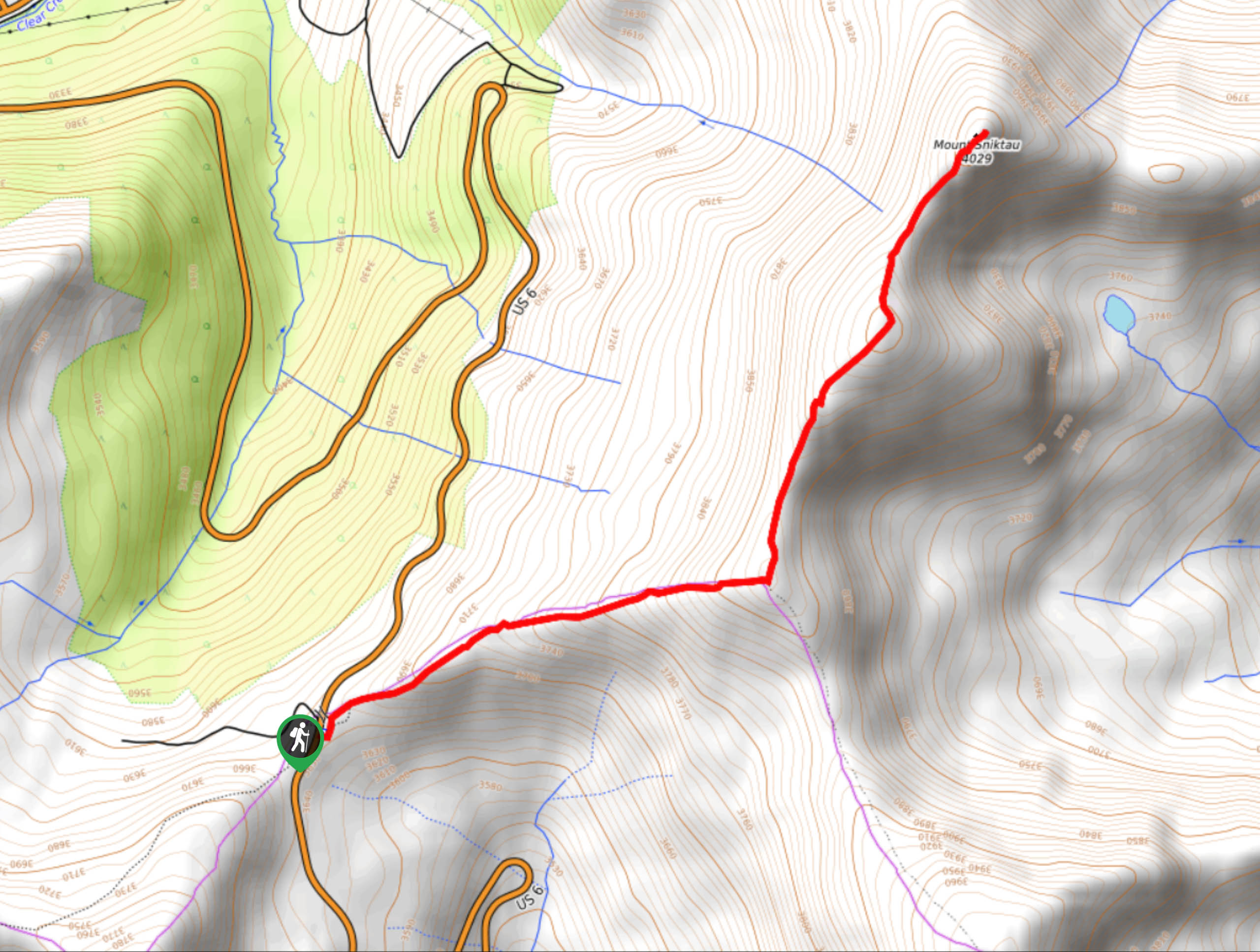
The Mount Sniktau Trailhead is located off US Highway 6 on the Loveland Pass.

About
| Backcountry Campground | Dispersed Backcountry Camping, restrictions apply. |
| When to do | May-October |
| Pets allowed | Yes - On Leash |
| Family friendly | Older Children only |
| Route Signage | Average |
| Crowd Levels | High |
| Route Type | Out and back |
Mount Sniktau Trail
Elevation Graph
Weather
Mount Sniktau Hike Description
The Mount Sniktau Trail, like most hikes along the Continental Divide, is scenic the whole way up. Enjoy panoramic views of the Divide and lush forested valleys below along the entirety of the path. Though strenuous, this hike is well worth the effort. Challenge yourself and summit Mount Sniktau in the Arapaho National Forest. Note that you will be climbing up an exposed ridge, so prepare for windy and inclement weather as you gain altitude. Always check the weather prior to setting out to avoid dangerous afternoon lightning storms. Wear layers and pack plenty of water for this adventure up to summit Mount Sniktau.
Embark on your journey up to Mount Sniktau from the trailhead and parking lot. Take the Mount Sniktau Trail northeast. You will be climbing up the path as soon as you step on the trail, all the way up to the summit. Begin trekking along the exposed route. Ascend the rocky cliffs up to the ridge and you will encounter a junction. At this point you will want to stay left on the Mount Sniktau Trail. Veer left and hike along the windy ridge. Enjoy the striking views of the Continental Divide track northwest towards Mount Sniktau.
Climb up to the summit of Mount Sniktau and revel in the 360-degree views of the Front Range. Catch your breath and appreciate the grandeur of the neighboring peaks before beginning your descent. To get back to the trailhead, simply retrace your steps along the trail.
Similar hikes to the Mount Sniktau Trail hike

Hankins Pass Hike
The Hankins Pass Hike is a quintessential adventure across the Lost Creek Wilderness. The hike demonstrates the diversity of the…

Miller Gulch Loop Trail
The Miller Gulch Loop Trail is a scenic meadowland adventure in the Pike National Forest. Hike through grassy meadows laden…

The Castle Hike
The Castle Hike is an exciting adventure up the steep, forested terrain to The Castle Rock. From atop the summit,…
Comments