
Square Top Lakes Hike
View Photos
Square Top Lakes Hike
Difficulty Rating:
The Square Top Lakes Trail is a scenic adventure through the Arapaho National Forest to the base of Square Mountain. Enjoy an up close and personal view of the flat-top peak and unforgettable vistas of the surrounding mountainous landscape. Track up the path laden with alpine willows and navigate several stream crossings on this nature excursion.
Getting there
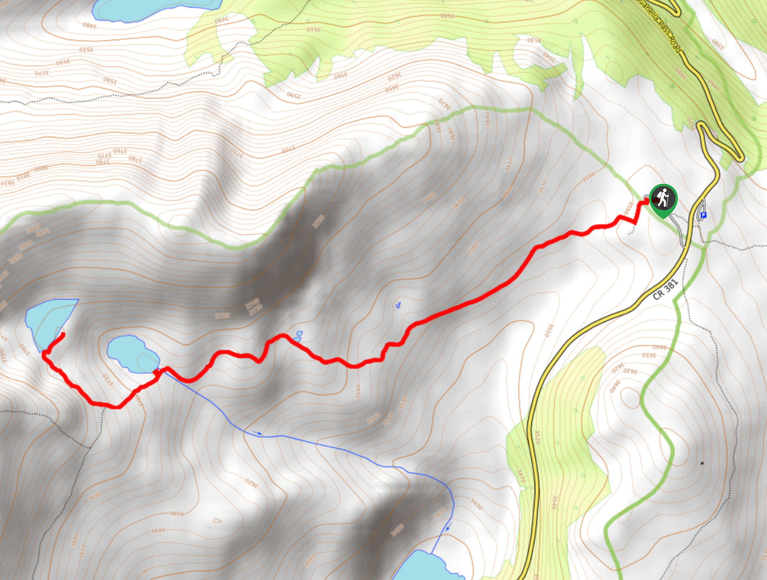
The Square Top Lakes Hike is accessed via the South Park Trailhead off Guanella Pass Road.

About
| Backcountry Campground | Dispersed Backcountry Camping, restrictions apply. |
| When to do | May-October |
| Pets allowed | Yes - On Leash |
| Family friendly | Older Children only |
| Route Signage | Average |
| Crowd Levels | High |
| Route Type | Out and back |
Square Top Lakes Hike
Elevation Graph
Weather
Square Top Lakes Hike Description
If you are looking to get out into nature for the day and pack in some movement, then the Square Top Lakes Trail is a safe bet. Hike along the quintessential Colorado tundra up to the crystalline Square Top Lakes. This trail is wonderfully scenic as it is almost entirely exposed. Hike the path and get your blood pumping as you trek up the ridge to the Square Top Lakes. Note that after heavy rainfall or snowmelt the trail can get a bit soggy.
Begin your excursion up to the Square Top Lakes from the South Park Trailhead. Track southwestward up the South Park Trail as it guides you through the grassy plains. Hike along the exposed route and admire the expansive panoramas of the surrounding tundra landscape. Trek up the path and notice Duck Lake in the south. The route will more intensely climb in elevation as you near the base of Square Top Mountain. Navigate the increasingly rocky terrain up to the Square Top Lakes.
Revel in the beauty of the crystal-clear alpine lakes that on a clear day, will reflect the image of Square Top Mountain’s peak. Explore the shores and dip your tired feet in the chilly, but inviting waters. Rehydrate and refuel before beginning your descent back down the trail, retracing your steps all the way back to the car park.
Similar hikes to the Square Top Lakes Hike hike

Hankins Pass Hike
The Hankins Pass Hike is a quintessential adventure across the Lost Creek Wilderness. The hike demonstrates the diversity of the…

Miller Gulch Loop Trail
The Miller Gulch Loop Trail is a scenic meadowland adventure in the Pike National Forest. Hike through grassy meadows laden…

The Castle Hike
The Castle Hike is an exciting adventure up the steep, forested terrain to The Castle Rock. From atop the summit,…
Comments