
Granite Ridge Ranked Peak Hike
View Photos
Granite Ridge Ranked Peak Hike
Difficulty Rating:
The Granite Ridge Ranked Peak Hike does not disappoint. Living up to its name, this trail will guide adventurers up to a unique granite peak overlooking the Cache La Poudre Wilderness. Explore the diverse landscapes that Colorado has to offer as you travel through the diverse terrain along the Granite Ridge Ranked Peak Hike.
Getting there
Granite Ridge Ranked Peak Hike is accessed via the Red Feather Lakes Road.

About
| Backcountry Campground | Dispersed Backcountry Camping, restrictions apply. |
| When to do | March-October |
| Pets allowed | Yes - On Leash |
| Family friendly | Yes |
| Route Signage | Poor |
| Crowd Levels | Moderate |
| Route Type | Lollipop |
Granite Ridge Ranked Peak Hike
Elevation Graph
Weather
Granite Ridge Ranked Peak Hike Description
Travel through cattle meadows, wetlands, past granite outcropping, through pine forests and up to an exposed summit. This unique adventure is the perfect excuse to get out into nature. Hike through the Cache La Poudre Wilderness and revel in the picturesque scenery. It is worth noting that sections of this trail are primitive and difficult to locate. We suggest using the trail GPS to help you navigate the unmarked routes. This path also weaves between tree shade and exposed terrain—wear layers as insurance against changing conditions.
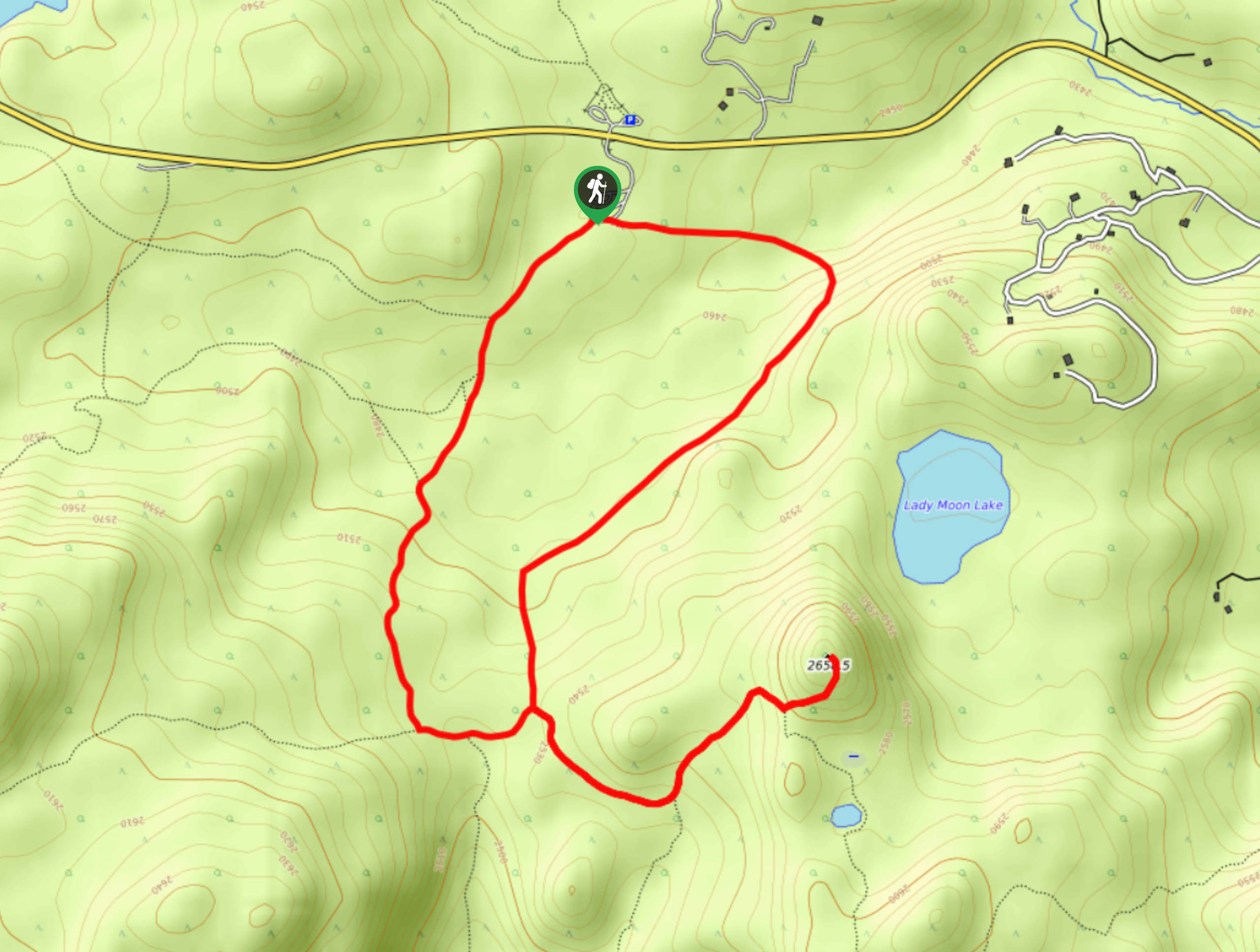
Embark on your adventure up the Granite Ridge Ranked Peak Trail from the Lady Moon Trailhead. This circuit hike can be completed in either direction, but we found it easier to navigate heading counterclockwise. Track along the Lady Moon Trail and ignore off-shooting paths. Trek through the meadows and keep your eye out for grazing cattle. The route will eventually guide you beneath tree coverage and to an intersection. At this point, you will want to turn left onto the Granite Ridge Trail. Hike along the rocky ridge and use your trail GPS to help navigate the now primitive terrain. Continue climbing the pass until you summit the ranked peak.
Explore the unique granite spires that compose the peak and revel in the expansive mountain vistas and notice Lady Moon Lake below. Retrace your steps down the summit and along the unmarked trail. When you meet back up with Granite Ridge Trail, turn right and head down an unmarked path. This route will eventually loop you back to the trailhead. Navigate the unmarked terrain through granite outcropping and wetlands back to the carpark.
Similar hikes to the Granite Ridge Ranked Peak Hike hike

Miller Gulch Loop Trail
The Miller Gulch Loop Trail is a scenic meadowland adventure in the Pike National Forest. Hike through grassy meadows laden…

The Castle Hike
The Castle Hike is an exciting adventure up the steep, forested terrain to The Castle Rock. From atop the summit,…

Rutherford Trail
The Rutherford Hike is a charming nature walk in Georgetown Colorado. This secluded trail is a wonderful adventure the whole…
Comments