
Citadel Mountain Hike
View Photos
Citadel Mountain Hike
Difficulty Rating:
Hike the Citadel Mountain Trail on your next journey into the Arapaho National Forest. This exciting adventure is reserved for intrepid outdoor enthusiasts who don’t mind off-roading. Hike the primitive trail up to the summit of Citadel Mountain, where dumbfounding vistas of the mountainous landscape await.
Getting there
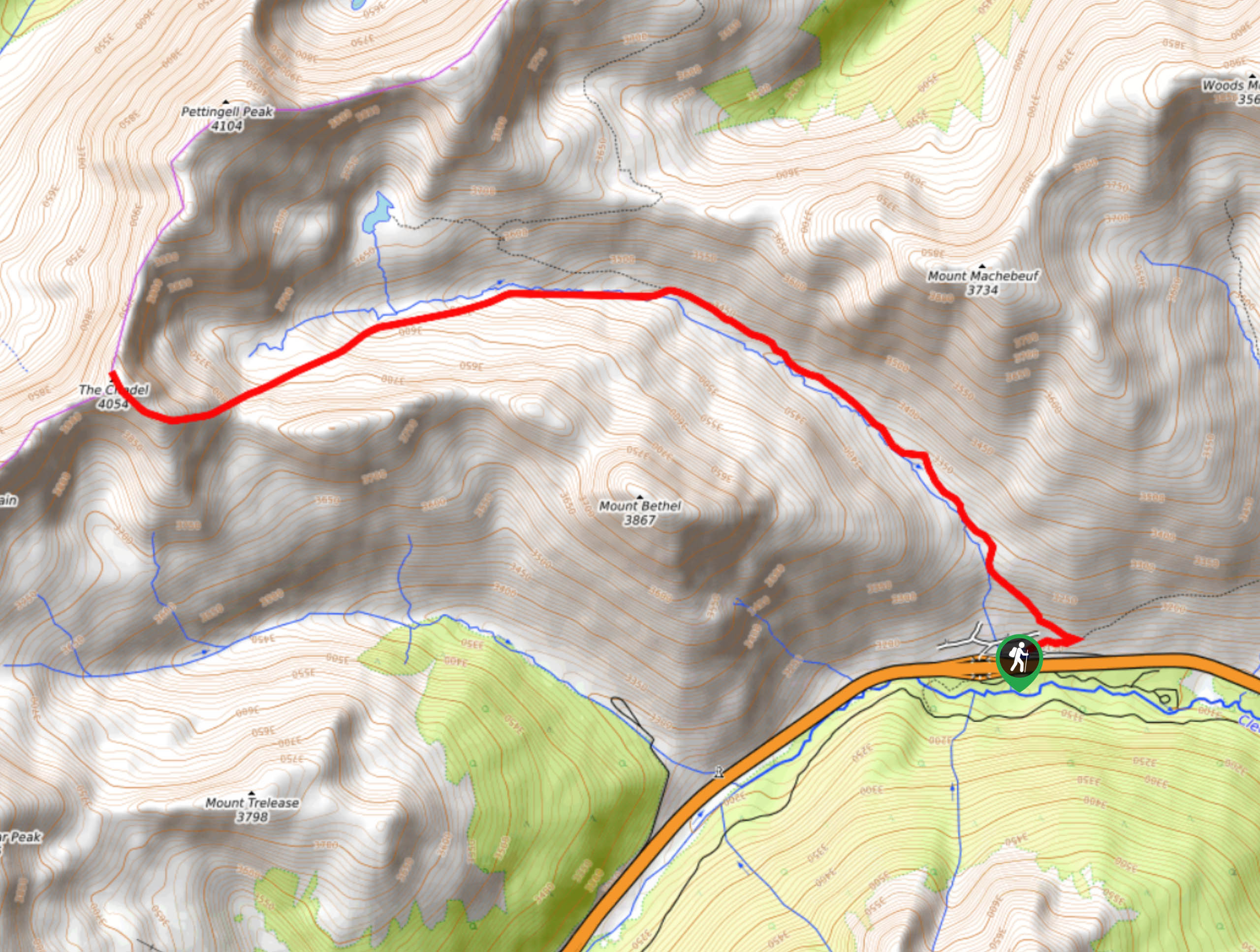
The Citadel Mountain Hike begins at the Herman Gulch trailhead off the I-70.

About
| Backcountry Campground | Dispersed Backcountry Camping, restrictions apply. |
| When to do | June-October |
| Pets allowed | Yes - On Leash |
| Family friendly | No |
| Route Signage | Poor |
| Crowd Levels | Low |
| Route Type | Out and back |
Citadel Mountain Hike
Elevation Graph
Weather
Citadel Mountain Hike Description
The Citadel Mountain Trail is an exciting wilderness excursion up to a quintessential Colorado peak. Hike up the forested gulch to a small alpine lake before summiting Citadel Mountain. Travel through the beautiful aspen woodlands before summiting the tree line and scrambling up the rocky ridges of Citadel Mountain. Reserved for experienced hikers with a keen sense of adventure, this path is stunning. Bring a trail GPS along with you on this journey, as the rearmost section of the hike up to the peak is primitive and difficult to navigate. Furthermore, dress warmly as the exposed summit will likely be windy and cold.
Embark on your journey along the Citadel Hike from the Herman Gulch Trailhead. From the trailhead and parking lot, follow the Herman Gulch Trail northwestward below the tree coverage. Hike up the aspen-lined gulch and enjoy the ambiance of the Herman Gulch Creek running beside you. Hike up the valley, and as you ascend the trail, more and more lodgepole pines will dot the path. As you climb the path, you will encounter an intersection. Stay left on the more primitive Citadel Mountain Trail.
Notice Herman Lake on your left as you diverge away from the marked route. Follow your trail GPS and the cairns from this point forward. Hike up the rocky ridge and over the mountain’s saddle. The path will guide you west up to the summit of Citadel Mountain. Bask in the expansive views of the alpine wilderness and notice Pettingell Peak across the ridge in the north. Admire the vistas before beginning your descent. When you are ready, backtrack along the path down to the parking lot.
Similar hikes to the Citadel Mountain Hike hike

Hankins Pass Hike
The Hankins Pass Hike is a quintessential adventure across the Lost Creek Wilderness. The hike demonstrates the diversity of the…

Miller Gulch Loop Trail
The Miller Gulch Loop Trail is a scenic meadowland adventure in the Pike National Forest. Hike through grassy meadows laden…

The Castle Hike
The Castle Hike is an exciting adventure up the steep, forested terrain to The Castle Rock. From atop the summit,…
Comments