
Bristlecone Loop Trail
View Photos
Bristlecone Loop Trail
Difficulty Rating:
The Bristlecone Loop Trail is a wonderful family-friendly adventure in the Mount Goliath Natural Area. Hop out of the car and stretch your legs as you trek around the short loop. Learn more about the Colorado wilderness and the bristlecone trees from the interpretive signs that dot the path.
Getting there
The Bristlecone Loop Trail is located at the Mount Goliath Visitors Centre off Mount Evans Road.

About
| Backcountry Campground | No |
| When to do | June-October |
| Pets allowed | Yes - On Leash |
| Family friendly | Yes |
| Route Signage | Good |
| Crowd Levels | Low |
| Route Type | Lollipop |
Bristlecone Loop Trail
Elevation Graph
Weather
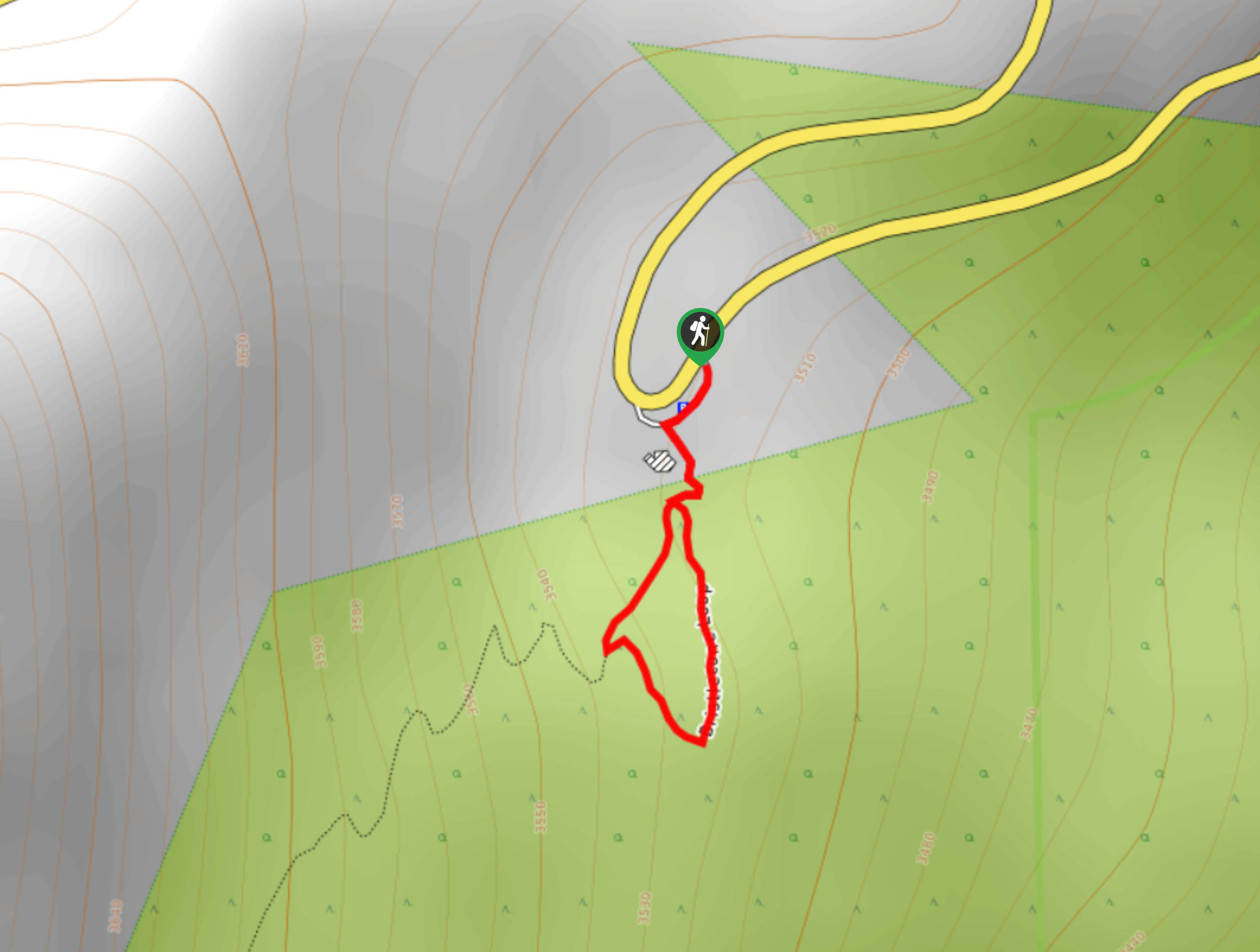
Bristlecone Loop Hike Description
Hike the short Bristlecone Loop Trail in the Mount Goliath Natural Area. Get the whole family out into the fresh air as you hike the short dirt trail around the alpine landscape. Admire the oddity of the Bristlecone pine trees and explore the surrounding wilderness.
Begin your adventure around the Bristlecone Loop from the Mount Goliath Visitors Centre. You can complete the loop from either direction, but we went clockwise. Veer left on the Bristlecone Loop Trail and enjoyed the views of the unique trees. Continue around the loop, and you will eventually meet a junction. Here, stay right and merge onto the M. Walter Pesman Trail. Hike this path, and it will lead you back to the visitors’ centre. Ensure to admire the mountainous views from the center and surrounding area.
Similar hikes to the Bristlecone Loop Trail hike

Rutherford Trail
The Rutherford Hike is a charming nature walk in Georgetown Colorado. This secluded trail is a wonderful adventure the whole…
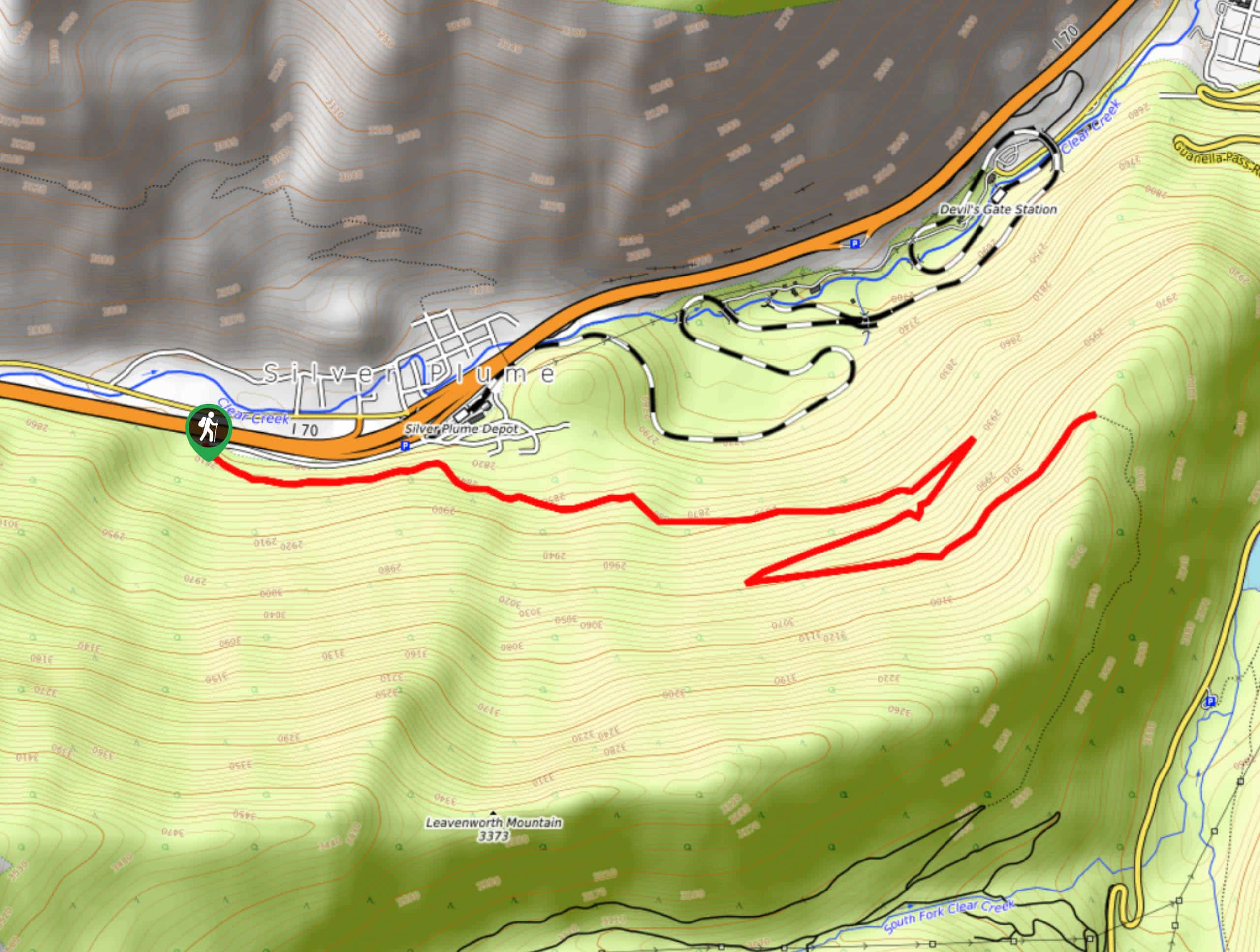
Pavilion Point Hike
The Pavilion Point Hike is an awesome adventure that the whole family can enjoy. Near Silver Plume Train Depot, kids…
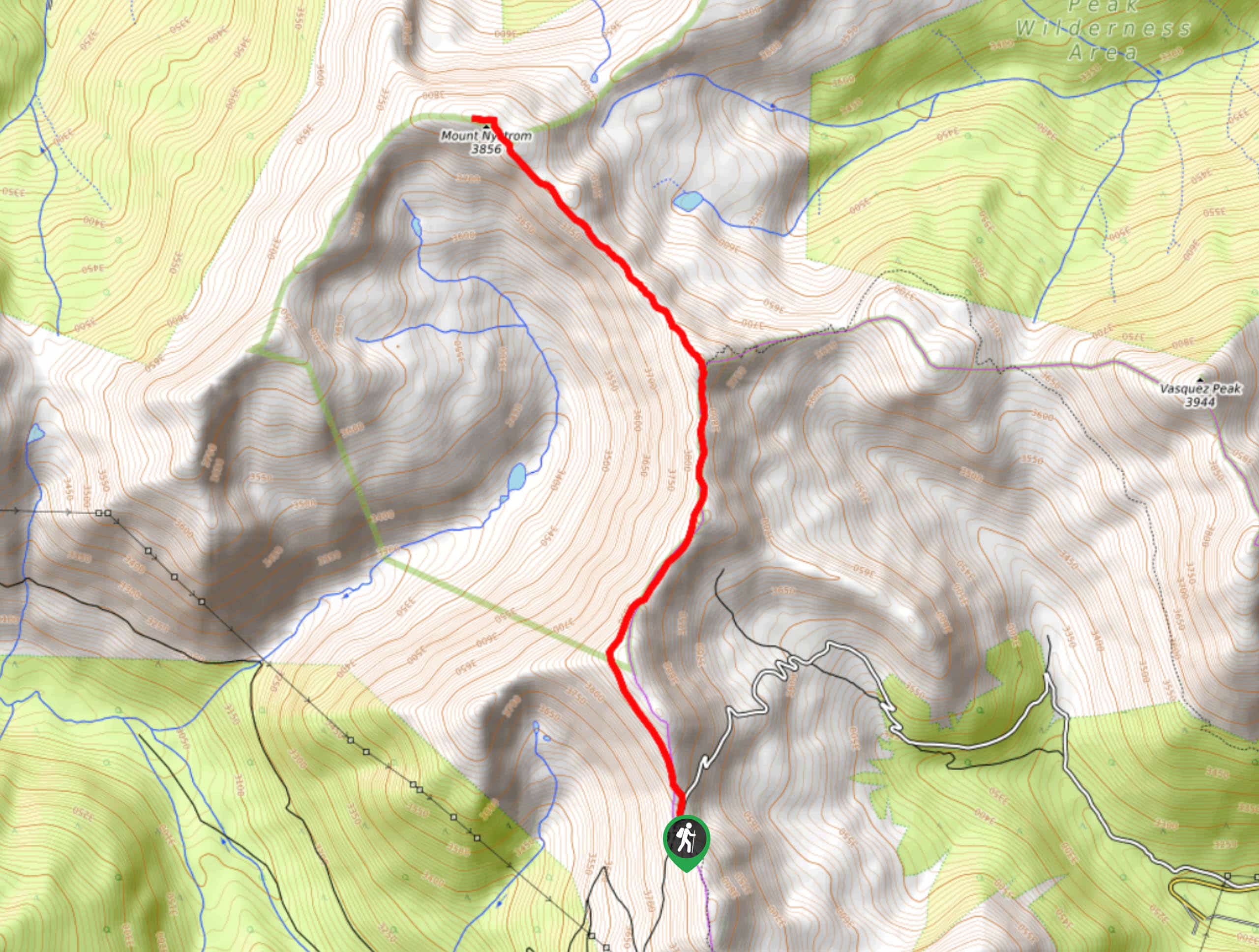
Mount Nystrom Trail
The Mount Nystrom Trail is an exciting adventure above the clouds. Hike the exposed path to the summit and enjoy…
Comments