Kenosha Pass to Georgia Pass via the Colorado Trail
View Photos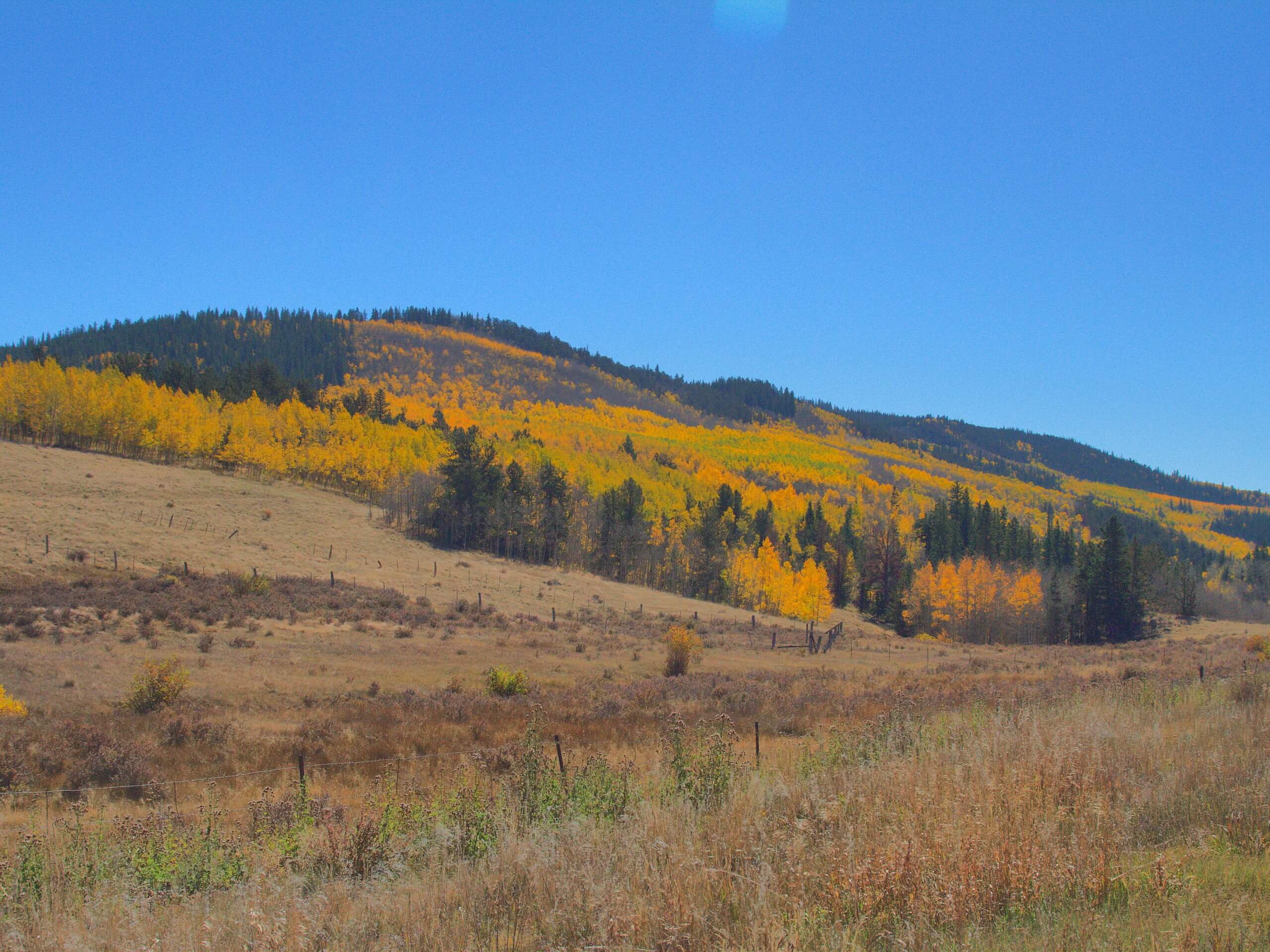
Kenosha Pass to Georgia Pass via the Colorado Trail
Difficulty Rating:
Hike across the Colorado Wilderness as you travel along the Colorado Trail from Kenosha Pass to Georgia Pass. This adventure is not for the faint of heart, but those who do conquer this trail are rewarded with stunning scenery and awe-inspiring Front Range vistas.
Getting there
Embark on your adventure from the Kenosha Pass Campground off Highway 285.

About
| Backcountry Campground | Dispersed Backcountry Camping |
| When to do | March-October |
| Pets allowed | Yes - On Leash |
| Family friendly | No |
| Route Signage | Average |
| Crowd Levels | Moderate |
| Route Type | One Way |
Kenosha Pass to Georgia Pass via the Colorado Trail
Elevation Graph
Weather
Kenosha Pass to Georgia Pass via the Colorado Trail Hike Description
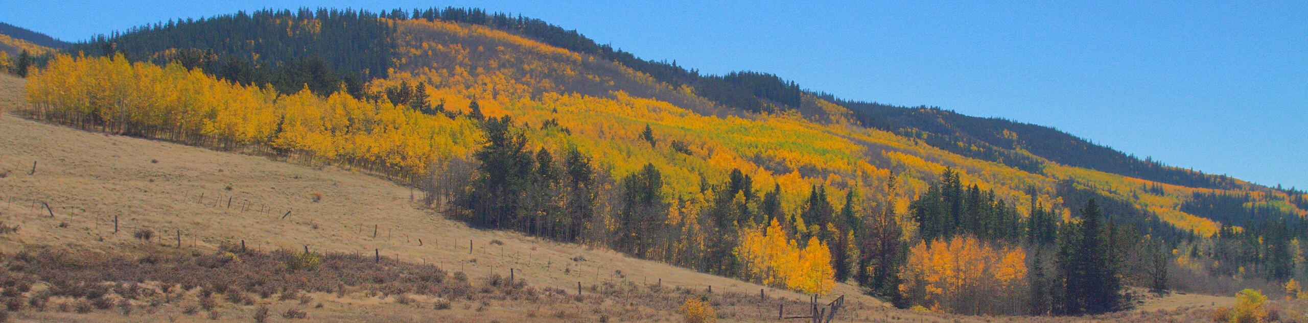
Hike from one end of the Colorado wilderness to the other. The Kenosha Pass to Georgia Pass via the Colorado Trail is an epic adventure across several quintessential landscapes up to the famous Continental Divide. Reserved for experienced hikers with stamina, this trail is highly demanding. Make sure you pack some sunblock and wear layers because much of this trek is exposed. Additionally, don’t forget to drop off a car at Georgia Pass or arrange a pickup on the other side! The last thing you will want to do after a long day of hiking is figure out transportation. The Kenosha Pass to Georgia Pass via the Colorado Trail will guide you through woodlands, along streams, past lakes and across meadows. With new scenery to admire every step of the way, this path has it all.
When you are geared up and ready to roll, depart from the Kenosha Pass Campground. From the campground, track northwest along the Colorado Trail. Hike along the path and ignore intersecting trails. Eventually, you will trek along the base of Jefferson Hill. Admire the peak and continue northwest. Soon you will cross Forest Road 37 before reconnecting with the Colorado Trail. Pass the several dispersed campsites that line the path and continue hiking. This section of the route will get increasingly steep as you near Georgia Pass.
Travel along the increasingly rocky terrain and notice Jefferson Lake on your right. Navigate a few sets of switchbacks and you will soon summit Georgia Pass. Enjoy the panoramic views from atop the Continental Divide. Revel in the impressive views before ending your journey.
Similar hikes to the Kenosha Pass to Georgia Pass via the Colorado Trail hike

Hankins Pass Hike
The Hankins Pass Hike is a quintessential adventure across the Lost Creek Wilderness. The hike demonstrates the diversity of the…

Miller Gulch Loop Trail
The Miller Gulch Loop Trail is a scenic meadowland adventure in the Pike National Forest. Hike through grassy meadows laden…

The Castle Hike
The Castle Hike is an exciting adventure up the steep, forested terrain to The Castle Rock. From atop the summit,…
Comments