
Mason Creek Trail
View Photos
Mason Creek Trail
Difficulty Rating:
The Mason Creek Trail is an awesome day-hike through Staunton State Park. If you are anything like us and love a trail with diverse terrain and stimulating sights, then you will love the Mason Creek Hike. With every step you take along this trail you will be rewarded with new scenery as you travel around the loop.
Getting there
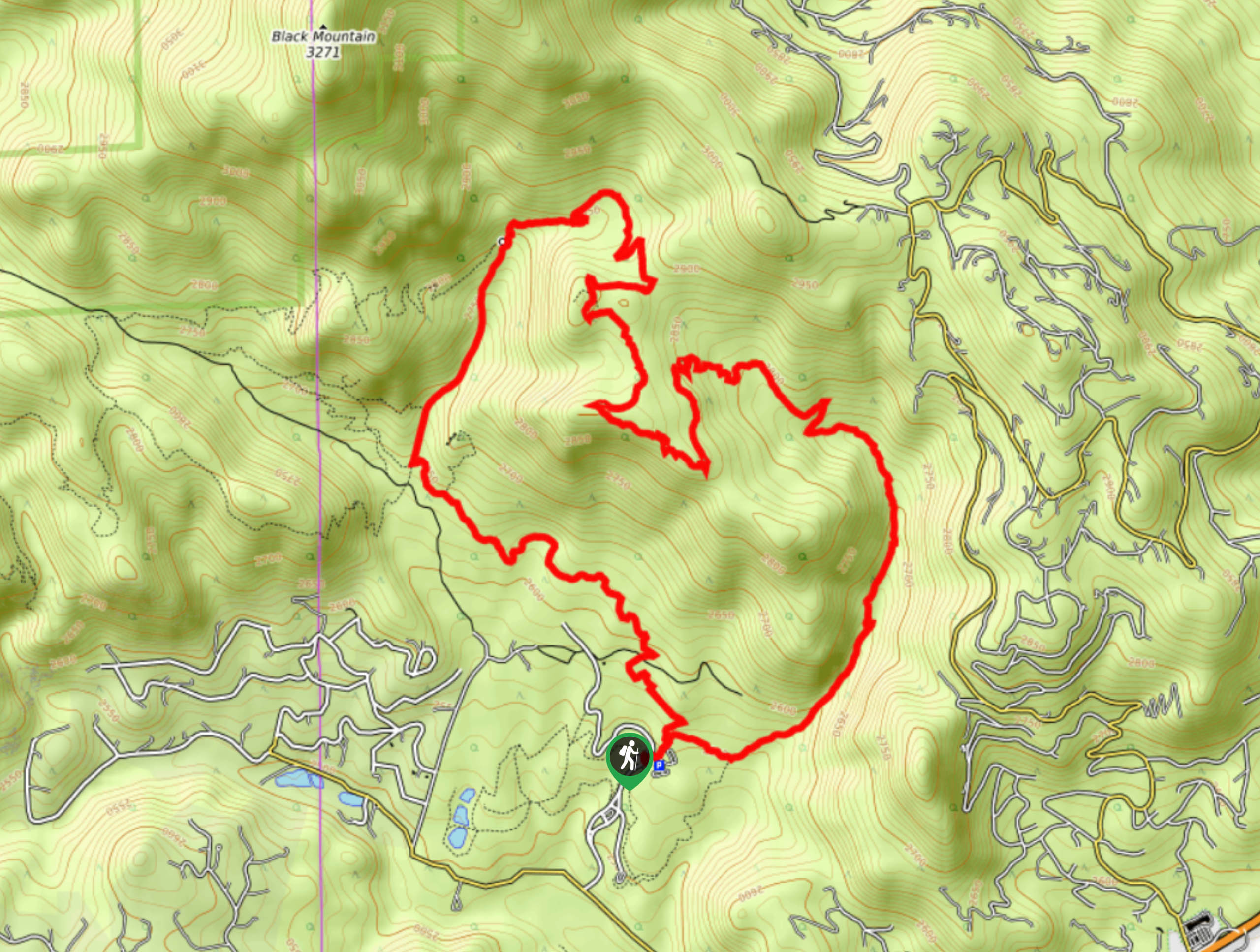
The Mason Creek Trail is located within the Staunton State Park off S Elk Creek Road.

About
| Backcountry Campground | No |
| When to do | March-October |
| Pets allowed | Yes - On Leash |
| Family friendly | Older Children only |
| Route Signage | Average |
| Crowd Levels | High |
| Route Type | Lollipop |
Mason Creek Trail
Elevation Graph
Weather
Mason Creek Hike Description
Exciting and wonderfully scenic, the Mason Creek Trail is an outdoor enthusiast’s dream. Whether you hike it or bike it, this nature adventure is an epic excursion. This shared path is very popular, and rightfully so, but if you wish to avoid the crowds, consider a weekday hike or an early morning adventure. Additionally, located within the Staunton State Park, visitors are required to purchase a day permit from the toll booth at the park’s entrance. Before beginning your adventure, ensure to pack plenty of water and snacks as this trail is on the longer side.
Embark on your adventure from the Mason Creek Trailhead within the park. You can complete this circuit in either direction, but we prefer to do this trek counterclockwise. When you are set, track northeast on the Mason Creek Trail. Hike along the semi-exposed path along the creek. Soon the trail will divert you northwest up a rocky ridge. You will eventually meet an intersection; veer left and navigate a few switchbacks up Bear Paw Trail to an overlook. Hike along the ridge and admire the vistas of the Front Range and Pikes Peak.
Trek the exposed path and admire the mountainous landscape. Follow the route as you will confront another junction. Stay left, and you will be diverted onto Old Mill Trail. As you travel along this trail, it will gradually curve you southeast towards the car park. You will eventually meet another intersection; at this point, turn left down Staunton Ranch Trail. Travel along this path until it delivers you back to the trailhead and parking lot.
Similar hikes to the Mason Creek Trail hike

Hankins Pass Hike
The Hankins Pass Hike is a quintessential adventure across the Lost Creek Wilderness. The hike demonstrates the diversity of the…

Miller Gulch Loop Trail
The Miller Gulch Loop Trail is a scenic meadowland adventure in the Pike National Forest. Hike through grassy meadows laden…

The Castle Hike
The Castle Hike is an exciting adventure up the steep, forested terrain to The Castle Rock. From atop the summit,…
Comments