
Harmonica Arch Trail
View Photos
Harmonica Arch Trail
Difficulty Rating:
The Harmonica Arch Trail is a crowd-favourite; locals and visitors are impressed by this scenic wilderness venture. Hike through the dense woodlands up to a stone outcropping where lies one of Colorado’s largest and longest arches. The Harmonica Arch is a striking sight, and the 360-degree panoramic views from this geological masterpiece are just a bonus.
Getting there
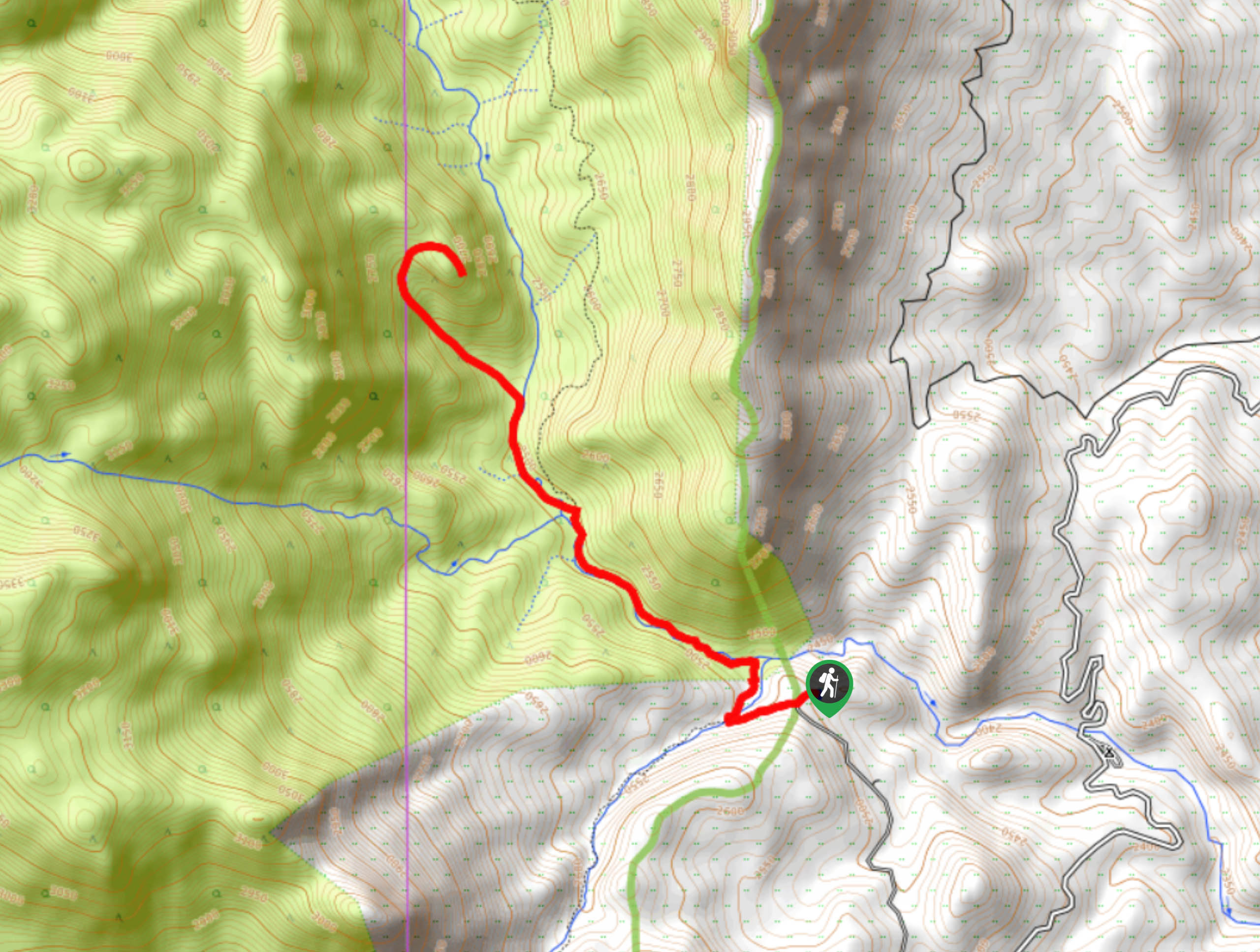
The Harmonica Arch Trailhead is located at the end of FR558 off FR211.

About
| Backcountry Campground | Dispersed Backcountry Camping |
| When to do | May-November |
| Pets allowed | Yes - On Leash |
| Family friendly | Older Children only |
| Route Signage | Poor |
| Crowd Levels | High |
| Route Type | Out and back |
Harmonica Arch Trail
Elevation Graph
Weather
Harmonica Arch Hike Description
You will not regret hiking the Harmonica Arch Trail. This stunning path impresses 100% of its adventurers. Note that self-issued permits are required and can be found at the trailhead. This path, though trafficked, is one of a kind. Gradually climbing in the initial segments of the hike, the rearmost ascent to arch is challenging. Be prepared to scramble up the steep, technical terrain to the overlook. Pack plenty of water and wear layers as insurance against windy conditions at the exposed arch.
Begin your journey to Harmonica Arch from the Goose Creek Trailhead. From the trailhead, track along the path and veer right at the first intersection. Cross Goose Creek and trek along the path as it guides you below tree shade. Travel along the babbling creek and you will pass several dispersed campsites. Hike along the trail and you will eventually have to divert from the marked Goose Creek Trail up to Harmonica Arch. Though trail markers are sparse, you will be able to notice the frequented path in the northwest. Use the trail GPS to help you navigate the primitive path.
Continue hiking along Goose Creek until you reach the forested gulch. Climb up the steep, rocky valley, following the cairns. Mind your footing as you scramble up the rocky terrain to an unforgettable overlook of the surrounding verdant and mountainous landscape that are the backdrop to the Harmonica Arch. Revel in the anomaly that is the granite arch and explore the rock summit. When you are ready, retrace your steps back to the parking lot.
Similar hikes to the Harmonica Arch Trail hike

Hankins Pass Hike
The Hankins Pass Hike is a quintessential adventure across the Lost Creek Wilderness. The hike demonstrates the diversity of the…

Miller Gulch Loop Trail
The Miller Gulch Loop Trail is a scenic meadowland adventure in the Pike National Forest. Hike through grassy meadows laden…

The Castle Hike
The Castle Hike is an exciting adventure up the steep, forested terrain to The Castle Rock. From atop the summit,…
Comments