
Pavilion Point Hike
View Photos
Pavilion Point Hike
Difficulty Rating:
The Pavilion Point Hike is an awesome adventure that the whole family can enjoy. Near Silver Plume Train Depot, kids will love the sounds of the passing trains and adults will enjoy the stunning scenery. Blow off some steam as you ascend the well-maintained trail up to a stunning overlook.
Getting there
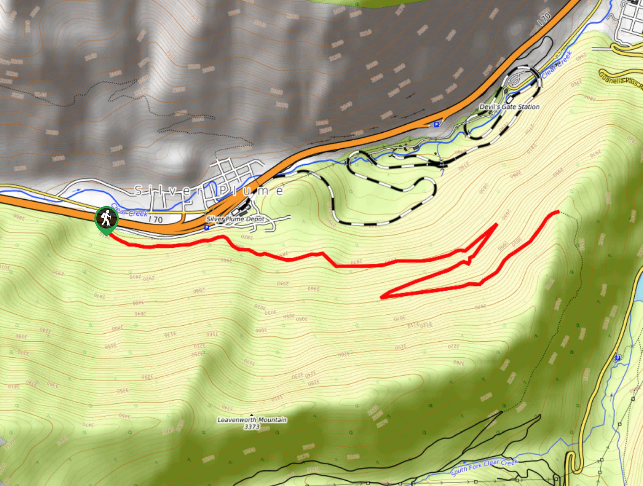
The Pavilion Point Trailhead is located off I-70 at the end of Mountain Street.

About
| Backcountry Campground | No |
| When to do | Year-round |
| Pets allowed | Yes - On Leash |
| Family friendly | Yes |
| Route Signage | Average |
| Crowd Levels | Moderate |
| Route Type | Out and back |
Pavilion Point Hike
Elevation Graph
Weather
Pavilion Point Hike Description
The Pavilion Point is a wonderful excursion that hikers of all-skill levels can manage. Ascend the forested terrain to a memorable overlook of Georgetown and the impressive flanking cliffs. The Pavilion Point hike is a hidden gem, so if you are seeking a secluded adventure then you have come to the right spot. Note the initial section of the route may be a bit noisy due to the I-70, but the trains below mask much of the highway’s noise.
Embark on your nature walk up the Pavilion Point Trail from the trailhead. Take the path signposted Argentine Central Railroad Grade Trail, a mouthful, we know. Anyways, track east up the trail. As you ascend the path, keep an eye out for historic mine remnants that so famously dot the cliff sides in this area. Hike up the aspen lined path, navigating a switchback to the summit.
From the ridge’s summit, enjoy views of Georgetown in the north and sights of the verdant valley walls that sit parallel in the east. Take a break and enjoy the scenery. When you are ready, backtrack along the route to return to the trailhead.
Similar hikes to the Pavilion Point Hike hike

Miller Gulch Loop Trail
The Miller Gulch Loop Trail is a scenic meadowland adventure in the Pike National Forest. Hike through grassy meadows laden…

The Castle Hike
The Castle Hike is an exciting adventure up the steep, forested terrain to The Castle Rock. From atop the summit,…

Rutherford Trail
The Rutherford Hike is a charming nature walk in Georgetown Colorado. This secluded trail is a wonderful adventure the whole…
Comments