
Signal Mountain Hike
View Photos
Signal Mountain Hike
Difficulty Rating:
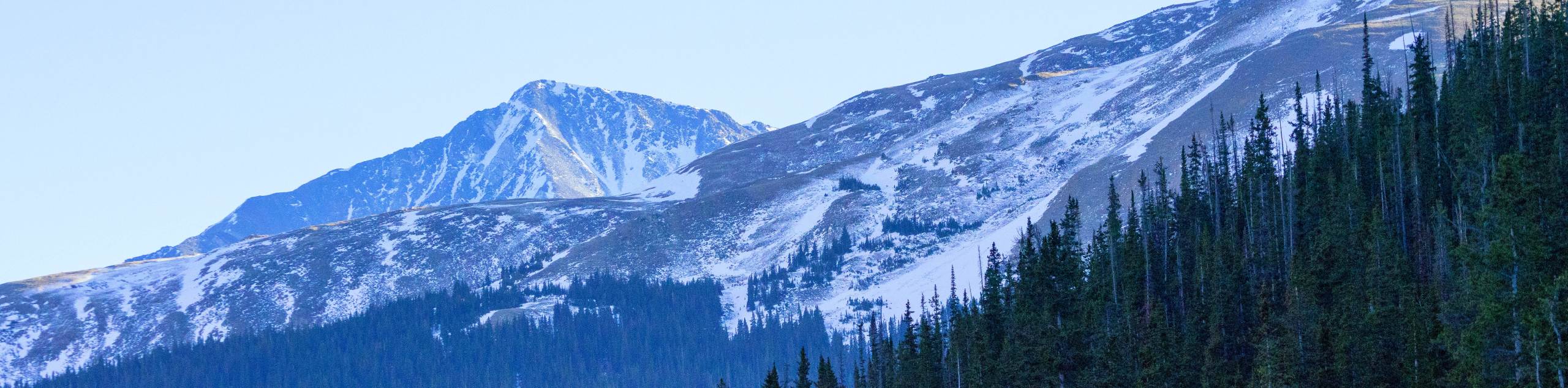
The Signal Mountain Hike is one of the most beautiful adventures through the Front Range. Though this trail borders on one of the most popular Colorado destinations, the Signal Mountain Trail is secluded and quiet. Hike through meadowlands, beside babbling streams, and up to an incredible overlook. Get your steps in along this impressive alpine trail.
Getting there
The Signal Mountain Trailhead is located off N County Road 63E.

About
| Backcountry Campground | Dispersed Backcountry Camping, restrictions apply. |
| When to do | March-October |
| Pets allowed | Yes - On Leash |
| Family friendly | No |
| Route Signage | Poor |
| Crowd Levels | Low |
| Route Type | Out and back |
Signal Mountain Hike
Elevation Graph
Weather
Signal Mountain Hike Description
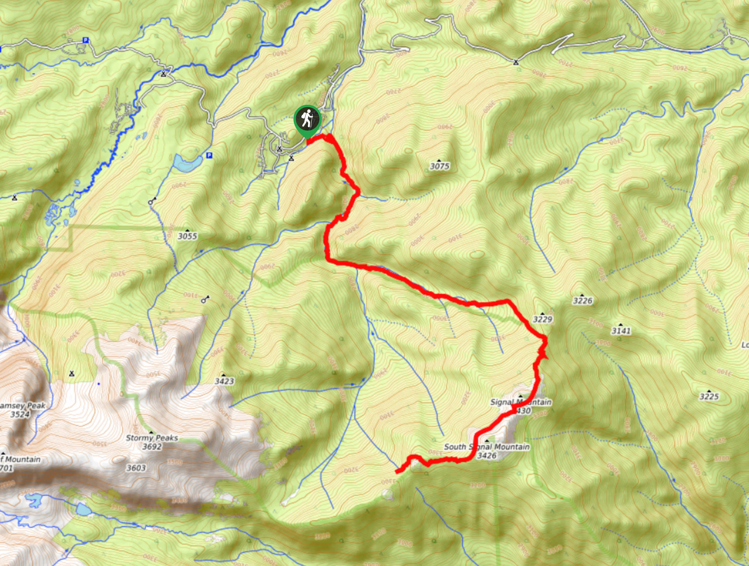
Though we get excited about most outdoor adventures, the Signal Mountain Hike may be one of our favorites. Travel though several terrains, past wildlife and up to not one, but two Front Range summits. This path is lengthy and demands stamina from its hikers. Make sure you are prepared for a long trek into the wilderness and pack a water filter or plenty of water. Additionally, we would recommend checking the forecast prior to your excursion to mitigate the chances of getting caught in a storm at the summit. As always, wear layers and bring a wind breaker as insurance against windy conditions on the exposed sections of the path.
Begin your journey up to the Signal Mountain summit from the trailhead and parking lot. From the trailhead, track the Signal Mountain Trail up the Pennock Creek. Travel up the forest gulch and enjoy the meditative ambiance of the forested route. Continue up the trail, and you will intersect with the creek on several occasions. The path will weave you between tree coverage and alpine meadows before ascending into the alpine tundra.
Hike along the now exposed trail up a rocky ridge. This route will begin to curve you southwest up the Signal Mountain Summit. Explore the rocky summit and enjoy the expansive vistas. If you still have some gas in the tank, travel along the mountain saddle and ascend South Signal Mountain. At his point, you will have an incomparable view of the Rocky Mountain National Park and its striking peaks. Enjoy the incredible sights before beginning your descent. When you are ready, retrace your steps along the trail all the way back to the trailhead and parking lot.
Similar hikes to the Signal Mountain Hike hike

Hankins Pass Hike
The Hankins Pass Hike is a quintessential adventure across the Lost Creek Wilderness. The hike demonstrates the diversity of the…
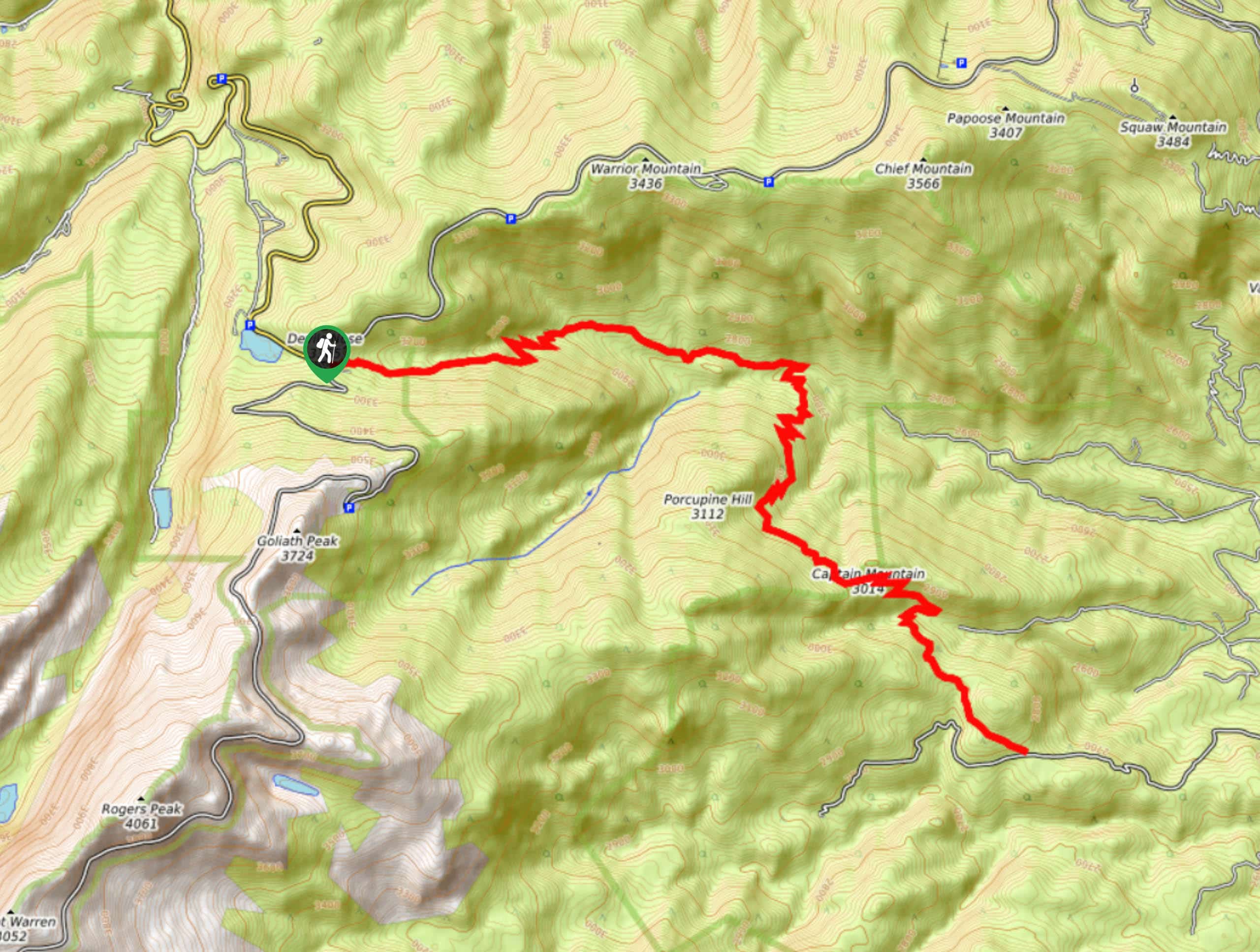
Captain Mountain Hike
The Captain Mountain Hike is a demanding excursion in the Mount Evans Wilderness. Hike through the dense Colorado Forests and…
Pettingell Peak via Herman Gulch Trail
The Pettingell Peak via Herman Gulch Trail is a stimulating hike up to mesmerizing Front Range views from the summit.…
Comments