
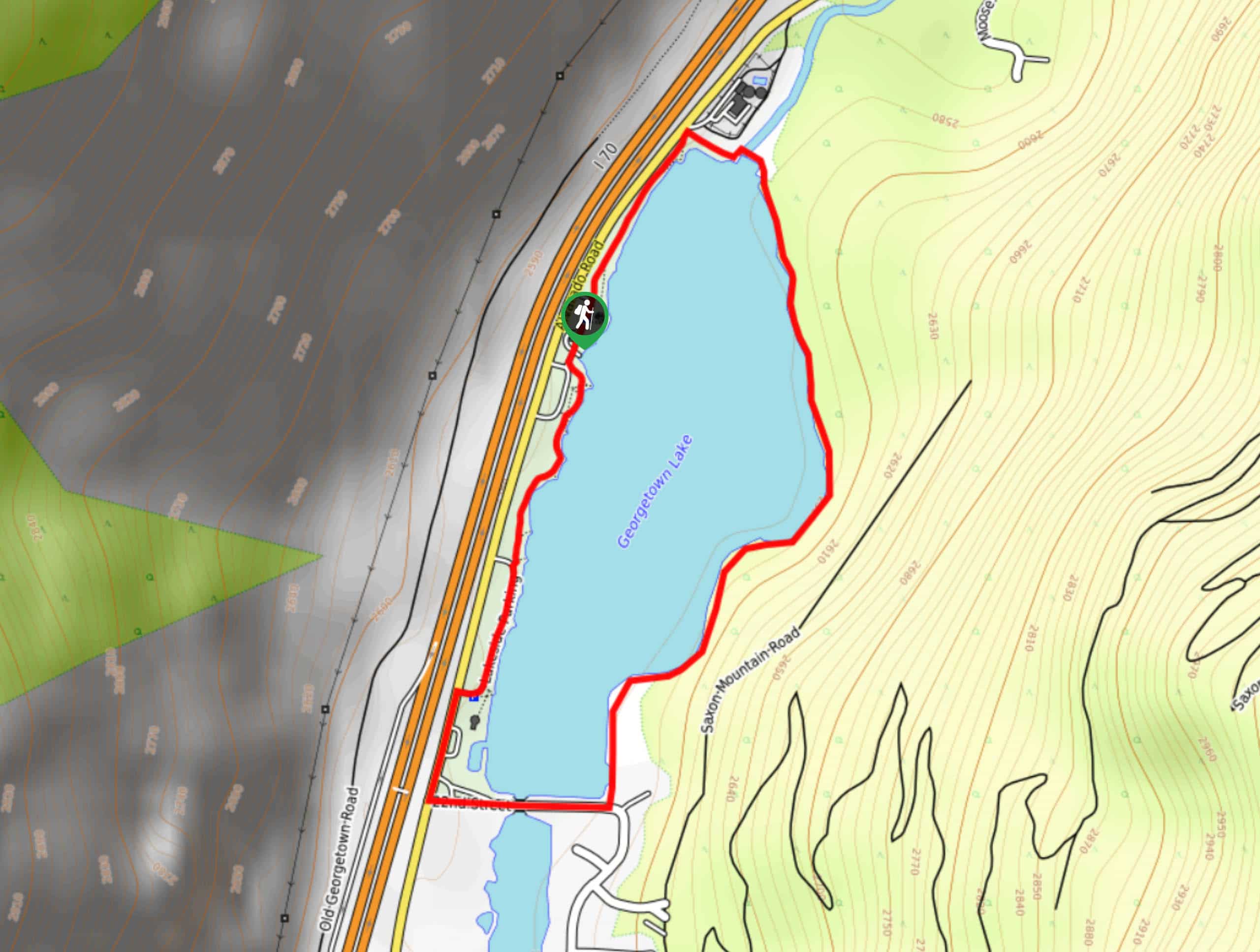
Tom Benoff Lake Trail
View Photos
Tom Benoff Lake Trail
Difficulty Rating:
The Tom Benoff Lake Trail is an awesome nature walk near Georgetown, Colorado, that the whole family will enjoy. Stretch your legs and blow off some steam as you walk around the shimmering lake through diverse terrains. Enjoy the stunning scenery as you travel around the Tom Benoff Lake Trail.
Getting there
Access the Tom Benoff Lake Trail via the I-70.

About
| Backcountry Campground | No |
| When to do | April-October |
| Pets allowed | Yes - On Leash |
| Family friendly | Yes |
| Route Signage | Good |
| Crowd Levels | Moderate |
| Route Type | Circuit |
Tom Benoff Lake Trail
Elevation Graph
Weather
Tom Benoff Lake Hike Description
The Tom Benoff Lake Trail is the perfect nature walk to explore the diverse Colorado wilderness. This well maintained, well-marked trail is suitable for hikers of all skill levels and kids, so you have no excuse! Lace up those sneakers and head out on the Tom Benoff Lake Hike.
The Tom Benoff Lake Trail is a circuit hike; thus, can be completed in either direction, but we prefer to track clockwise! From the parking lot, head north along the Tom Benoff Lake Trail. Hike along the shore’s edge until you meet a bridge. Cross the bridge over Clear Creek and the route will divert you south alongside the east shores of Georgetown Lake. Travel the wooded path that hugs the curves of the shoreline. As you trek along the path, it will become increasingly exposed as you traverse a meadow.
At this point the route will begin to curve west. Hike across another bridge before the path veers north. Hike along the trail until it delivers you back to the parking lot.
Similar hikes to the Tom Benoff Lake Trail hike

Rutherford Trail
The Rutherford Hike is a charming nature walk in Georgetown Colorado. This secluded trail is a wonderful adventure the whole…
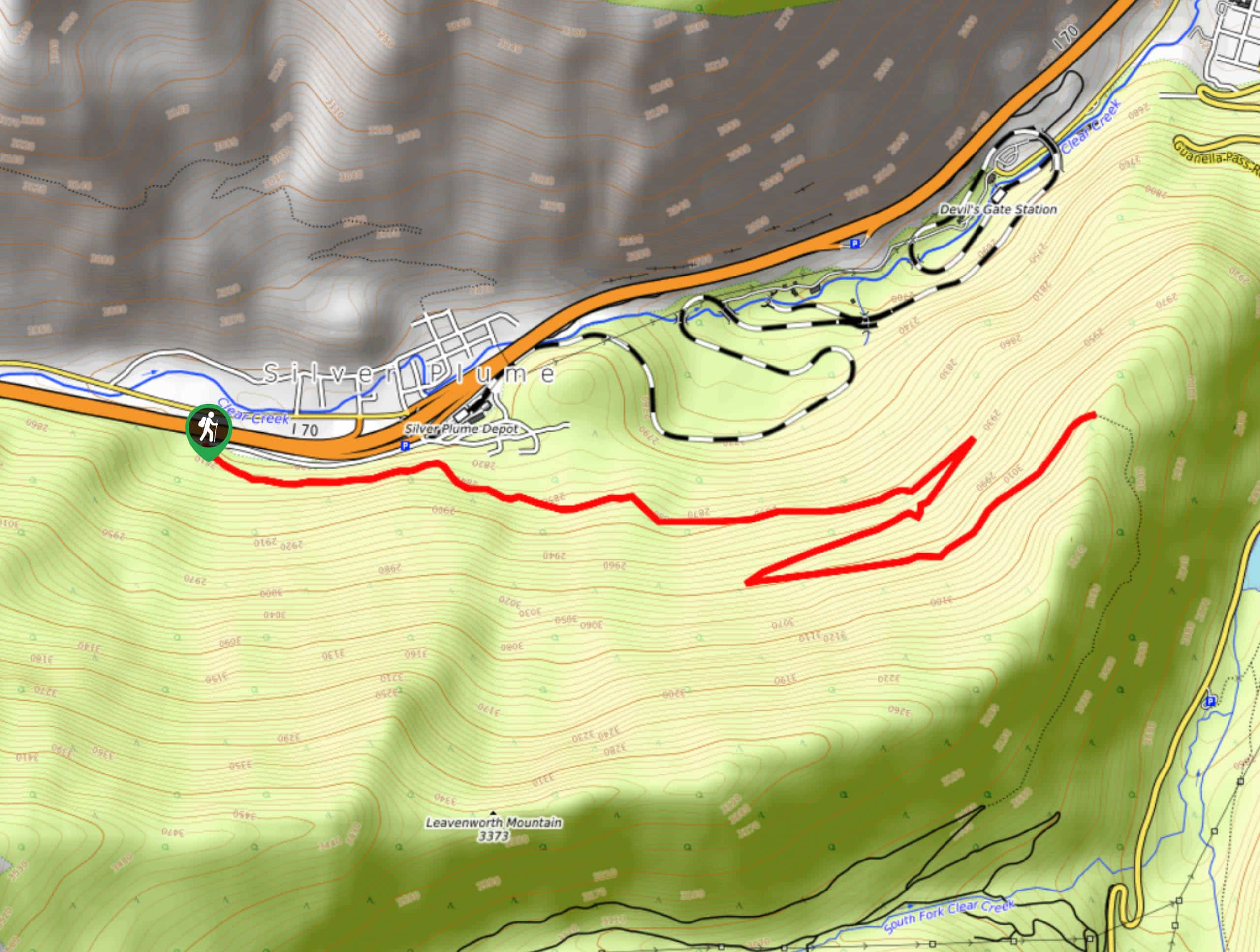
Pavilion Point Hike
The Pavilion Point Hike is an awesome adventure that the whole family can enjoy. Near Silver Plume Train Depot, kids…
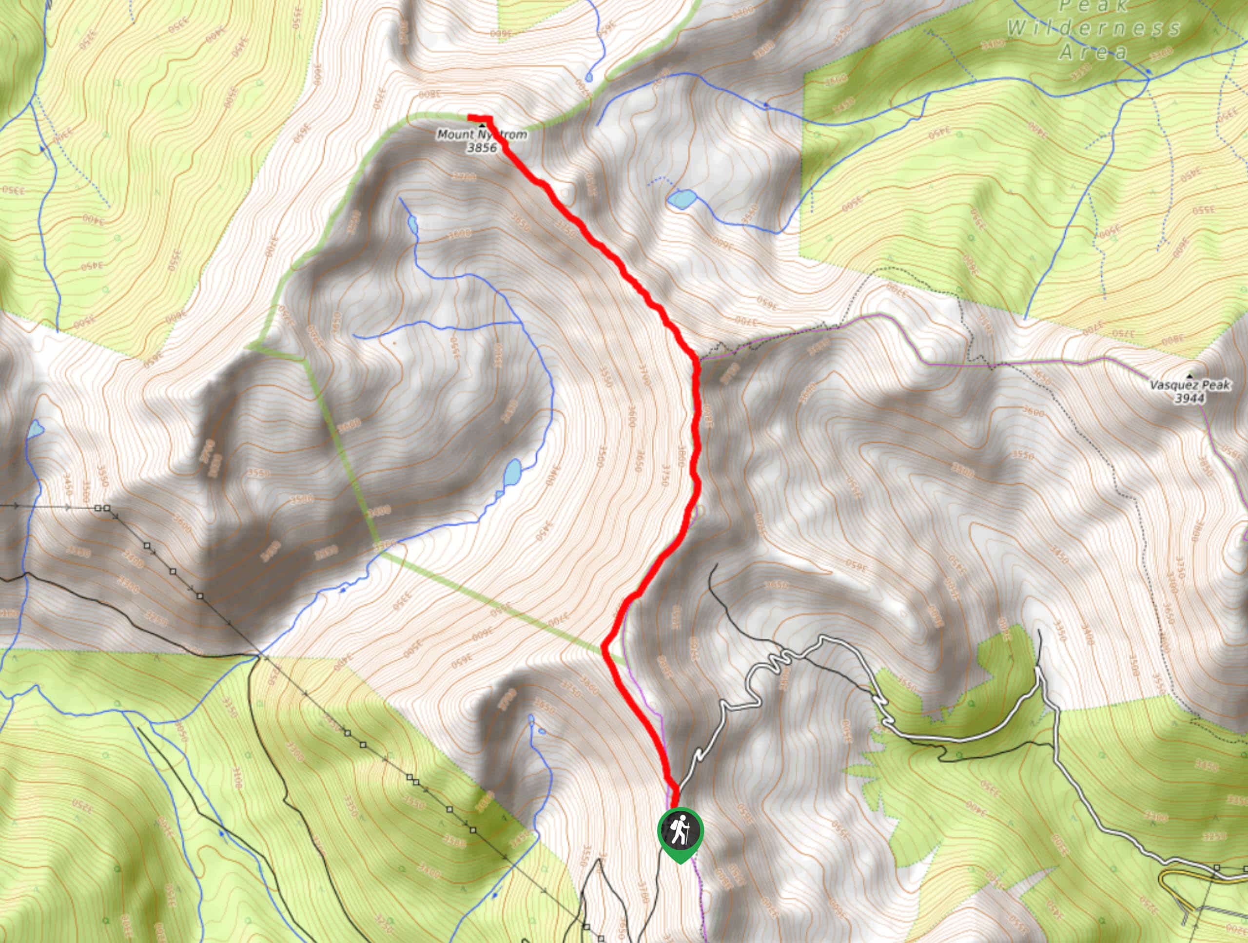
Mount Nystrom Trail
The Mount Nystrom Trail is an exciting adventure above the clouds. Hike the exposed path to the summit and enjoy…
Comments