
Ginny and Valley Loop Trail
View Photos
Ginny and Valley Loop Trail
Difficulty Rating:
Lace up your hiking shoes or throw on a helmet, because the Ginny and Valley Loop Trail is an epic wilderness excursion. Hike the meadow-cloaked path along rocky ridges and through the burned ponderosa pines. The popularity of this trail among outdoor enthusiasts means that it is often highly trafficked, so expect to share the route with bikers and horseback riders alike!
Getting there
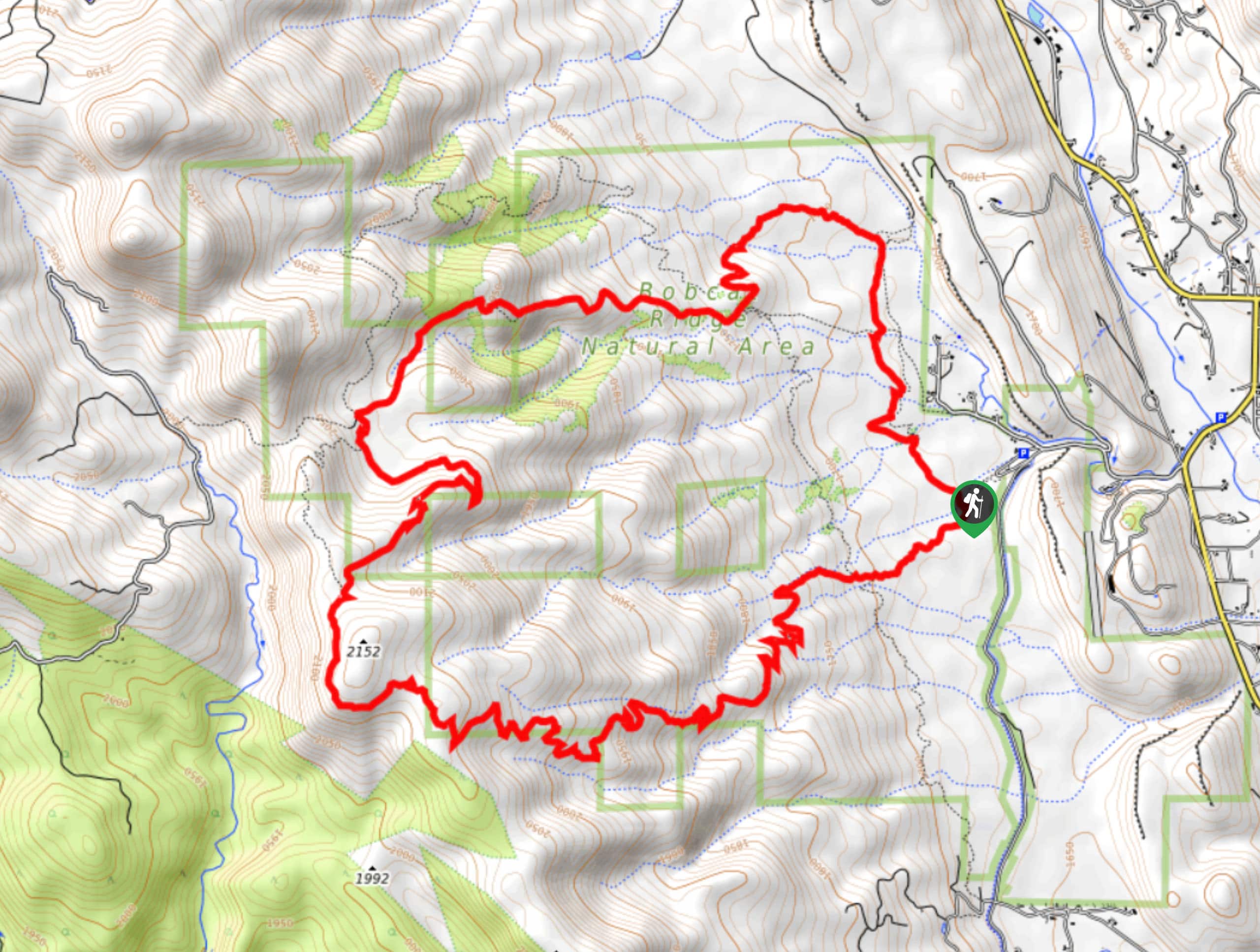
The Ginny and Valley Loop Trail is located within the Bobcat Ridge Natural Area off County Road 32C.

About
| Backcountry Campground | No |
| When to do | April-October |
| Pets allowed | No |
| Family friendly | Older Children only |
| Route Signage | Average |
| Crowd Levels | High |
| Route Type | Circuit |
Ginny and Valley Loop Trail
Elevation Graph
Weather
Ginny and Valley Loop Hike Description
Immerse yourself in the quintessential Colorado plains as you make your way around the Ginny and Valley Loop Trail. This adventure is a great day to get your steps in as you traverse the meadowlands that expose vistas of the surrounding Front Range peaks. Be sure to bring your camera along as there are often more than not elk, deer, turkeys, bear, and snakes along this journey. If you do happen to encounter the wildlife, ensure to give them plenty of space. Though you can enjoy this trail by bike or horse, we prefer the old fashion way, walking. Hike around this scenic loop in the Bobcat Ridge Natural Area.
When you are ready to roll, depart from the trailhead and parking lot. This journey can be completed in either direction, but we prefer to trek counter clockwise. Take the Valley Loop Trail north as it intersects with streams on several occasions. Ignore merging and intersecting paths and the route will guide you up a ridge and curve you southwest. Shortly after the path curves you will reach an intersection with the Powerline Trail. Turn right and ascend the meadow path. At this point, the crowd should thin out a bit. Follow along the Powerline Trail west until you encounter the junction with Ginny Trail. Veer left onto Ginny Trail and hike among the sparse tree burn.
Hike the Ginny Trail south and notice sights of the Rocky Mountain National Park and Mummy Range in the west. Continue trekking the meadow laden path and it will eventually curve you east. Descend the route and navigate the switchbacks down to Valley Loop Trail. Merge onto Valley Loop and hike this path back to the trailhead and parking lot.
Similar hikes to the Ginny and Valley Loop Trail hike

Miller Gulch Loop Trail
The Miller Gulch Loop Trail is a scenic meadowland adventure in the Pike National Forest. Hike through grassy meadows laden…

The Castle Hike
The Castle Hike is an exciting adventure up the steep, forested terrain to The Castle Rock. From atop the summit,…

Rutherford Trail
The Rutherford Hike is a charming nature walk in Georgetown Colorado. This secluded trail is a wonderful adventure the whole…
Comments