
Ginny and Powerline Trail
View Photos
Ginny and Powerline Trail
Difficulty Rating:
The Ginny and Powerline Hike packs the perfect amount of strenuity and scenery. Get your steps in as you hike up the ridges of the Bobcat Ridge Natural Area and revel in the beauty of the mountainous scenery that lines the horizon. This trek is an awesome half-day hike into the wilderness.
Getting there
The Ginny and Powerline Trail is situated within the Bobcat Ridge Natural Area.

About
| Backcountry Campground | No |
| When to do | April-October |
| Pets allowed | No |
| Family friendly | Older Children only |
| Route Signage | Average |
| Crowd Levels | Moderate |
| Route Type | Circuit |
Ginny and Powerline Trail
Elevation Graph
Weather
Ginny and Powerline Hike Description
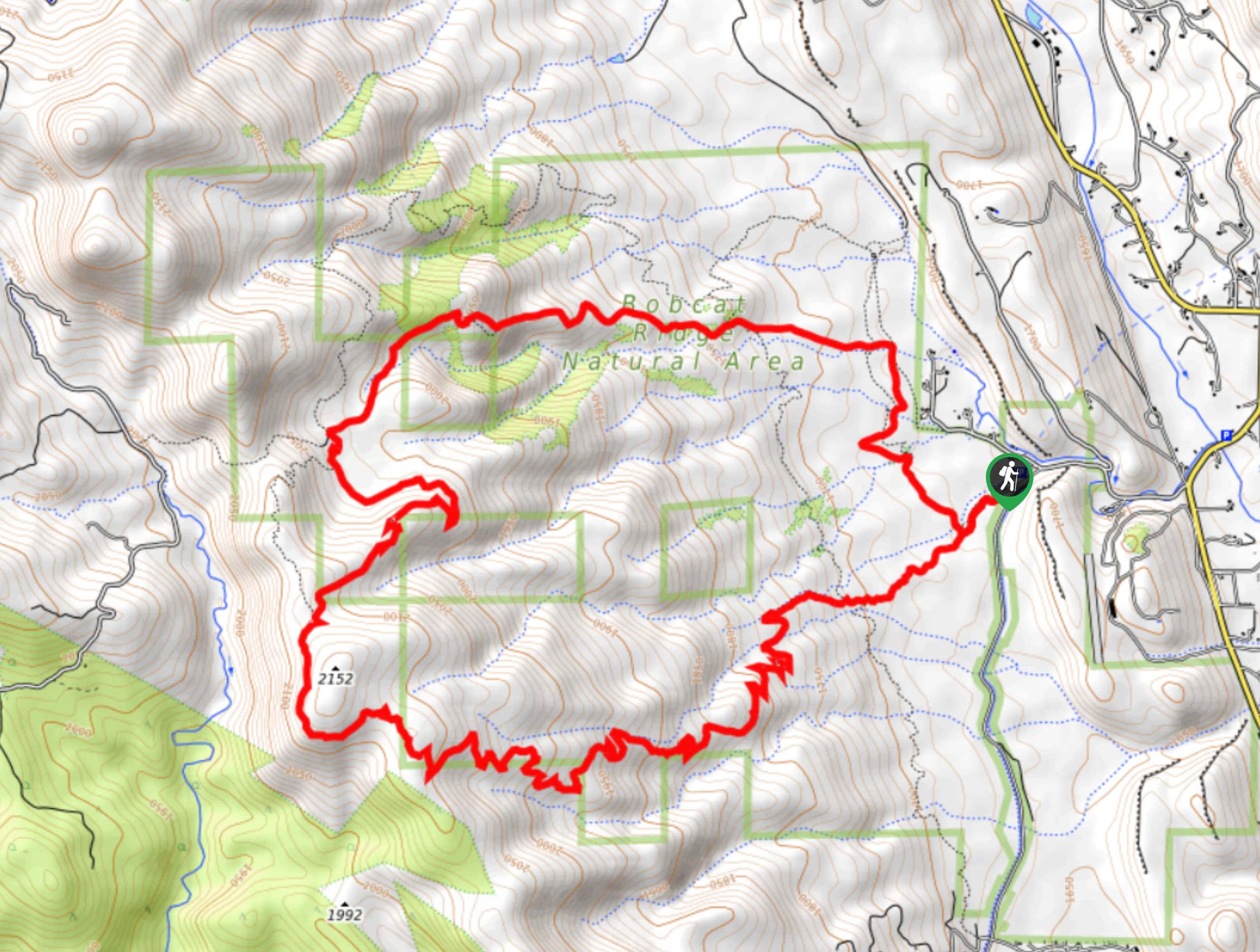
The Ginny and Powerline Hike is a scenic adventure through the Bobcat Ridge Natural Area. Hike through grassy plains, over streams, past granite outcroppings and through eerie tree burn. This excursion packs a punch! It is worth noting that the path is almost entirely exposed, so check the forecast and dress accordingly. Don’t be surprised if you encounter wildlife on this journey; there have been sightings of elk, deer, turkeys, bears and even mountain lions. Be respectful of the wildlife and maintain a safe distance.
Begin your journey around the Ginny and Powerline Trail from the parking lot and trailhead. Departing from the trailhead, you can trek from either direction, but we completed it counterclockwise. Take the Valley Loop Trail and track north from the trailhead. Hike over the intersecting creeks, and at the first intersection, veer left up the Powerline Trail. Ascend the meadow-laden path up to the ridge. At the next junction, head left, and you will be diverted onto the Ginny Trail. Trek the Ginny Trail south through sparse tree burn and along the scenic ridge. You will eventually be guided down a set of steep switchbacks to the Valley Loop Trail.
Merge onto the Valley Loop Trail, and it will lead you back to the trailhead and parking lot.
Similar hikes to the Ginny and Powerline Trail hike

Miller Gulch Loop Trail
The Miller Gulch Loop Trail is a scenic meadowland adventure in the Pike National Forest. Hike through grassy meadows laden…

The Castle Hike
The Castle Hike is an exciting adventure up the steep, forested terrain to The Castle Rock. From atop the summit,…

Rutherford Trail
The Rutherford Hike is a charming nature walk in Georgetown Colorado. This secluded trail is a wonderful adventure the whole…
Comments