
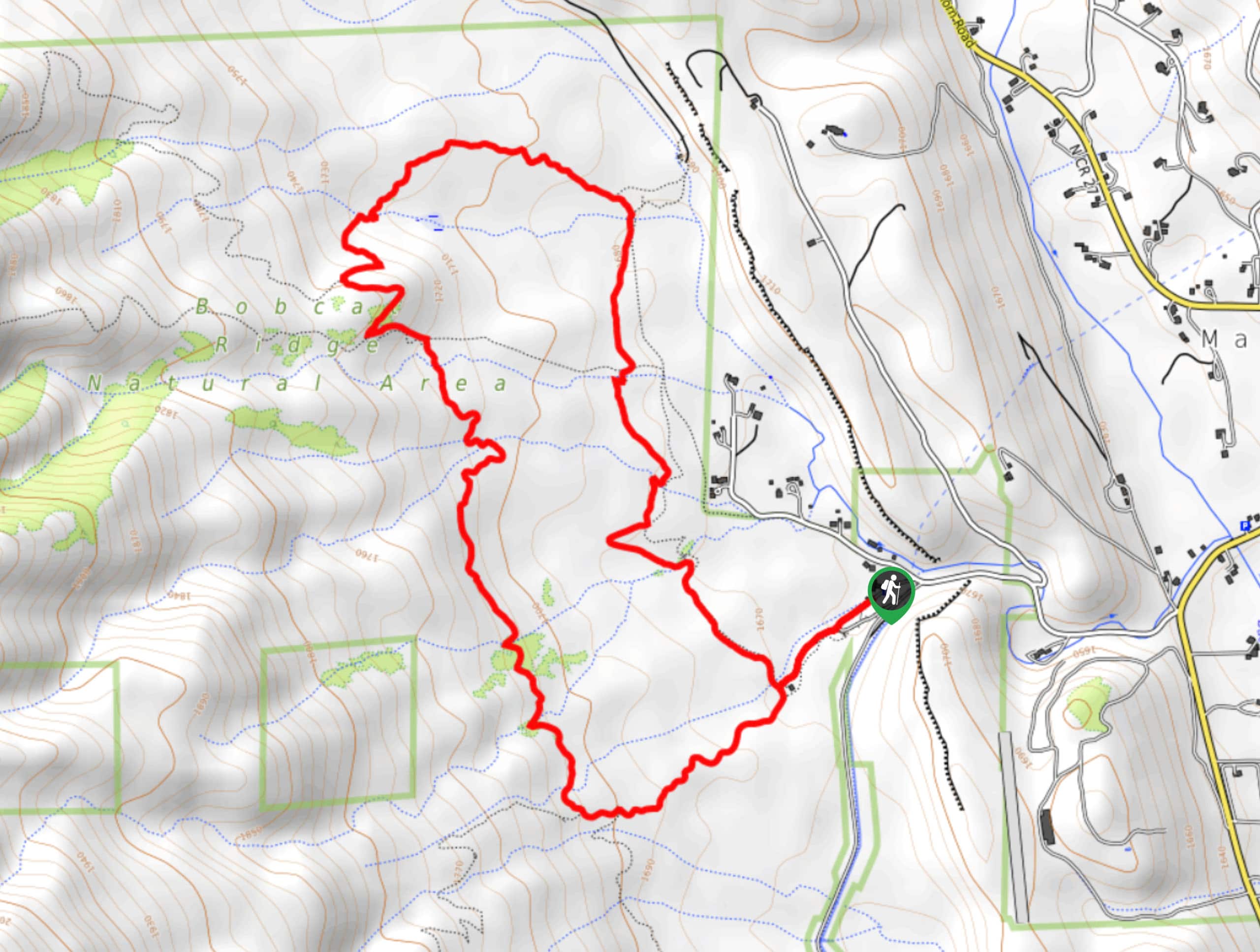
Valley Loop Trail
View Photos
Valley Loop Trail
Difficulty Rating:
The Valley Loop Trail is a wonderful family-friendly nature walk in the Bobcat Ridge Natural Area. Hike the mildly undulating path through grassy meadows, past ponderosa pines and over babbling streams. This adventure through the arid plains is a great place to spot wildlife.
Getting there
The Valley Loop Trail is located within the Bobcat Ridge Natural Area off County Road 32C.

About
| Backcountry Campground | No |
| When to do | May-September |
| Pets allowed | No |
| Family friendly | Yes |
| Route Signage | Average |
| Crowd Levels | High |
| Route Type | Lollipop |
Valley Loop Trail
Elevation Graph
Weather
Valley Loop Hike Description
The Valley Loop Hike is a crowd favorite in the Bobcat Ridge Natural Area, so don’t be surprised if you’re sharing the trail with dozens of other adventurers. If you are hoping to avoid the traffic, consider a weekday adventure along the nature trail. Whether you choose to hike on the weekend or during the week, don’t be surprised if you encounter wildlife. Travel through the arid terrain and keep your eyes peeled for sunbathing snakes on the granite outcroppings. As you make your way along the exposed path, you will also be rewarded with panoramic mountain views.
Begin your journey around the Valley Loop Trail from the trailhead and parking lot. This circuit trail can be completed in either direction, but we prefer to hike this one counterclockwise. From the trailhead, turn right and track north on the Valley Loop Trail. Hike up the trail and over several stream crossings. Though bikers can adventure this trail, horseback riders and hikers alike, this loop is often trafficked by walkers. You will follow the Valley Loop Trail for the entirety of the hike, so ignore merging and intersecting routes. Eventually, the path will curve you west past a historic cabin.
Follow the route and navigate a set of switchbacks up to the ridge—trek south across the ridge, admiring the mountainous views. Keep an eye out for wildlife as you hike through the grassy terrain. Notice tree burn from the Cameron Peaks fire, and the path will eventually curve you back down to the trailhead and parking lot.
Similar hikes to the Valley Loop Trail hike

Rutherford Trail
The Rutherford Hike is a charming nature walk in Georgetown Colorado. This secluded trail is a wonderful adventure the whole…
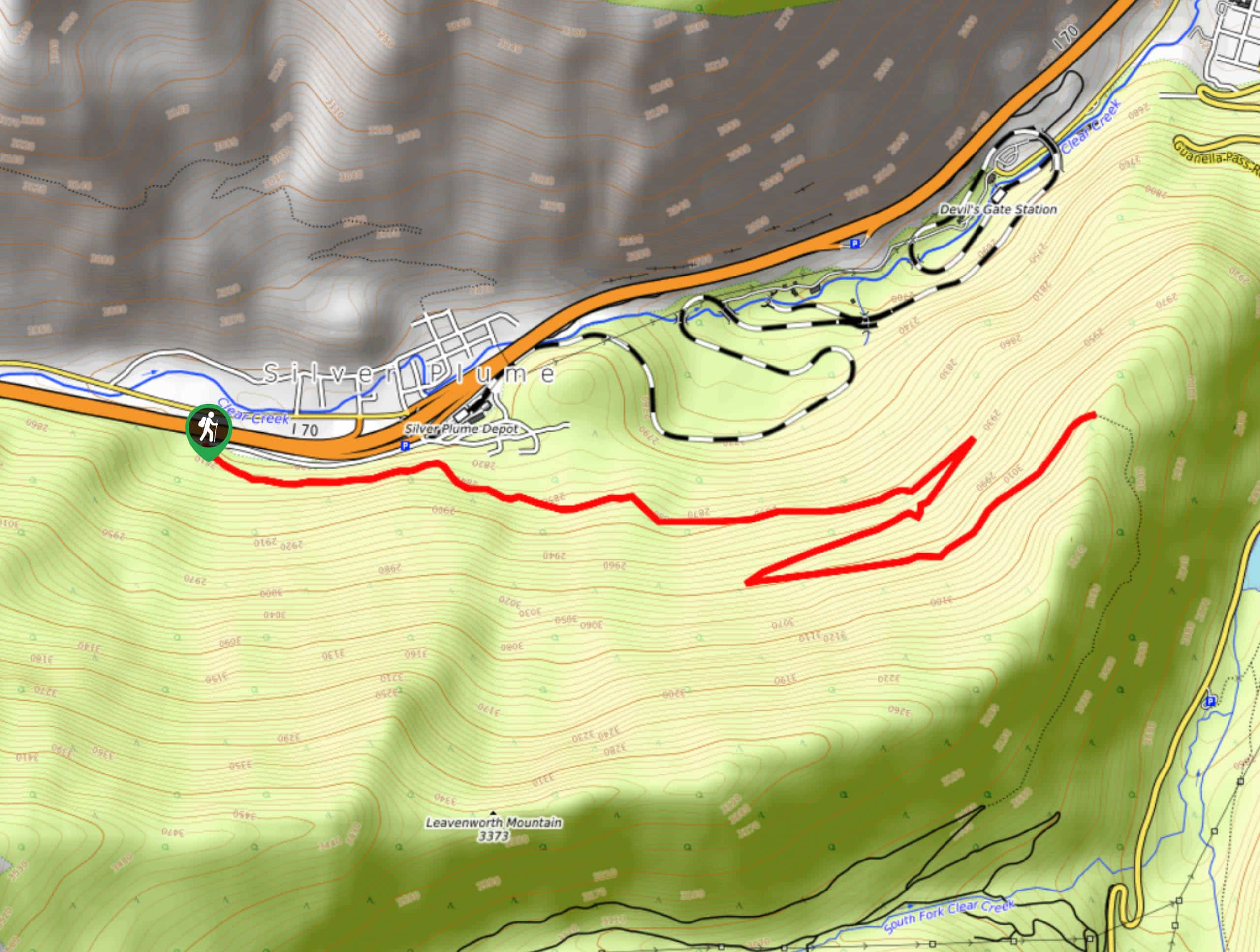
Pavilion Point Hike
The Pavilion Point Hike is an awesome adventure that the whole family can enjoy. Near Silver Plume Train Depot, kids…
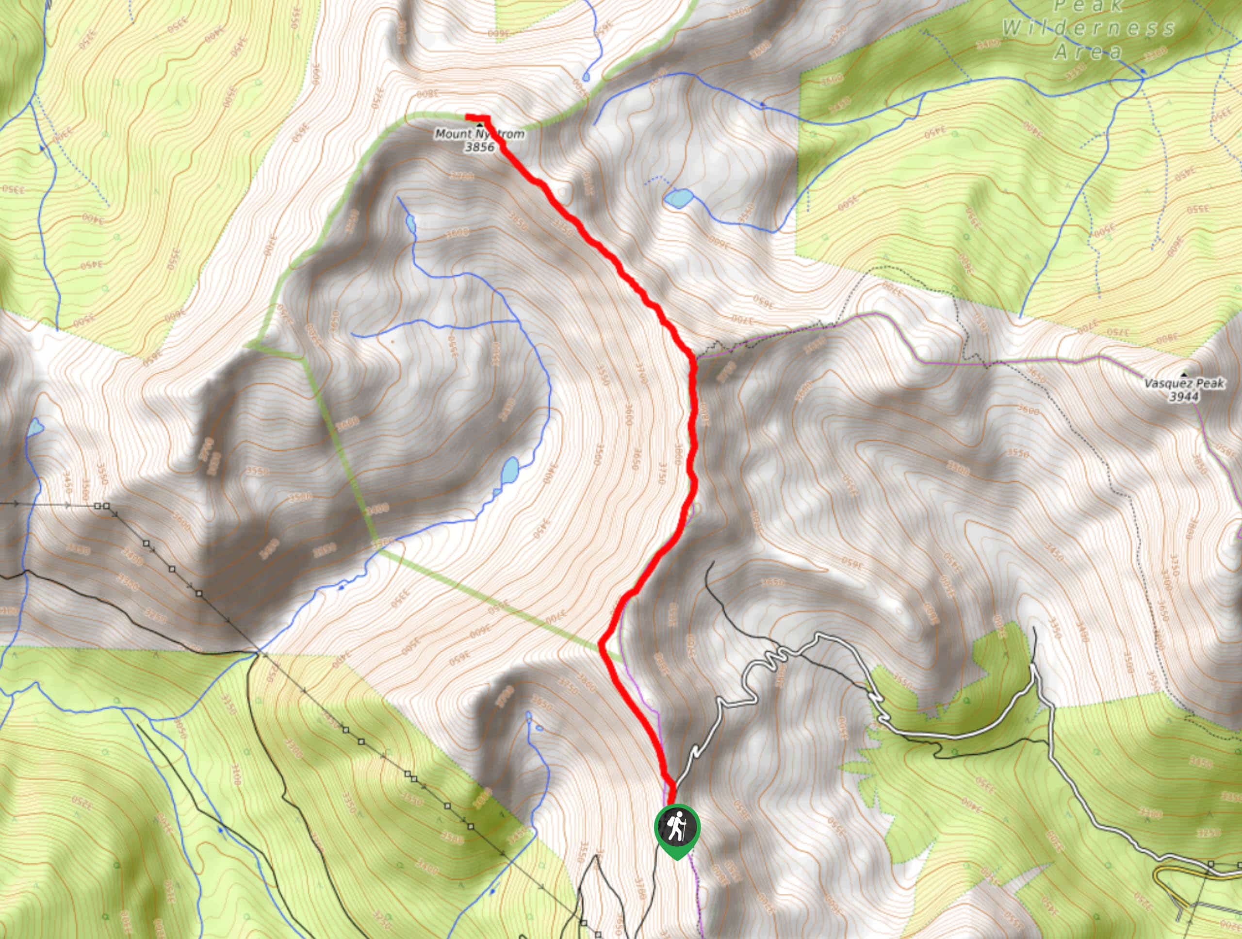
Mount Nystrom Trail
The Mount Nystrom Trail is an exciting adventure above the clouds. Hike the exposed path to the summit and enjoy…
Comments