
Eden Valley Hike
View Photos
Eden Valley Hike
Difficulty Rating:
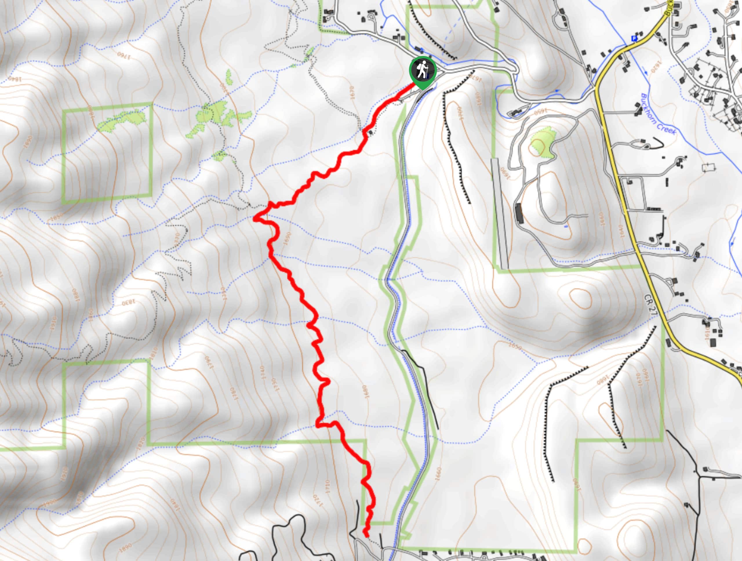
The Eden Valley Hike is an undulating path that will guide you across the Bobcat Ridge Natural Area. Short and sweet, this adventure is ideal for family adventure into the wilderness. Kids will love the rocks sculpted with wildlife that line the path.
Getting there
The Eden Valley Hike is located within the Bobcat Ridge Natural Area off County Road 32C.

About
| Backcountry Campground | No |
| When to do | April-October |
| Pets allowed | No |
| Family friendly | Yes |
| Route Signage | Average |
| Crowd Levels | Moderate |
| Route Type | Out and back |
Eden Valley Hike
Elevation Graph
Weather
Eden Valley Hike Description
The Eden Valley Trail is a rocky path that traverses through grassy plains dotted with sagebrush. The Eden Valley Trail is a popular mountain biking destination so expect to share the path with fellow outdoor enthusiasts. As you travel through the Bobcat Ridge Natural Area keep your eyes peeled for bobcats, deer, bear, and rattlesnakes!
Embark on your nature hike from the trailhead and parking lot. Track the Valley Loop Trail until you encounter an intersection. At the junction, veer left on the Eden Valley Spur Trail. Hike the undulating through the grassy plains. Enjoy the vistas of the encompassing Front Range peaks in the distance. Follow the trail and trek south over the several intersecting streams. Travel along the meadowland path until you meet the trail’s end.
At the path’s end, turnaround and retrace your steps along the route back to the trailhead and parking lot.
Similar hikes to the Eden Valley Hike hike

Rutherford Trail
The Rutherford Hike is a charming nature walk in Georgetown Colorado. This secluded trail is a wonderful adventure the whole…
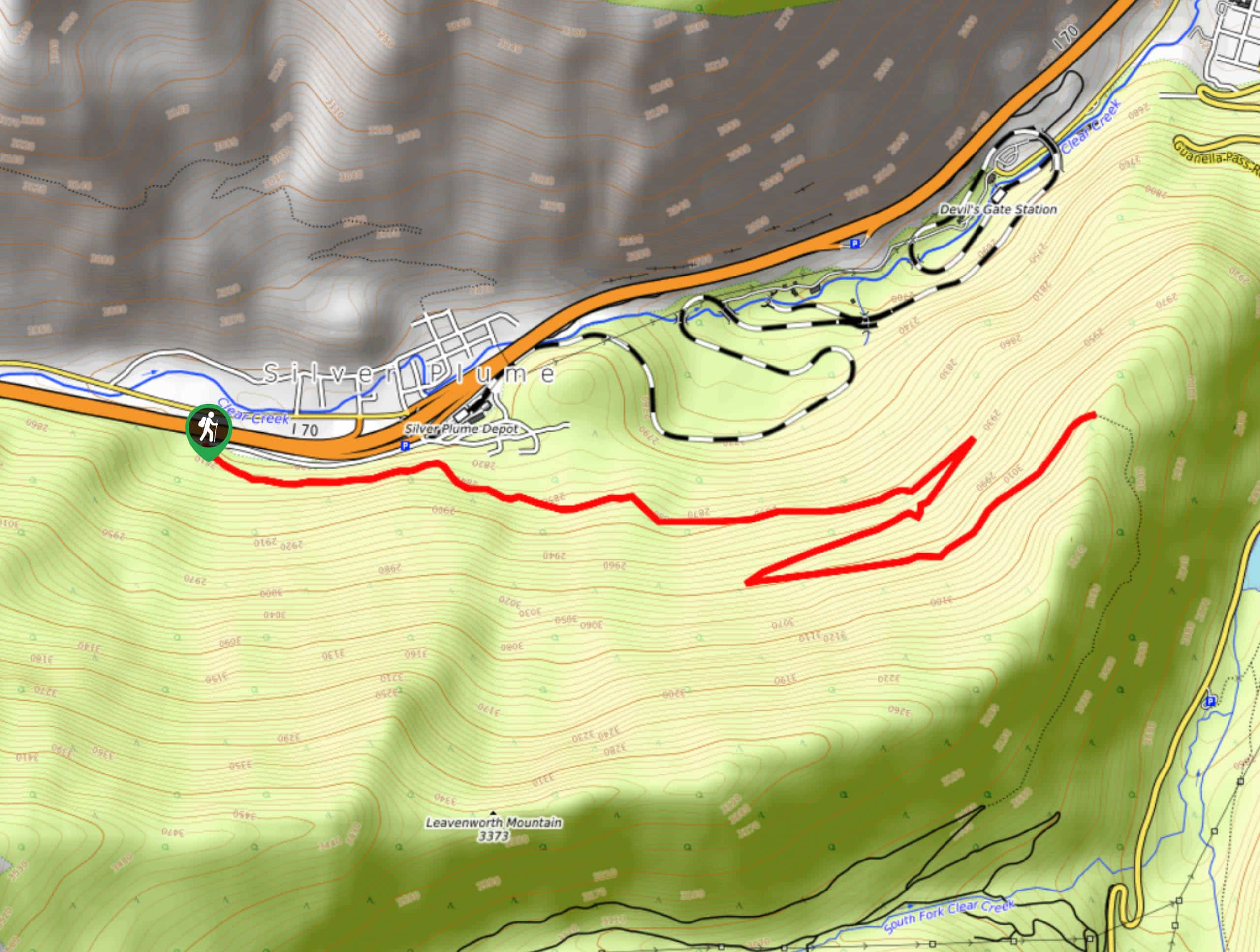
Pavilion Point Hike
The Pavilion Point Hike is an awesome adventure that the whole family can enjoy. Near Silver Plume Train Depot, kids…
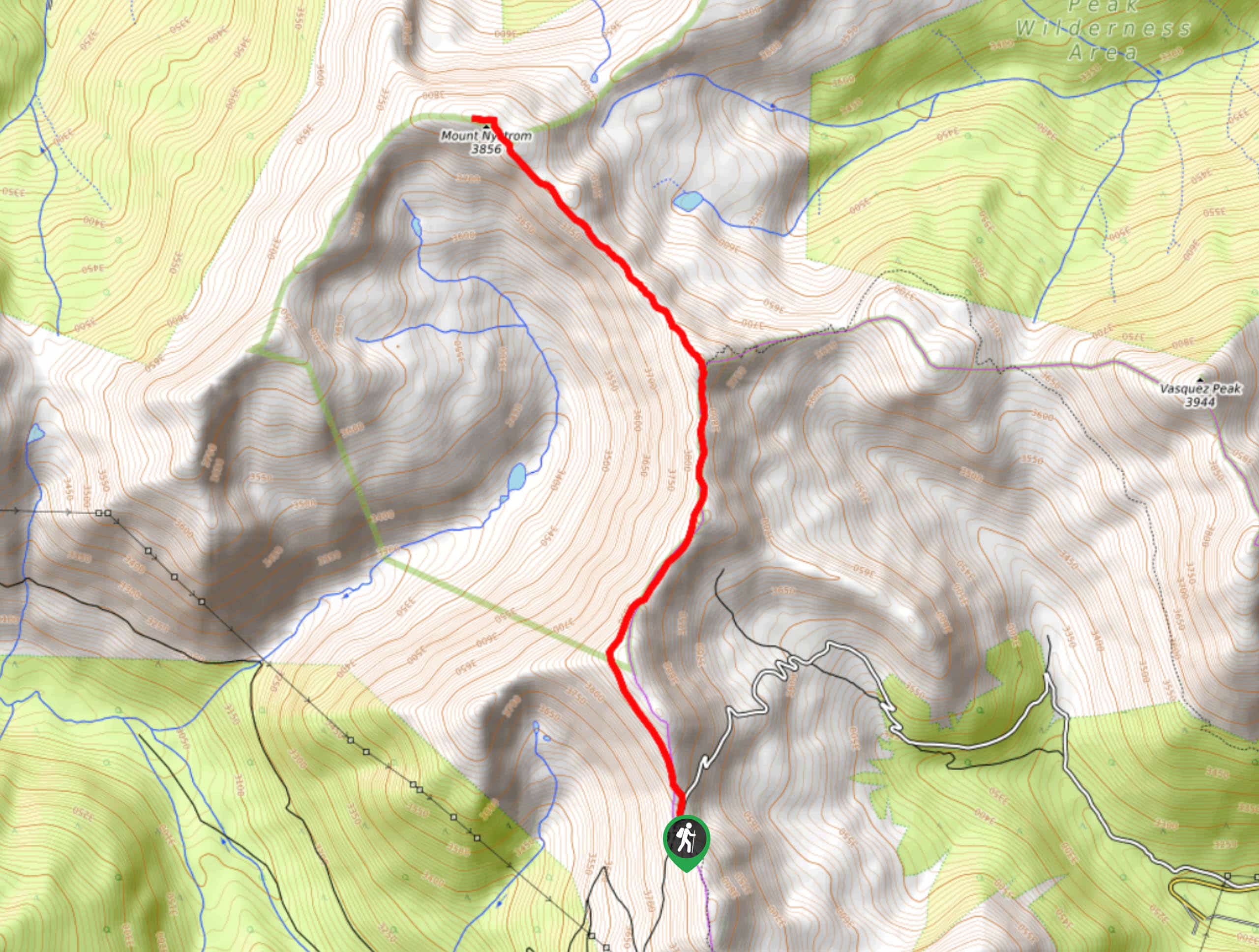
Mount Nystrom Trail
The Mount Nystrom Trail is an exciting adventure above the clouds. Hike the exposed path to the summit and enjoy…
Comments