
Blue Sky Trail
View Photos
Blue Sky Trail
Difficulty Rating:
Bordering the city of Fort Collins, the Blue Sky Trail is a wonderful escape into nature. Hike it or bike it, this trail will get your blood pumping. Travelling over 12.4mi there and back, you will have ample time to enjoy the impressive Colorado landscape that encompasses the meadowed trail.
Getting there
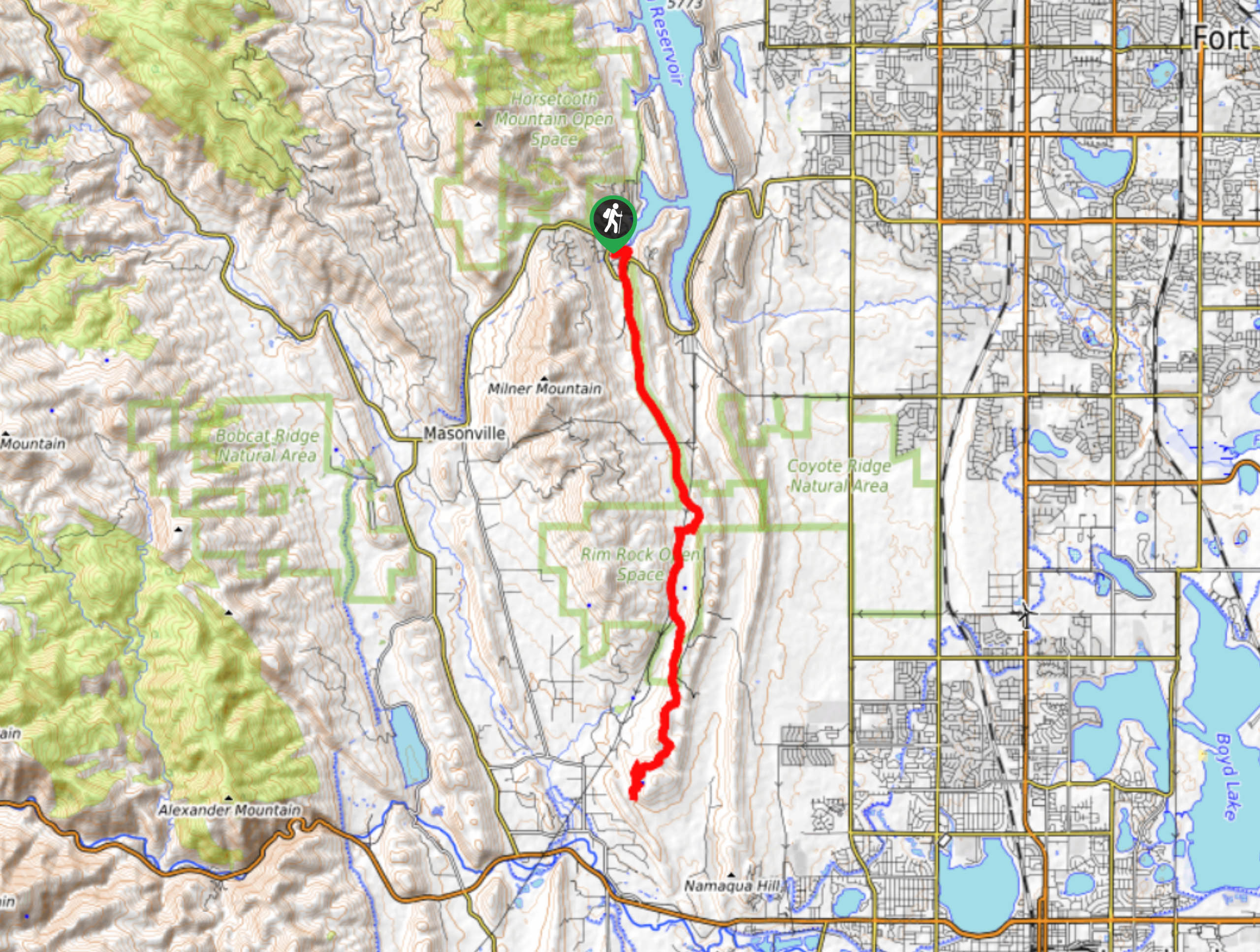
Find the Blue Sky Trail in the Horsetooth Mountain Open Space off W County Road 38E.

About
| Backcountry Campground | No |
| When to do | March-October |
| Pets allowed | Yes - On Leash |
| Family friendly | No |
| Route Signage | Average |
| Crowd Levels | Moderate |
| Route Type | Out and back |
Blue Sky Trail
Elevation Graph
Weather
Blue Sky Hike Description
Immerse yourself in the rocky meadow landscape on the Blue Sky Trail. This well-maintained path will guide its adventurers through sparse forests and along wildflower-abundant plains hemmed with craggy ridges. If you are seeking a lengthy adventure, then the Blue Sky Hike is the perfect excursion. The trail closes at dusk, so make sure you head out in the early morning to beat the sunset. Though this trail is long, the path is explicit and well maintained. Undulating the entirety of the way, there are only a few steep segments along the path. Note that the trailhead for the Blue Sky Hike is in the Horsetooth Mountain Open Space, so visitors must purchase a $9USD permit.
Begin your journey on the Blue Sky Trail from the Inlet Bay Trailhead and Parking Lot. From the parking lot, take the east Inlet Bay Trail. The path will guide you southeast over Spring Creek and under W County Road 38E. After the underpass the trail morphs into the Blue Sky Trail. The route will straighten out and track south. Hike the path and notice Spring Creek in the west and catch a glimpse of Fort Collins in the east. Track south along the dirt path, be cautious of the mountain bikers you are sharing the trail with. You will meet several intersections with merging routes as you trek along, staying on on the Blue Sky Trail.
The trail will eventually turn into the Hunter Loop Trail, this is the final segment of the path. You will encounter your turn around point at the end of Hunter Loop Trail. Backtrack along the trail all the way back to the parking lot.
Similar hikes to the Blue Sky Trail hike

Hankins Pass Hike
The Hankins Pass Hike is a quintessential adventure across the Lost Creek Wilderness. The hike demonstrates the diversity of the…

Miller Gulch Loop Trail
The Miller Gulch Loop Trail is a scenic meadowland adventure in the Pike National Forest. Hike through grassy meadows laden…

The Castle Hike
The Castle Hike is an exciting adventure up the steep, forested terrain to The Castle Rock. From atop the summit,…
Comments