Crosier Mountain via Devil’s Gulch Trail
View Photos
Crosier Mountain via Devil’s Gulch Trail
Difficulty Rating:
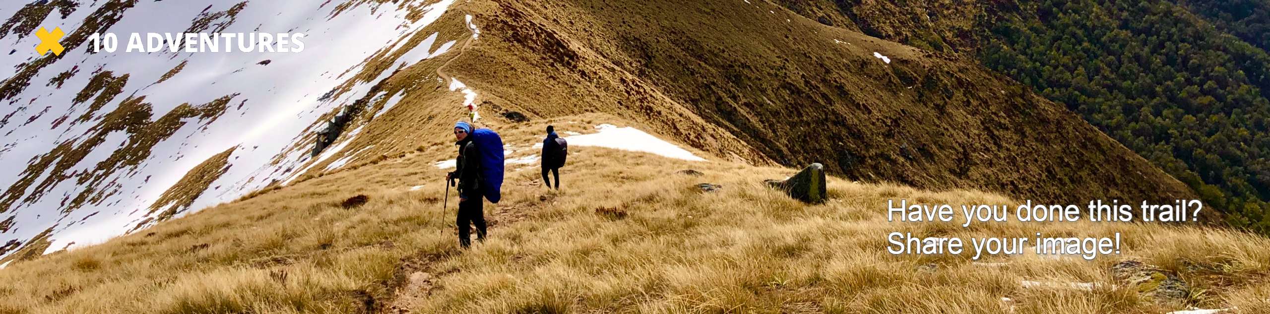
The Crosier Mountain via Devil’s Gulch Trail is a lovely, forested excursion in the Roosevelt National Forest. With the perfect balance between steep and scenic, this hike is a winner in our books. Hike through the dense aspen forests and once you top the timberline, the trail will open up to expansive views of the encompassing mountainous wilderness.
Getting there
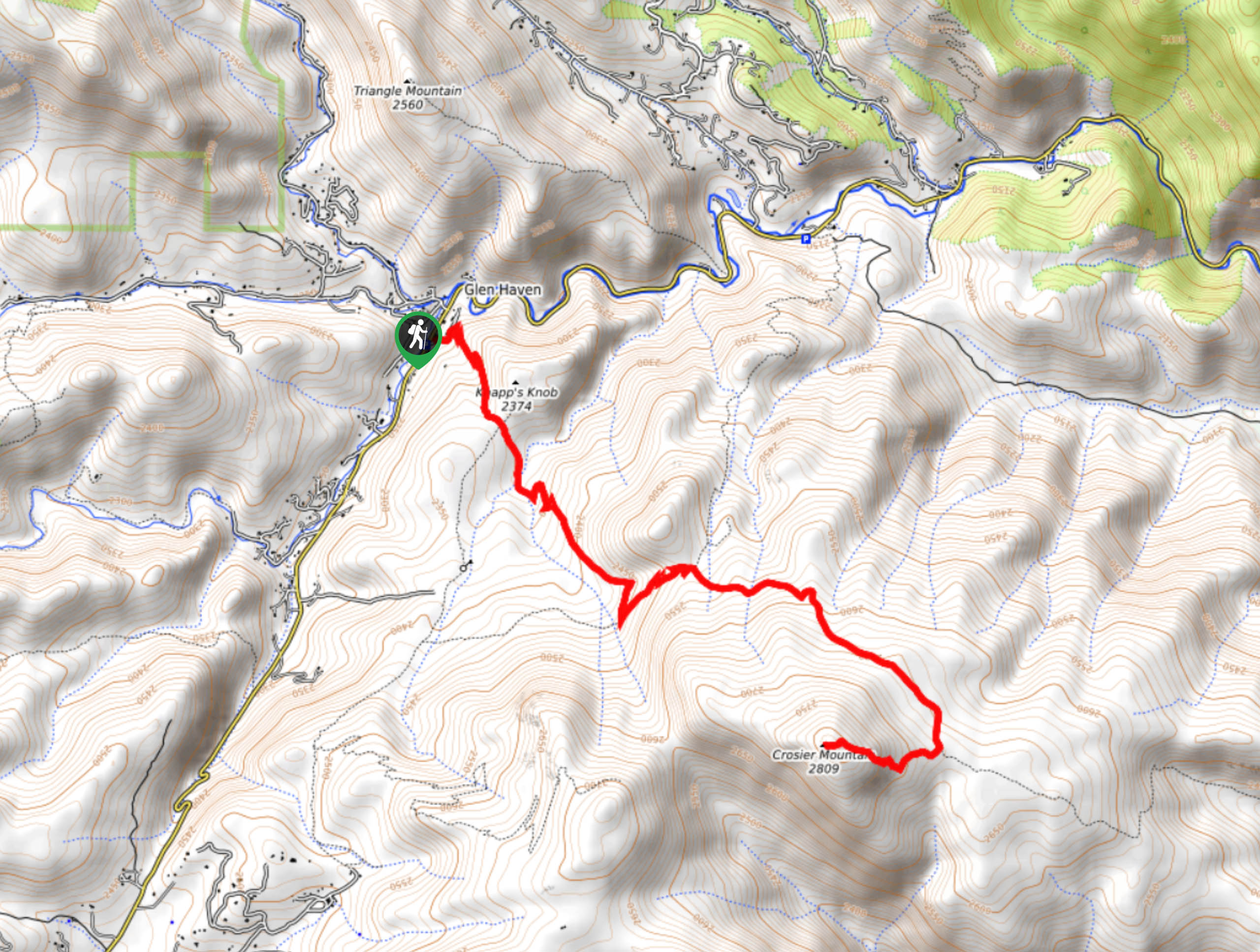
The Crosier Mountain via Devil’s Gulch Trailhead is off of the Devil’s Gulch Road.

About
| Backcountry Campground | Dispersed backcountry camping, see regulations. |
| When to do | Year-round |
| Pets allowed | Yes - On Leash |
| Family friendly | Older Children only |
| Route Signage | Average |
| Crowd Levels | Moderate |
| Route Type | Out and back |
Crosier Mountain via Devil’s Gulch Trail
Elevation Graph
Weather
Crosier Mountain via Devil’s Gulch Hike Description
Adventure the Crosier Mountain via Devil’s Gulch Trail year-round. We love a versatile trail, and this hike checks that box. Trade your hiking boots for snowshoes in the winter months and enjoy this wonderfully scenic trail year-round. Personally, we think the trail is at its peak in the autumn, when the aspen leaves are at their peak vibrance. Whether you hike this route in January or August, make sure to pack plenty of water. The rearmost section of the trail is steep and delivers you to a high-altitude peak-hydration is a must.
Start your journey up the Crosier Mountain via Devil’s Gulch Trail from the parking lot. Find the trailhead and track southeast on the Crosier Mountain Trail. Hike up the forested gulch and a path will intersect with the trail. Ignore the intersection and hike on. Follow the forest path and admire the grandeur of the towering aspen and pine trees. As you continue trekking, the tree shade will become increasingly sparse as you weave through the shade into open meadows. You will intersect with several creeks before the trail’s elevation picks up in intensity. Stay on the Crosier Mountain Trail, ignoring any merging paths as you hike. As you near Crosier Mountain the route will become increasingly exposed. Trek up the path and navigate the switchbacks to the summit.
Though you have been gradually climbing the entirety of the hike, the final segment of the trail is a challenge. Scramble up the east side of Crosier Mountain and navigate the rocky terrain. Once you summit the peak you will be rewarded with dumfounding views of the neighboring snow-capped peaks. Catch your breath and appreciate the incredible mountain scenery. Notice the Mummy Mountain Range in the west. Relax and refuel before beginning your descent. When you are ready, simply backtrack along the path back to the parking lot.
Similar hikes to the Crosier Mountain via Devil’s Gulch Trail hike

Hankins Pass Hike
The Hankins Pass Hike is a quintessential adventure across the Lost Creek Wilderness. The hike demonstrates the diversity of the…

Miller Gulch Loop Trail
The Miller Gulch Loop Trail is a scenic meadowland adventure in the Pike National Forest. Hike through grassy meadows laden…

The Castle Hike
The Castle Hike is an exciting adventure up the steep, forested terrain to The Castle Rock. From atop the summit,…
Comments