
Geneva Creek Iron Fens Hike
View Photos
Geneva Creek Iron Fens Hike
Difficulty Rating:
The Geneva Creek Iron Fens Hike is a unique trail through the Colorado Wilderness. The wetlands at the top of the trail have a reddish mars-like appearance due to the iron in the water that streams down from the calcareous rocks. Hike, bike or drive up the old mining road to the Iron Fens.
Getting there
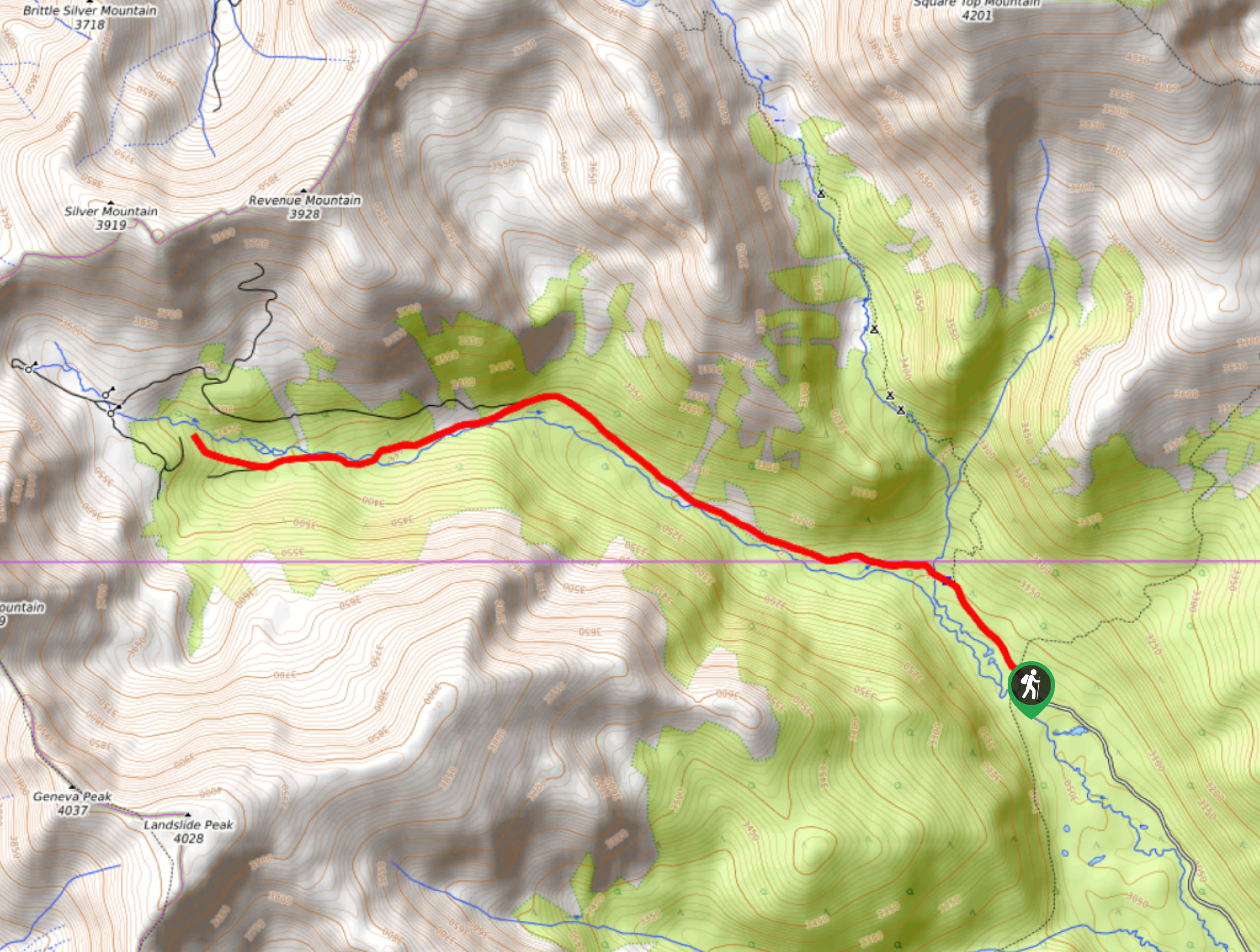
Begin your hike up to the Geneva Creek Iron Fens from the trailhead off County Road 1038.

About
| Backcountry Campground | Designated Dispersed Campsites |
| When to do | May-September |
| Pets allowed | Yes - On Leash |
| Family friendly | Yes |
| Route Signage | Average |
| Crowd Levels | Low |
| Route Type | Out and back |
Geneva Creek Iron Fens Hike
Elevation Graph
Weather
Geneva Creek Iron Fens Hike Description
The adventure up to the Geneva Creek Iron Fens is a unique experience. Hike, bike, or drive—this trail offers activities for all sorts of outdoor enthusiasts. We love a good hike, so we prefer to walk up this route. Easy to navigate and well-marked, this path is manageable for hikers of most skill levels and children. Hike past old mines, up the creek road and to the red-hued wetlands.
Embark on your adventure up the Geneva Creek Iron Fens Trail from the first gate. Hike up County Road 1038, minding cars passing by. Soon the route will become a more primitive dirt route. If you are driving, make sure your vehicle has high ground clearance. This route will travel through a mixed pine and aspen forest up to the Iron Fens. Trek up along Geneva Creek and keep your eye out for old mine remnants. At the first junction, veer left and the path will guide you to the waterfall and Iron Fens.
Admire the unique red landscape and cascading waterfall. Make sure to stay on the trail as the environment is extremely fragile. Explore the mars-like terrain and snap a few pics before beginning your descent. When you are ready, retrace your steps back to the parking lot.
Similar hikes to the Geneva Creek Iron Fens Hike hike

Hankins Pass Hike
The Hankins Pass Hike is a quintessential adventure across the Lost Creek Wilderness. The hike demonstrates the diversity of the…

Miller Gulch Loop Trail
The Miller Gulch Loop Trail is a scenic meadowland adventure in the Pike National Forest. Hike through grassy meadows laden…

The Castle Hike
The Castle Hike is an exciting adventure up the steep, forested terrain to The Castle Rock. From atop the summit,…
Comments