
Stout Loop Trail
View Photos
Stout Loop Trail
Difficulty Rating:
The Stout Loop Trail is one of many adventure opportunities in the Horsetooth Mountain Open Space. Hike through grassy meadows, along pine lined trails and up to a stunning overlook of the Horsetooth Reservoir below and the Horsetooth Rock towering above. This charming route packs a punch.
Getting there
The Stout Loop Trail is located in the Horsetooth Mountain Open Space off of West County Road 38E.

About
| Backcountry Campground | Yes, only at designated backcountry campsites. See rules and regulations. |
| When to do | March-October |
| Pets allowed | Yes - On Leash |
| Family friendly | Yes |
| Route Signage | Average |
| Crowd Levels | Moderate |
| Route Type | Lollipop |
Stout Loop Trail
Elevation Graph
Weather
Stout Loop Hike Description
Adventure through the Horsetooth Mountain Open Space on foot or bike, either way, you will be rewarded with stunning scenery. Hike through grassy plains overlooking the shimmering reservoir that is situated in the foreground of the mountainous landscape. This path is a lovely day hike that the whole family will enjoy! Note that this path is exposed, so pack plenty of water and slather on the sunscreen on warm sunny days! The dry environment of the Horsetooth Mountain Open Space is inviting to rattlesnakes, so keep an ear out for them and mind your footing in the grassy meadows. Visitors are required to purchase a pass to hike the trails. These permits can be purchased at the kiosk as you enter the Open Space and typically cost about $9USD.
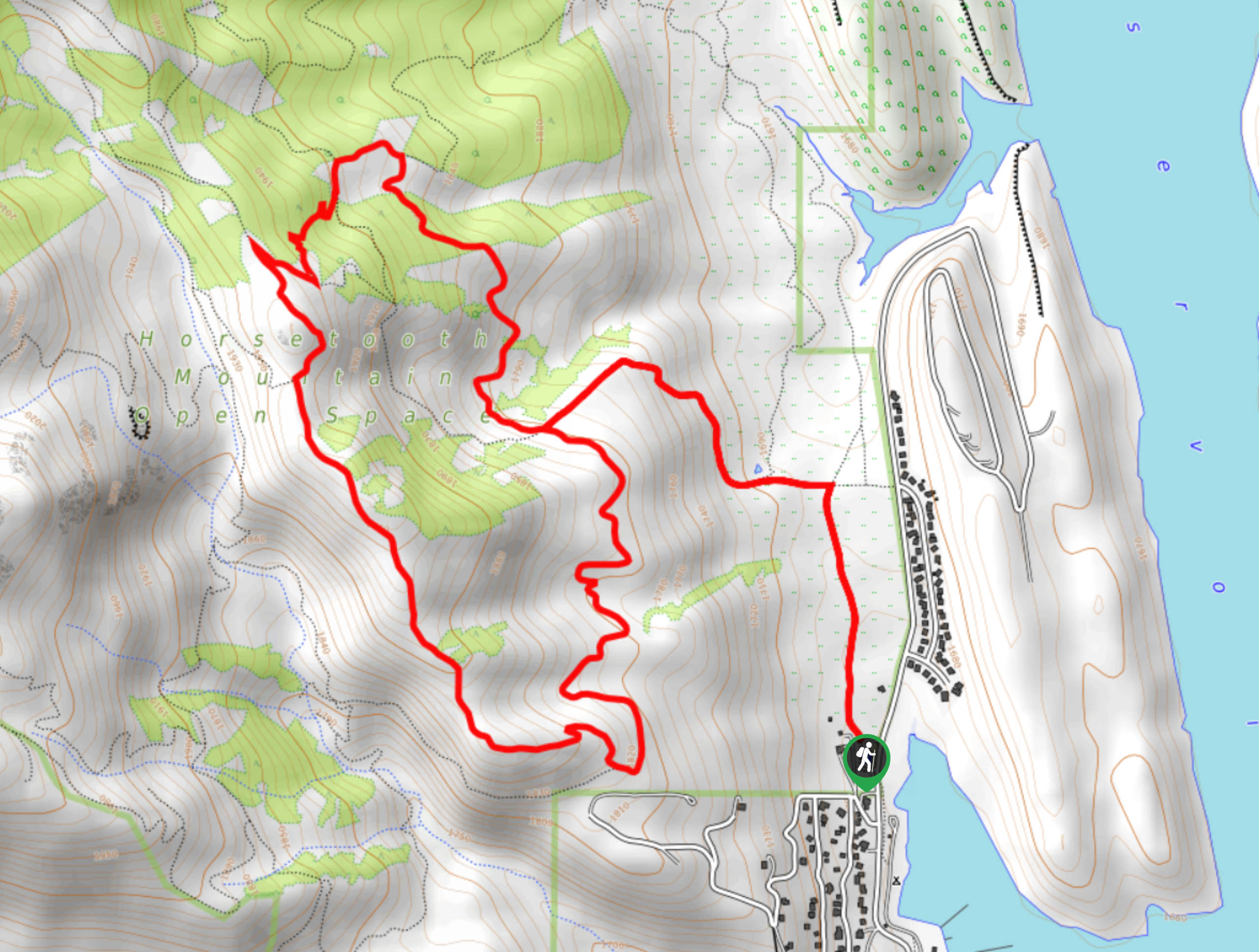
Embark on your adventure around the Stout Loop Trail from the Soderberg Trailhead. Track north along the Swan Johnson Trail and at the first intersection, veer left up the Towers Trail. Hike up the dirt path to the meadowlands. Soon you will encounter another junction. From this point, you can complete from either direction, but we suggest hiking counterclockwise on this one. Take the Stout Trail north, and it will guide you below sparse pine tree shade. At the fork in the road, veer left up Sawmill Trail and then take another quick left onto Loggers Trail. After you merge onto Loggers Trail, you will confront another intersection, take a right up Herrington Trail.
Ascend the timberline and then hook briefly back onto the Towers Trail by turning right at the junction. Soon you will meet another turn, veer left on Herrington Trail. Hike this path for a while before it merges into the Stout Trail. Enjoy the sights of the reservoir below as you descend this route Venture along the Stout Trail as it loops you back to the first intersection. From here, turn right and retrace your steps down Towers Trail and back onto Swan Johnson to the trailhead and parking lot.
Similar hikes to the Stout Loop Trail hike

Miller Gulch Loop Trail
The Miller Gulch Loop Trail is a scenic meadowland adventure in the Pike National Forest. Hike through grassy meadows laden…

The Castle Hike
The Castle Hike is an exciting adventure up the steep, forested terrain to The Castle Rock. From atop the summit,…

Rutherford Trail
The Rutherford Hike is a charming nature walk in Georgetown Colorado. This secluded trail is a wonderful adventure the whole…
Comments