James Peak Hike
View Photos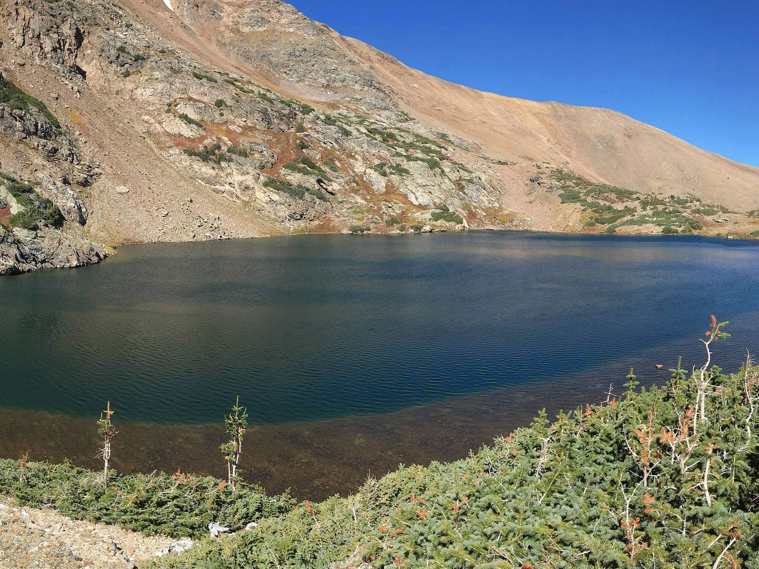
James Peak Hike
Difficulty Rating:
Bask in beautiful scenery along the entirety of the James Peak Hike. This demanding trail will guide its conquerors through subalpine woodlands, through alpine tundras and up a glacier all before culminating at the summit. This trail is no-joke, but the views from the summit are well worth the effort.
Getting there
Located in the James Peak Wilderness, the James Peak Trailhead is off of the Fall River Road.

About
| Backcountry Campground | Dispersed backcountry camping, see rules. |
| When to do | June-October |
| Pets allowed | Yes - On Leash |
| Family friendly | No |
| Route Signage | Poor |
| Crowd Levels | Extreme |
| Route Type | Out and back |
James Peak Hike
Elevation Graph
Weather
James Peak Hike Description
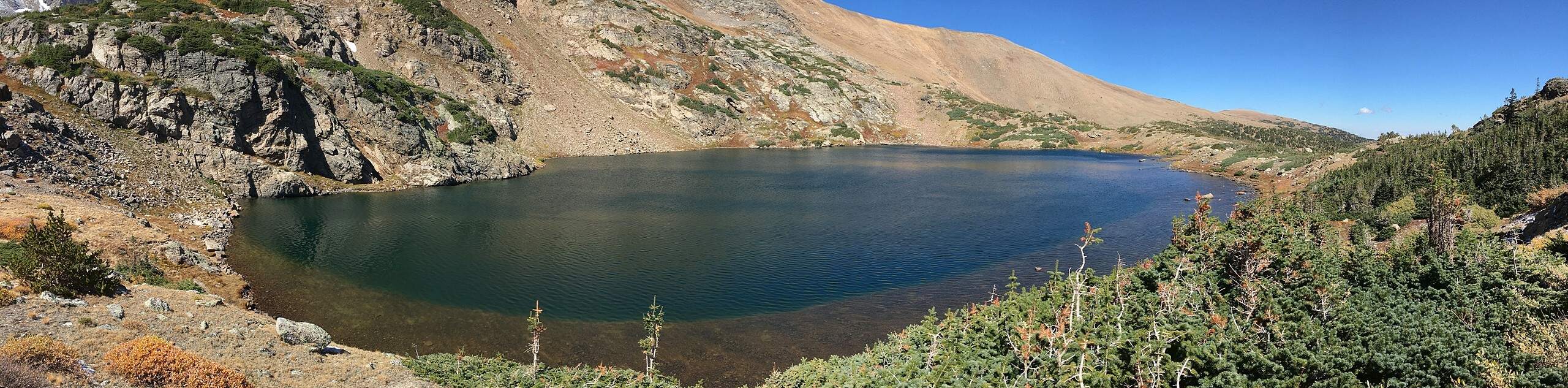
The James Peak Hike is a crowd-favorite trail in the James Peak Wilderness, and rightfully so. Hike this trail in the early morning to avoid the inevitable crowds this excursion draws. Furthermore, arriving early mitigates the possibility of getting caught in an afternoon storm at the summit. Though this trail is extremely popular, route signage is poor. Make sure to have the trail GPS handy to help you navigate the tricky terrain to the summit. If you are hiking in the autumn or winter, we recommend wearing microspikes to help navigate the snowy terrain at the peak. As always, layers are good insurance against inclement and windy weather at high altitudes. Note that to park at the trailhead, visitors are required to purchase a pass that typically costs around $5USD.
Begin your adventure at the James Peak Trailhead. Track along Saint Mary’s Drive. The trail will shortly merge onto the Saint Mary’s Street Trail. Hike the forested path up to Saint Mary’s Lake. Enjoy the shimmering alpine lake and continue up the path. The trail will curve northwest and route markers will become more sparse. Hike up Saint Mary’s Glacier and then take the Kingston Peak Spur Trail at the top. This section of the trail is steep and exposed, so mind your footing and use the trail GPS to avoid any false peaks. Hike up the path until you meet a cluttered intersection. Stay northwest and hook onto the James Peak South Trail.
Trek the technical terrain as you ascend towards James Peak. Notice Stewart Lake and Loch Lomond Lake in the south. Hike past the garden of lakes and navigate tightly wound switchbacks up the ridge of James Peak. Scramble up the steep rocky scree and summit James Peak. Appreciate the grandeur of the peak as you tower over the subalpine wilderness below. Enjoy the 360-degree views of encompassing peaks and the mountainous landscape that shapes the horizon. Catch your breath and hydrate before retracing your steps down the route all the way back to the parking lot.
Similar hikes to the James Peak Hike hike

Hankins Pass Hike
The Hankins Pass Hike is a quintessential adventure across the Lost Creek Wilderness. The hike demonstrates the diversity of the…

Miller Gulch Loop Trail
The Miller Gulch Loop Trail is a scenic meadowland adventure in the Pike National Forest. Hike through grassy meadows laden…

The Castle Hike
The Castle Hike is an exciting adventure up the steep, forested terrain to The Castle Rock. From atop the summit,…
Comments