
Black Canyon Hike
View Photos
Black Canyon Hike
Difficulty Rating:
The Black Canyon Hike is a scenic escapade along the Colorado Trail to Black Canyon. Traverse the path that reveals the diversity of the Colorado wilderness. Hike among the aspen trees, through vast meadows, along alpine streams and down into a river valley.
Getting there
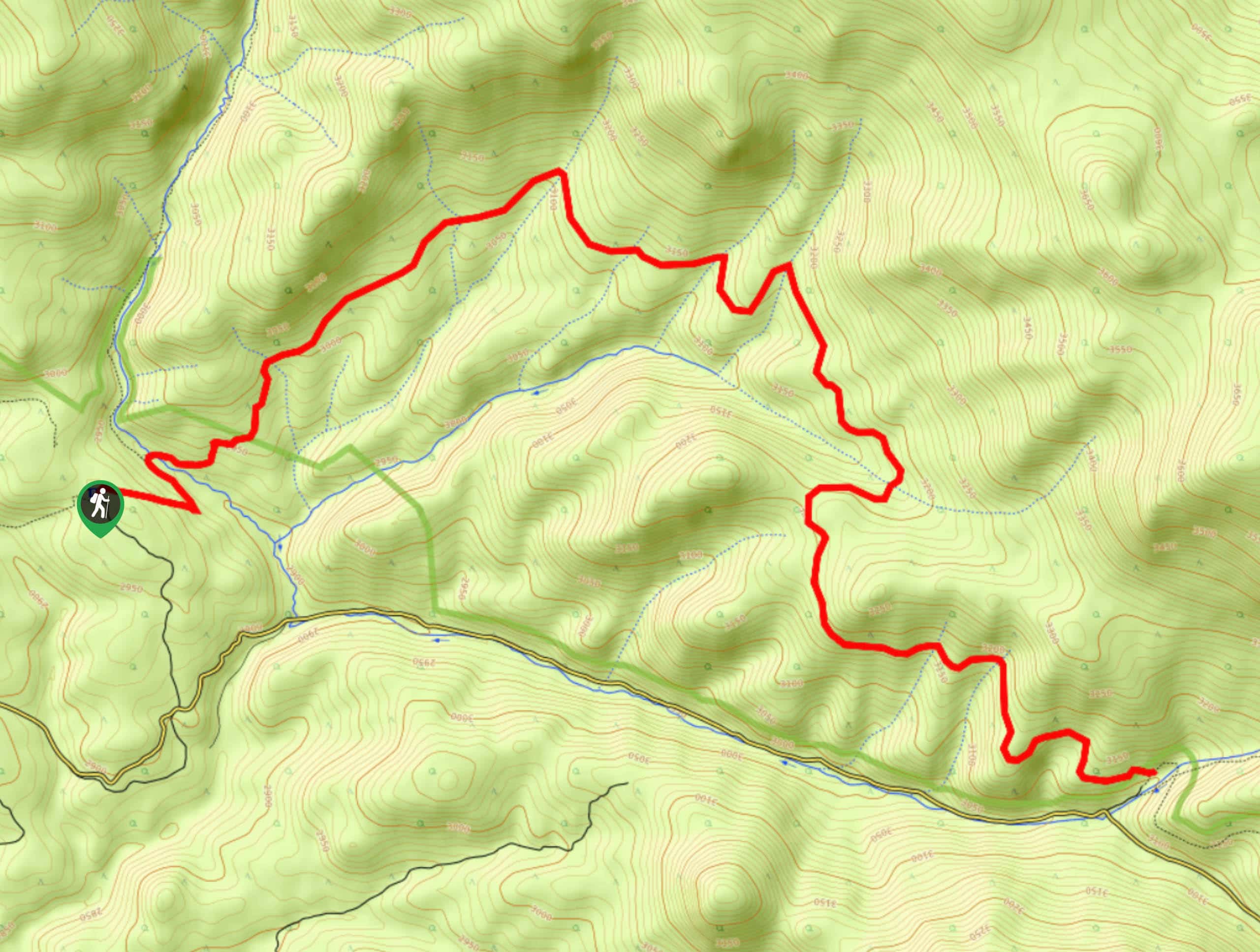
The Black Canyon Trailhead is located off the Rock Creek Road.

About
| Backcountry Campground | Dispersed Backcountry Camping Permitted, restrictions apply. |
| When to do | March-October |
| Pets allowed | Yes - On Leash |
| Family friendly | No |
| Route Signage | Average |
| Crowd Levels | Low |
| Route Type | Out and back |
Black Canyon Hike
Elevation Graph
Weather
Black Canyon Hike Description
The Black Canyon Trail is an unforgettable journey across the Lost Creek Wilderness. Lengthy and technical, this hike is reserved for experienced adventurers. Ensure to wear layers and check the forecast before heading out because this path weaves between exposed areas and tree shade. Additionally, if you have the gear, consider transforming this lengthy day hike into an overnight backpacking excursion. Set up camp at one of the many dispersed campsites along the trail! It is also worth noting that this primitive trail will guide you amongst wildlife. Be mindful of rattlesnakes, mountain lions and bears. Stay calm and give the wildlife plenty of space if you confront them.
Begin your Black Canyon Hiking adventure from the Colorado Trail Segment 5 Trailhead. Track northeast along the path as it guides you over Rock Creek before ascending into a meadow. Hike through the grassy plains, keeping an eye out for grazing deer and notice the Kenosha Mountains in the east. This route will intersect with streams on several occasions, and you progress. Climb up the path and beneath the tree coverage of towering pine trees. Take a break under the tree shade or consider camping at one of the campsites. Soon the trail will begin to curve southeast and descend into the Black Canyon. Intersecting with several streams, you will eventually descend into the canyon alongside Lost Park Road.
If you have a pickup, you can finish your excursion here. If not, simply retrace your steps back along the path to the trailhead.
Similar hikes to the Black Canyon Hike hike

Hankins Pass Hike
The Hankins Pass Hike is a quintessential adventure across the Lost Creek Wilderness. The hike demonstrates the diversity of the…

Miller Gulch Loop Trail
The Miller Gulch Loop Trail is a scenic meadowland adventure in the Pike National Forest. Hike through grassy meadows laden…

The Castle Hike
The Castle Hike is an exciting adventure up the steep, forested terrain to The Castle Rock. From atop the summit,…
Comments