Chief Mountain Hike
View Photos
Chief Mountain Hike
Difficulty Rating:
Hike the Chief Mountain Trail and be rewarded with 360-degree panoramic vistas of the Rocky Mountain Range. This easy trek is perfect for a family outing or a spontaneous day hike in the Front Range. The minimal effort needed to revel in spectacular views is why we—and so many other adventurers—love this short mountain excursion.
Getting there
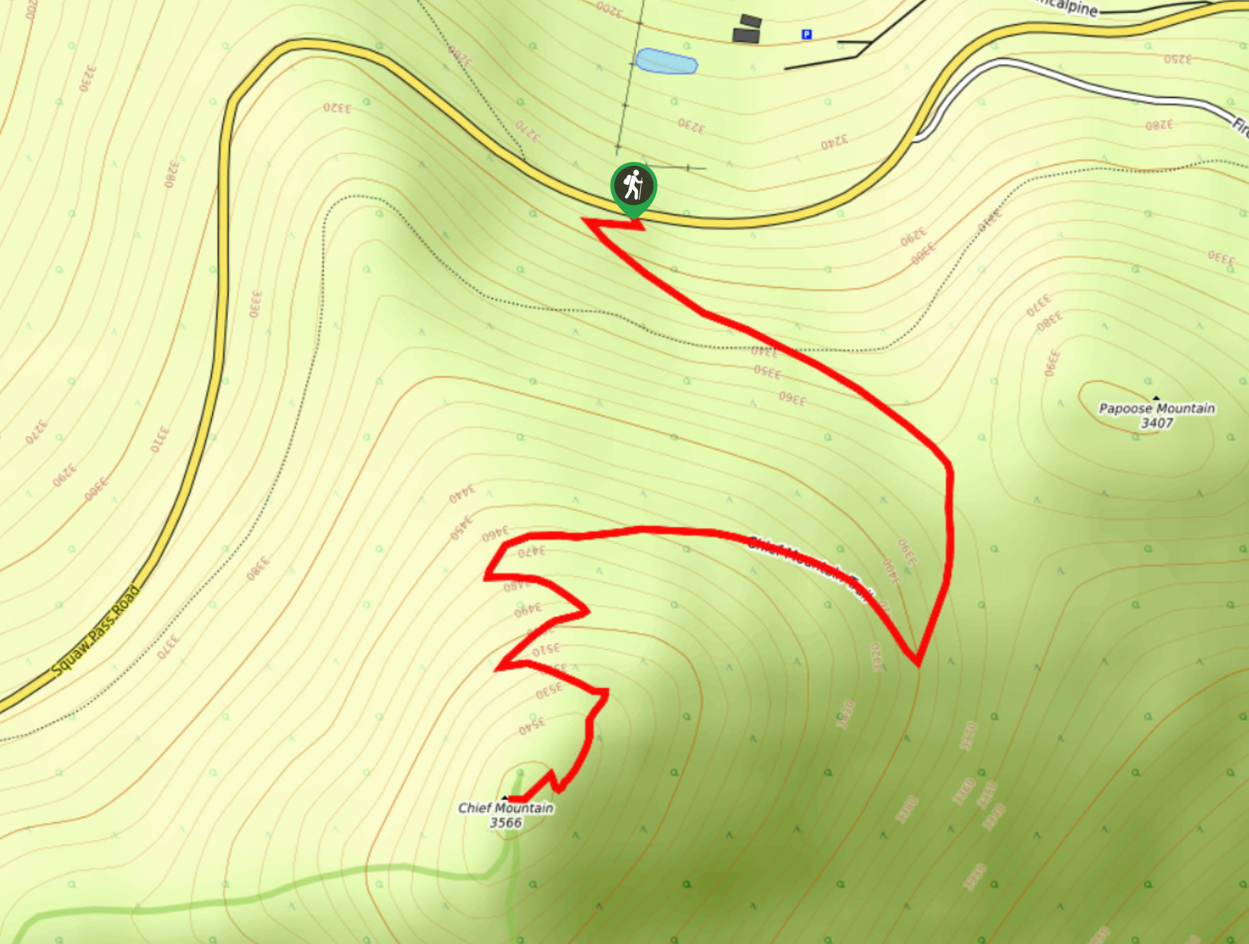
Chief Mountain Hike and Trailhead are located off highway CO-103. Note there is no parking lot at the trailhead, so you will have to park roadside.

About
| Backcountry Campground | Dispersed Backcountry Camping, see rules and regulations. |
| When to do | Year-round |
| Pets allowed | Yes - On Leash |
| Family friendly | Yes |
| Route Signage | Average |
| Crowd Levels | High |
| Route Type | Out and back |
Chief Mountain Hike
Elevation Graph
Weather
Chief Mountain Hike Description
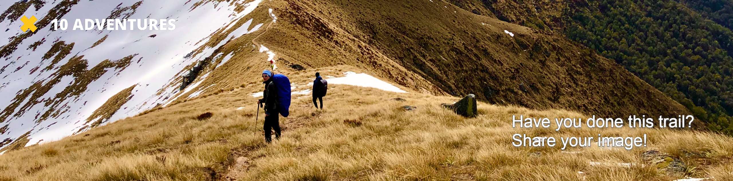
Ready for a fun adventure up Chief Mountain? Grab your hiking shoes and don’t forget your camera, because we know you are going to want pictures of this. The Chief Mountain Hike is short, sweet, but also very steep. Make sure you are acclimated to the region’s high altitude prior to attempting this excursion. If you are not from the area, make sure to pack extra water as the easy trail might require a bit more exertion.Adventuring up Chief Mountain in the autumn? Be aware that there will most likely be snow and ice near the summit! Make sure to plan accordingly and always expect windy and cold conditions at the top.
Low risk, high reward, that is what we like to hear. Hike up the well-marked path and over easy terrain to the summit. This hike is family-friendly, and great for adventurers of almost all skill levels! This trail is a great introductory excursion to hiking in the Rocky Mountains! Note that the trail is steep and rocky in a few sections, but it is very manageable. Next time you find yourself in the Front Range, make sure to add the Chief Mountain Hike to your itinerary.
Find the Chief Mountain Trailhead on the south side of the CO-103. Park along the shoulder of the highway and walk to the trailhead. Hook onto the Chief Mountain Trail and begin tracking southeast. Shortly after your departure from the trailhead you will meet an intersection. At the junction, stay straight on the Chief Mountain Trail. This path will guide you below tree coverage and you will be encompassed by towering pine and fir trees. Enjoy the sights and smells of the verdant subalpine forest.
Hike through the woodlands and the path will eventually curve you west. At this point, the trail will begin to lose the dense tree coverage as you begin to ascend the timberline. Climb the trail until you top the treeline. Above the trees it will likely be windier, layer up if necessary. Continue trekking west until you encounter a set of switchbacks. These switchbacks are easy to navigate but do climb steep and rocky terrain. Mind your footing and stay on the marked trail.
Maneuver the switchbacks and summit Chief Mountain. From atop the mountain enjoy panoramic views of the Mount Evans Wilderness and the dozens of peaks that dot the Colorado landscape. See Papoose Mountain near in the northeast and Warrior Mountain in the west. Revel in the forested valleys below and the expansive vistas before commencing your return.
To get back to the carpark retrace your steps down the path all the way back to the trailhead.
Frequently Asked Questions
What is the elevation of Chief Mountain?
Chief Mountain sits at about 11709 feet in elevation.
Is the Chief Mountain Colorado Hike family-friendly?
Yes, the Chief Mountain Colorado Hike is family-friendly. Note that it does climb in elevation and there are steep segments.
Insider Hints
If you are hiking the Chief Mountain Trail in the autumn and winter months, consider wearing microspikes to navigate possible icy steep sections of the trail.
Pack some rations and have a picnic at the summit.
Consider a week-day hike to avoid the trail traffic.
Enjoy stunning vistas of the changing foliage if you hike Chief Mountain in the autumn.
Similar hikes to the Chief Mountain Hike hike

Hankins Pass Hike
The Hankins Pass Hike is a quintessential adventure across the Lost Creek Wilderness. The hike demonstrates the diversity of the…

Miller Gulch Loop Trail
The Miller Gulch Loop Trail is a scenic meadowland adventure in the Pike National Forest. Hike through grassy meadows laden…

The Castle Hike
The Castle Hike is an exciting adventure up the steep, forested terrain to The Castle Rock. From atop the summit,…
Comments