
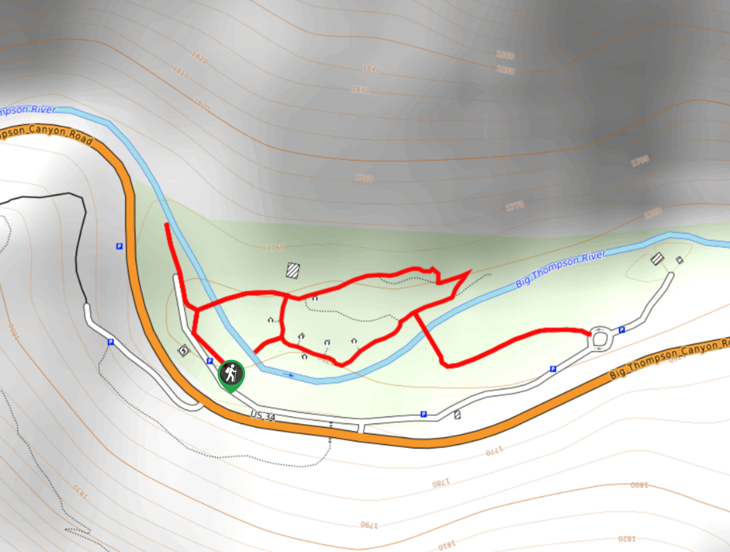
Viestenz-Smith Mountain Park Trail
View Photos
Viestenz-Smith Mountain Park Trail
Difficulty Rating:
Viestenz-Smith Mountain Park Trail is a scenic, but short adventure over the Big Thompson River and through the surrounding wilderness and historic artifacts. The Viestenz-Smith Mountain Park Trail is a perfect excuse to get the family into nature. Trek along the path and learn from the interpretive signs that line the trail.
Getting there
The Viestenz-Smith Mountain Park Trail is located off Highway 34.

About
| Backcountry Campground | No |
| When to do | Year-round |
| Pets allowed | Yes - On Leash |
| Family friendly | Yes |
| Route Signage | Average |
| Crowd Levels | Moderate |
| Route Type | Lollipop |
Viestenz-Smith Mountain Park Trail
Elevation Graph
Weather
Viestenz-Smith Mountain Park Hike Description
This lightly trafficked trail is an awesome way to get in some movement after a long drive or just a great adventure into nature. The Viestenz-Smith Mountain Park Hike is a stimulating adventure through the Colorado wilderness. Hike along the old, rusted power generators and trek the impressive bridges over the Big Thompson River.
From the parking lot, the network of Viestenz-Smith Mountain Park Trails can be completed in every which way, but we will let you know the best route to make the most of this short journey. From the carpark, track left along the trail and enjoy the up-close and personal views of the Big Thompson River and its flanking cliffs. At the end of the trail, turn around and veer left across the river. Travel to the north side of the river and explore the landscape. Hike along the trail and loop down to the far east bridge.When you cross the bridge,veer left and meander the riverside trail to the path’s end. When you meet the trail’s end, retrace your steps back across the bridge. Once you are back on the north side of the river, take the path over the middle bridge and continue along this route as you pass the old power generators.
Enjoy the area and consider having a picnic overlooking the Big Thompson River. Travel back to the north side of the river and then loop back across the river to the parking lot.
Similar hikes to the Viestenz-Smith Mountain Park Trail hike

Rutherford Trail
The Rutherford Hike is a charming nature walk in Georgetown Colorado. This secluded trail is a wonderful adventure the whole…
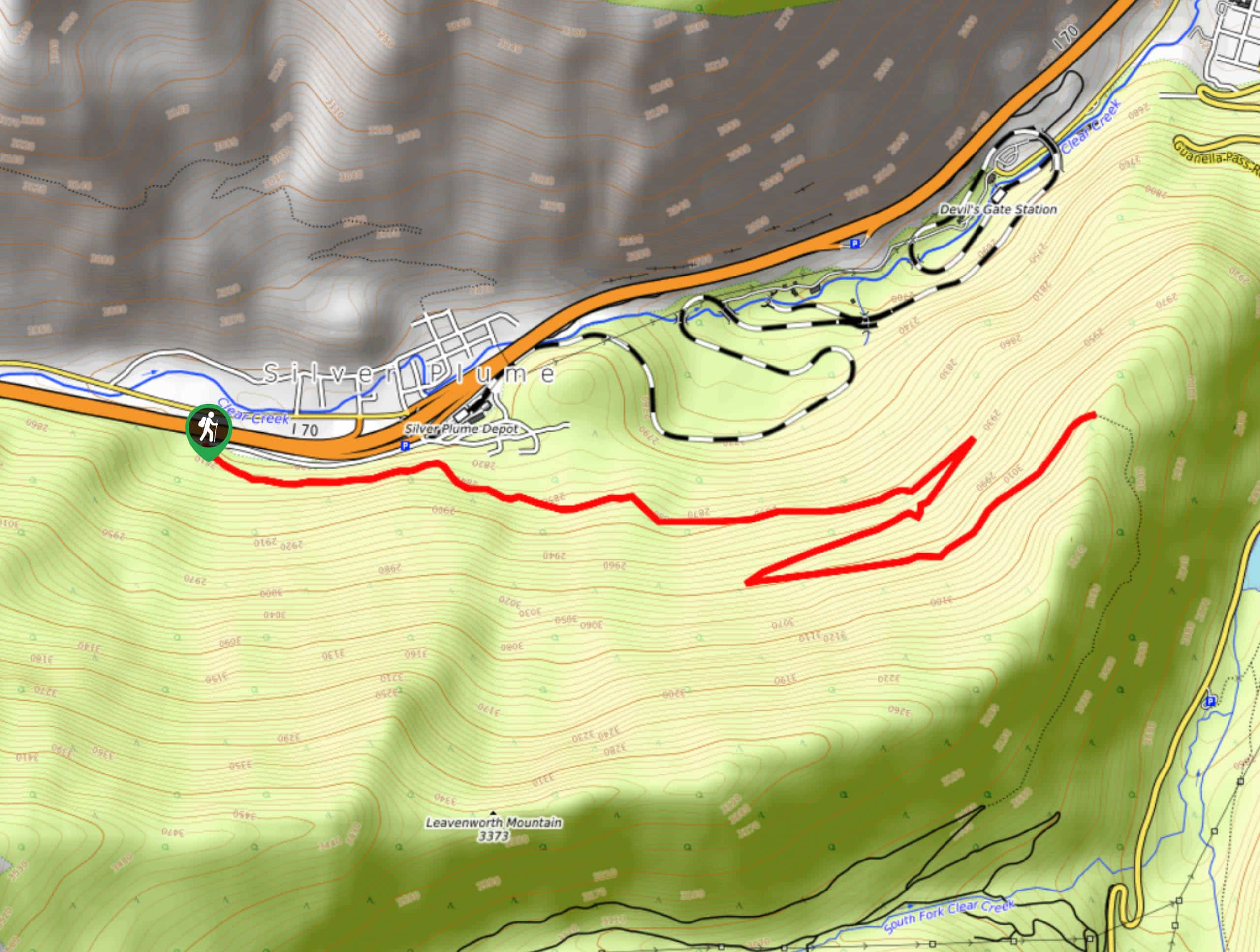
Pavilion Point Hike
The Pavilion Point Hike is an awesome adventure that the whole family can enjoy. Near Silver Plume Train Depot, kids…
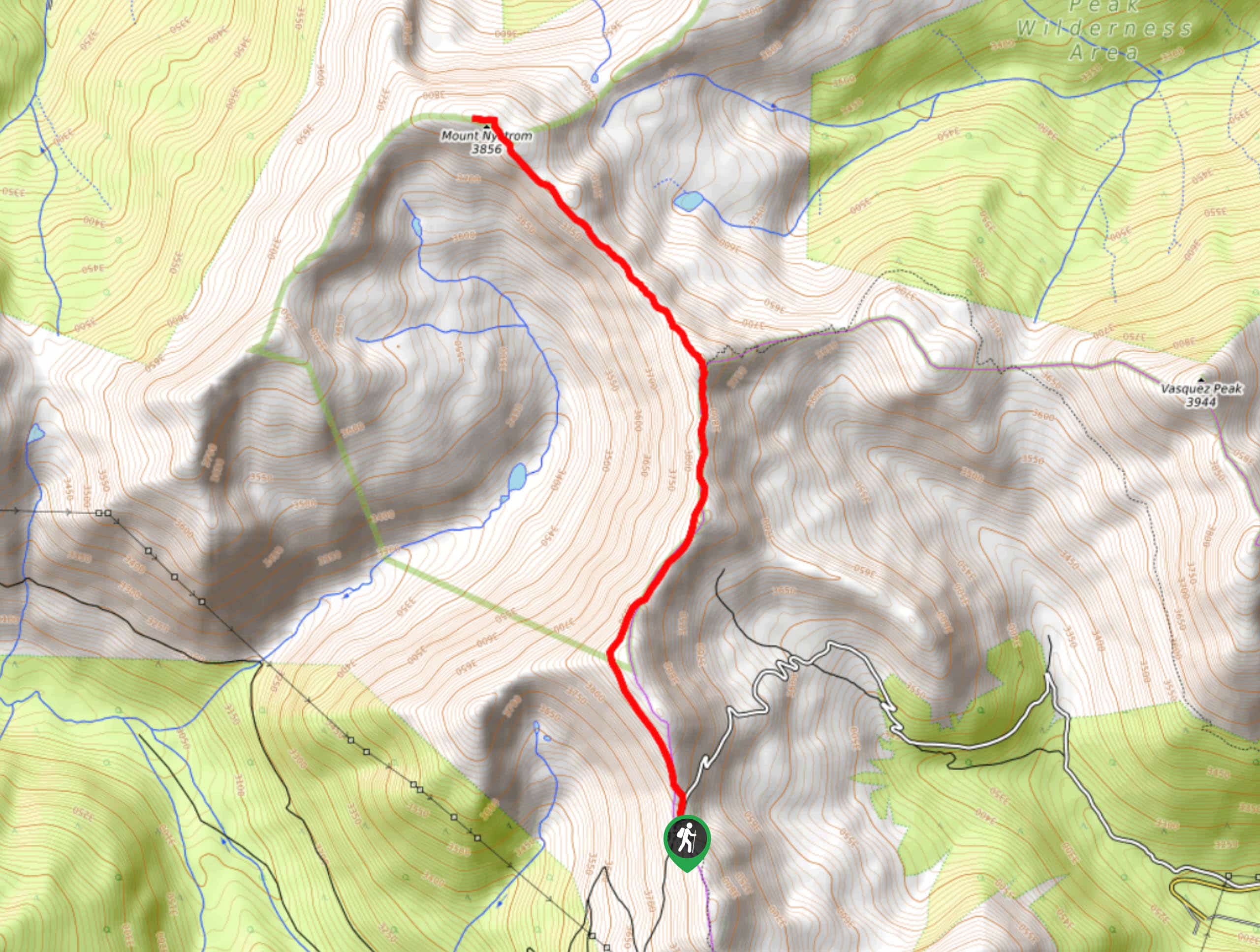
Mount Nystrom Trail
The Mount Nystrom Trail is an exciting adventure above the clouds. Hike the exposed path to the summit and enjoy…
Comments