
Red Rock Hike
View Photos
Red Rock Hike
Difficulty Rating:
The Red Rock Hike is a popular adventure in Staunton State Park, and there is no doubt as to why. Travel the well-marked, well-maintained trails through the quintessential Colorado landscapes. Hike through sagebrush, beneath aspens, and up a rocky ridge. This trail is sure to impress.
Getting there
The Red Rock Hike is located within Staunton State Park off S Elk Creek Road.

About
| Backcountry Campground | No |
| When to do | May-October |
| Pets allowed | Yes - On Leash |
| Family friendly | Yes |
| Route Signage | Good |
| Crowd Levels | High |
| Route Type | Out and back |
Red Rock Hike
Elevation Graph
Weather
Red Rock Hike Description
The Red Rock Hike is an awesome adventure up to the red-hued cliffs in Staunton State Park. The diversity of this trail will astound you. Hike through meadowlands, past streams, through mixed pine and aspen forests, all before culminating at the stunning overlook. Make sure you bring plenty of water on this excursion because more often than not, adventurers get sidetracked and trek the endless network of paths all day! Note the Staunton State Park charges a fee to enter. These passes typically cost around $10USD.
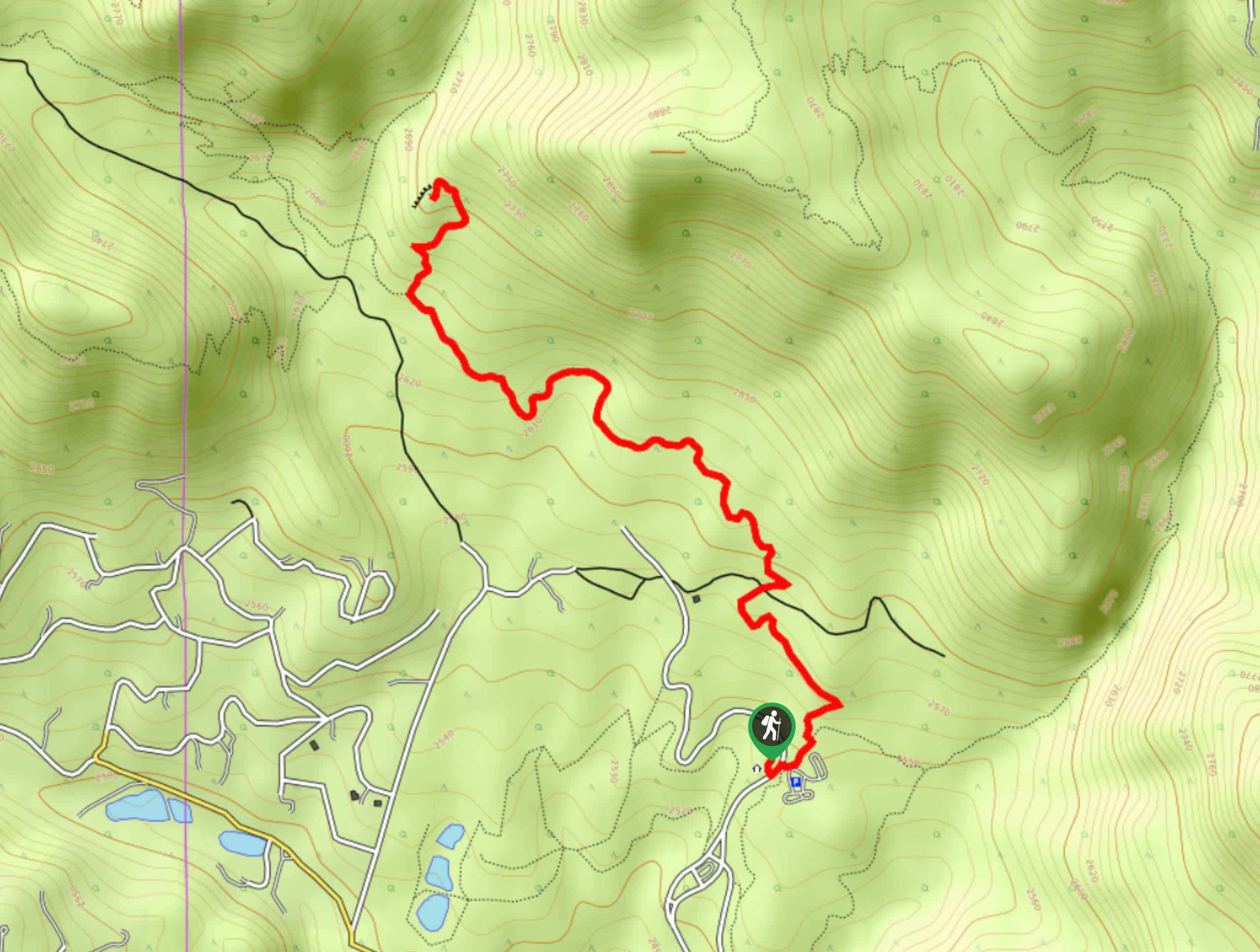
The Red Rock Hike departs from the Staunton Ranch Trailhead. From the trailhead, head northwest along the Staunton Ranch Trail. Hike the meadow-cloaked path along the base of the rocky cliffs. The route will then guide you beneath sparse tree coverage before delivering you to an intersection. At the junction, turn right and you will be diverted onto the Red Rock Trail. Ascend the rocky terrain to the summit of the red rocks.
Revel in the expansive views of the Front Range peaks from the overlook. Take a minute to appreciate the diversity of the Colorado environments before retracing your steps back to the trailhead.
Similar hikes to the Red Rock Hike hike

Miller Gulch Loop Trail
The Miller Gulch Loop Trail is a scenic meadowland adventure in the Pike National Forest. Hike through grassy meadows laden…

The Castle Hike
The Castle Hike is an exciting adventure up the steep, forested terrain to The Castle Rock. From atop the summit,…

Rutherford Trail
The Rutherford Hike is a charming nature walk in Georgetown Colorado. This secluded trail is a wonderful adventure the whole…
Comments