
Lake Park Loop Trail
View Photos
Lake Park Loop Trail
Difficulty Rating:
Hike the Lake Park Loop Trail to satisfy your movement goals for the whole week! This lengthy trail demands stamina as you trek over 20km through the scenic Colorado wilderness. Travel through aspens and spruce-interspersed forests, across alpine streams and to the Lizard Rocks. Though challenging, this hike rewards its adventurers with unforgettable scenery.
Getting there
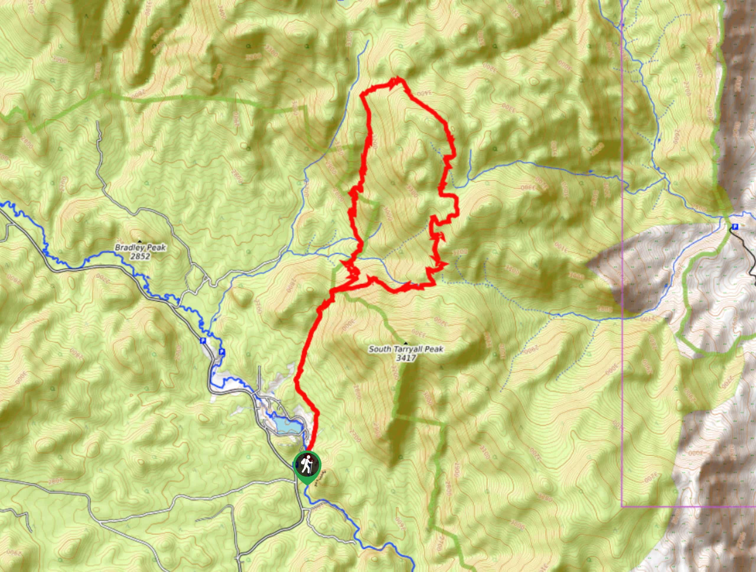
The Lake Park Loop Trail departs from the Spruce Grove Campground off Tarryall Road.

About
| Backcountry Campground | Dispersed Backcountry Camping Permitted, restrictions apply. |
| When to do | May-October |
| Pets allowed | Yes - On Leash |
| Family friendly | No |
| Route Signage | Average |
| Crowd Levels | Low |
| Route Type | Lollipop |
Lake Park Loop Trail
Elevation Graph
Weather
Lake Park Loop Hike Description
Get your heart rate up as you trek the Lake Park Loop Trail. Hike up steep terrains to a stunning overlook and lush wetlands. If you hope to avoid the crowds that many other hikes in the Lost Creek Wilderness draw, then the Lake Park Loop is a great option. We worry this hidden gem won’t stay hidden much longer, so best to adventure this hike ASAP. Note that there have been rattlesnakes spotted, and the Lizard Rock Trail has barbed wired along the edges of the path, so best keep your furry friend on a short leash during the initial segment of this hike. Visitors are also required to carry a self-issued hiking permit. These can be picked up from the trailhead and must be kept on you for the entirety of your excursion!
Begin your journey around the Lake Park Loop from the Spruce Grove Campground. From the trailhead, track north up the Lizard Rock Trail, intersecting with Tarryall Creek. Hike up the forested path, and you will eventually meet an intersection. If you wish to explore Lizard Rock and the overlook, turn left. Admire the grandeur of the Lizard Rock and retrace your steps to the junction. At this point, you will want to turn right onto the Hankins Pass Trail. Hike northeast along this route, and at the next intersection, keep left, and you will be diverted onto Lake Park Trail.
Ascend the Lake Park Trail through aspen groves, wetlands, and up rocky ridges. Eventually, the path will curve you west and deliver you to another fork in the road. Here, turn left onto Brookside McCurdy Trail. This route will guide you south down a forested gulch. Enjoy the foliage as you descend the trail that intersects with several alpine streams. Soon the path will meet another junction, take the Hankins Pass Trail, then merge back onto the Lizard Rock Trail. From this point, retrace your steps along this route back to the campground.
Similar hikes to the Lake Park Loop Trail hike

Hankins Pass Hike
The Hankins Pass Hike is a quintessential adventure across the Lost Creek Wilderness. The hike demonstrates the diversity of the…

Miller Gulch Loop Trail
The Miller Gulch Loop Trail is a scenic meadowland adventure in the Pike National Forest. Hike through grassy meadows laden…

The Castle Hike
The Castle Hike is an exciting adventure up the steep, forested terrain to The Castle Rock. From atop the summit,…
Comments