Colorado Mines Peak Hike
View Photos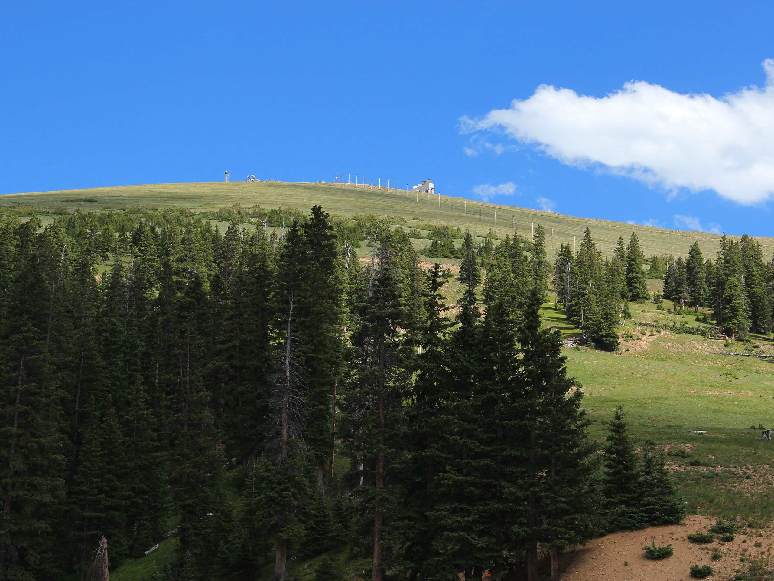
Colorado Mines Peak Hike
Difficulty Rating:
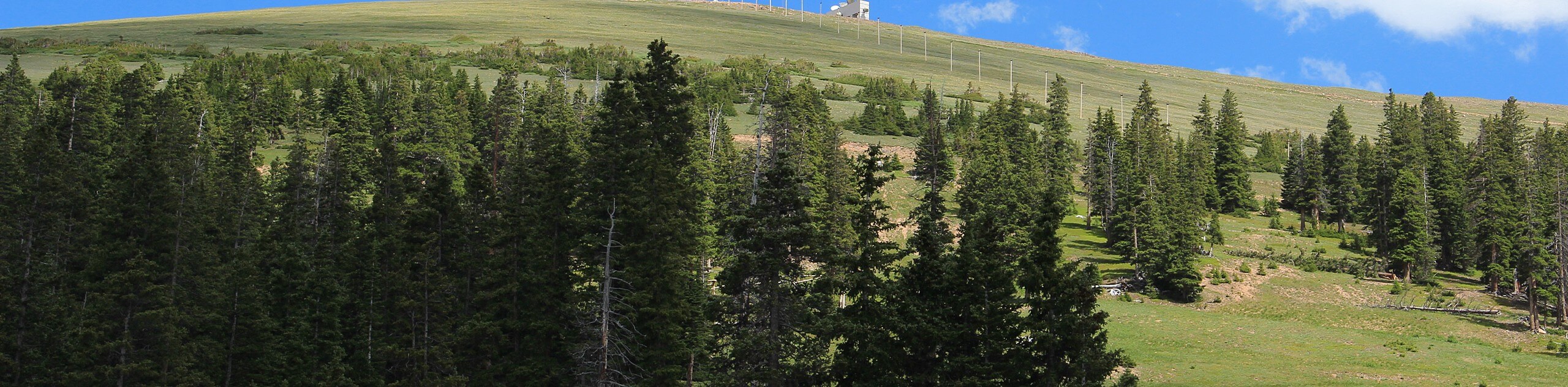
The Colorado Mines Peak Hike is a neat excursion in the Rocky Mountains. Trek up a winding service road to the Mines Peak summit and weather station. The Mines Peak summit is dotted with equipment that the Colorado Mines School uses to aid in aviation navigation through the Rocky Mountains.
Getting there
The Colorado Mines Peak Hike departs from the Berthoud Pass Parking Lot on the east side of the US-40.

About
| Backcountry Campground | No |
| When to do | Year-round |
| Pets allowed | Yes - On Leash |
| Family friendly | Older Children only |
| Route Signage | Good |
| Crowd Levels | High |
| Route Type | Out and back |
Colorado Mines Peak Hike
Elevation Graph
Weather
Colorado Mines Peak Hike Description
Hike up the famous Continental Divide to Colorado Mines Peak. This trail is a crowd favorite. Navigate switchbacks up the dirt service road up to the summit and weather station. The dirt road that guides hikers to the peak is obvious and the terrain is moderate. Though the path is easy to follow, note that you will be climbing up a steep path with extreme elevation gain. Make sure you are properly acclimated to the altitude in the area before commencing this hike. Know your boundaries, and if you begin to feel altitude sick, turn around.
Due to the high elevation of the peak, you can also expect snow and inclement weather. Wear layers and be prepared to track through snow as you ascend the path. Note this trail is open year-round; trade your hiking boots for snowshoes in the winter months. Whether you summit this trail in the summer or winter, ensure to bring plenty of water to stay hydrated during your exciting Front Range excursion.
The Colorado Mines Peak Hike is a great introductory trail to summit hiking in the Rocky Mountains. Compared to other adventures in the area, the route up to the mountain is explicit and easy to navigate. Don’t be fooled; it isn’t an easy hike, but it is well marked compared to many of the other primitive peak excursions in the area. Furthermore, you will get up close and personal with the Berthoud Pass Automated Weather Observing System. Some may argue the weather station is an eyesore, but we think it’s pretty interesting. This station ensures safe aviation navigation through the inclement weather so common within the Colorado Front Range. Additionally, you will be rewarded with panoramic vistas of neighboring craggy peaks that hem the river valleys below.
Embark on your adventure to summit the Colorado Mines Peak from the Berthoud Pass Parking Lot. From the carpark, take the Mines Peak Trail southeast. The initial segment of the hike will guide you through the dense Colorado woodlands. Admire the lush aspens as you navigate the first switchback. Continuously climbing in elevation, your legs will begin to feel it!
Follow along the trail as you summit the timberline and the terrain changes from an alpine forest to an alpine tundra. Once you make it out of tree cover, you will encounter an intersection, keep right on the Mines Peak Trail. Hike the steep, exposed route as you ascend towards the peak. Now at a high altitude, expect snow and wind as you maneuver the last segment of the hike.
Hike along the trail and navigate the last few switchbacks to summit the Continental Divide. Either the high elevation or the impressive 360-degree vistas will take your breath away as you ascend. Revel in the postcard worthy views from the summit of Colorado Mines Peak. If it is a clear day, you will be able to spot Mount Flora and Breckenridge Peak in the east. Explore the weather station and catch your breath before retracing your footsteps down the peak to the carpark.
Trail Highlights
Colorado Mines Peak
The Colorado Mines Peak sits at 12507ft of elevation and is situated along the famous Continental Divide. Though the service road is closed to personal vehicles, it is one of the highest mountain roads in Colorado. At the top of the peak, find the Berthoud Pass Automated Weather Observing System. This automated weather station is used by the Colorado Mines School to collect information on impending weather systems in the Rocky Mountains.
Insider Hints
If you are climbing the Colorado Mines Peak in the autumn or the winter, wear gaiters to keep snow out of your hiking boots.
For winter treks, wear snowshoes and bring hiking poles to help you navigate deep snow drift.
Ski goggles are a great accessory for windy winter summit hikes.
In the summer, consider hiking up the peak in the morning to avoid afternoon thunderstorms at the summit
Similar hikes to the Colorado Mines Peak Hike hike

Hankins Pass Hike
The Hankins Pass Hike is a quintessential adventure across the Lost Creek Wilderness. The hike demonstrates the diversity of the…

Miller Gulch Loop Trail
The Miller Gulch Loop Trail is a scenic meadowland adventure in the Pike National Forest. Hike through grassy meadows laden…

The Castle Hike
The Castle Hike is an exciting adventure up the steep, forested terrain to The Castle Rock. From atop the summit,…
Comments