
Mount Flora Hike
View Photos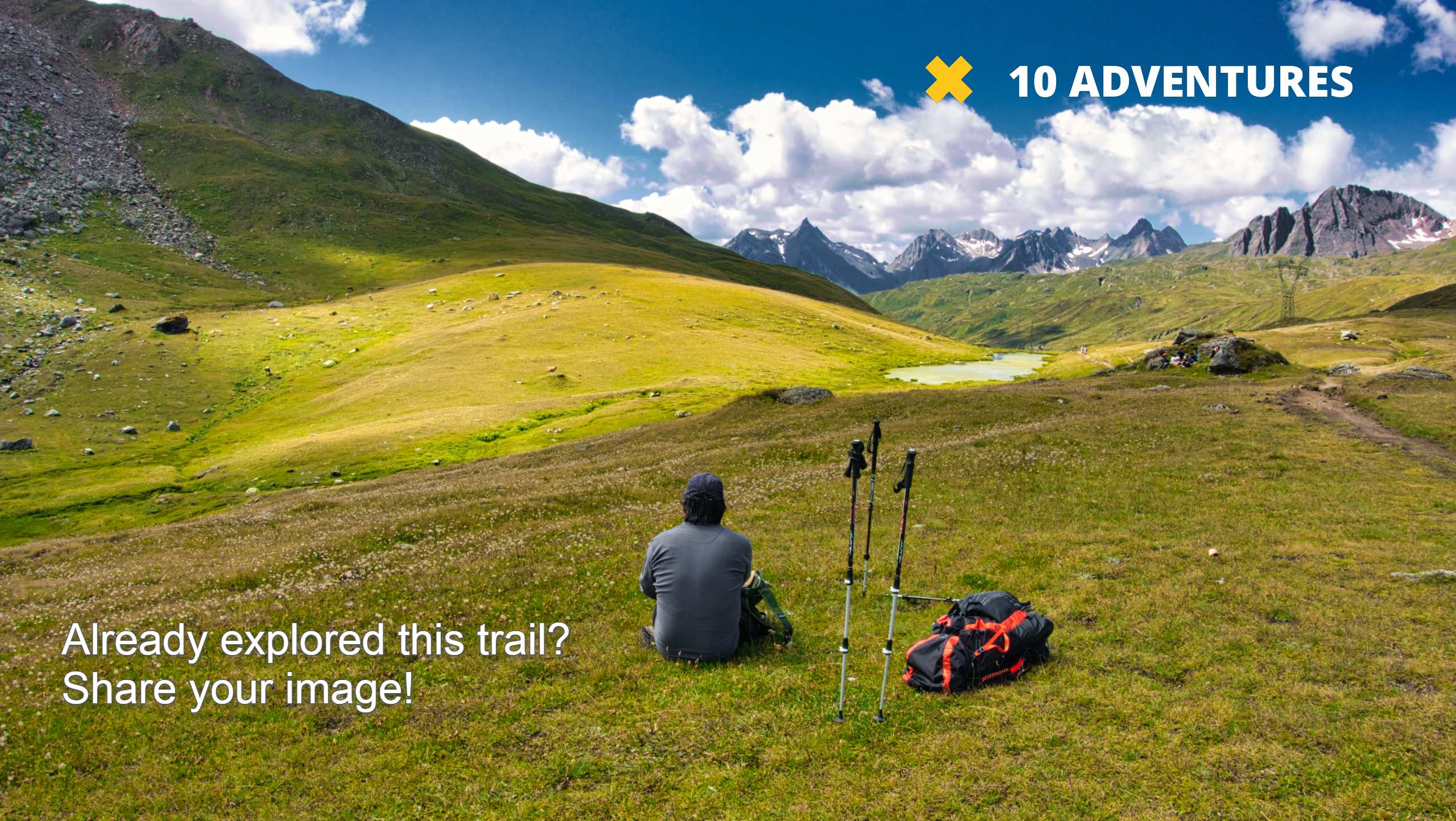
Mount Flora Hike
Difficulty Rating:
Hike the Mount Flora Trail up the Continental Divide and enjoy overwhelming 360-degree vistas of the surrounding Front Range. This hike is challenging, but manageable and well worth the effort! The next time you find yourself near Idaho Springs, make sure you plan an adventure day to Mount Flora.
Getting there
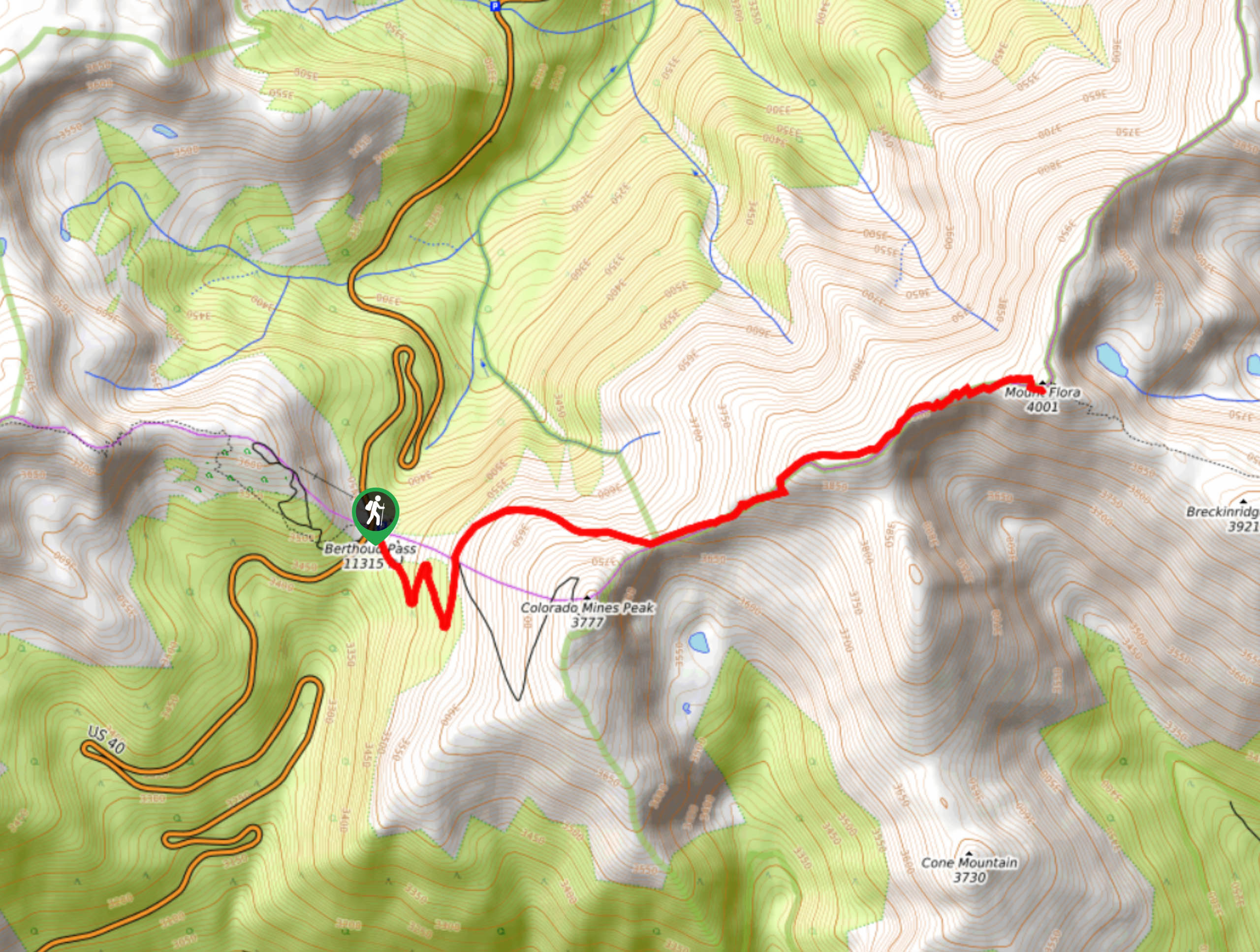
Access to the Mount Flora Trail is off of highway 40. Park in the Berthoud Pass Parking Lot.

About
| Backcountry Campground | No |
| When to do | May-September |
| Pets allowed | Yes - On Leash |
| Family friendly | Older Children only |
| Route Signage | Poor |
| Crowd Levels | High |
| Route Type | Out and back |
Mount Flora Hike
Elevation Graph
Weather
Mount Flora Hike Description
The Mount Flora Hike is a wonderfully scenic trail along the ridgeline of the famous Continental Divide. Challenging in spots, but highly rewarding, this hike should be added to your adventure bucket list. Walk along the exposed pass and take in the panoramic views of the surrounding mountainous landscape. Note that Mount Flora Hike is notoriously windy. Be prepared to get blasted with wind gusts once you summit the ridgeline, so make sure to wear plenty of layers and bring gloves and a hat. Though we enjoy this hike most in the summer months, you can hike the Mount Flora trail in the autumn and winter too. If you enjoy hikes in the cooler seasons, you can expect plenty of snow as you ascend the pass and summit Mount Flora. Bring snowshoes and trekking poles to help you navigate deep snow drifts!
Hike up into the clouds on the Mount Flora Trail. This trail is truly whimsical. Summit the Continental Divide, bask in the expansive views of the subalpine forests below and summit a Colorado peak. You will feel like the main character of a movie as you trek up the mountain’s trail. As you can tell we really enjoy this hike, and we can’t recommend it enough.
Begin your journey up to Mount Flora from the Berthoud Pass Parking Lot. The Mount Flora Trail shares a trailhead with the Colorado Mines Peak Trail. Parking is plenty, but even so we recommend arriving early to mitigate the chances of getting caught in an afternoon storm at the summit. When you are ready to take off, track south on the Mines Peak Trail. Continue along this path as it guides you through the pine woodlands and up a few steep switchbacks. Travel the path back and forth until you reach a junction. Here, veer left, and you will be diverted onto the Mount Flora Trail, otherwise known as the Continental Divide Trail (CDT).
The Mount Flora Trail is almost entirely exposed to the elements as the path guides you up the rocky pass. At this point, trail markers become more sparse, simply follow along the ridgeline path or follow the trail GPS to help you navigate this section. Follow the windy trail as it curves you northeast and up to the Continental Divide’s pass. Hike the rocky ridge and get an up close and personal view of the Colorado Mines Peak in the south. Track along the ridge and you will gradually gain elevation. At such a high altitude you may feel more out of breath than usual, take breaks and drink plenty of water.
Continue along the pass trail and it will guide you to the base of Mount Flora. Keep an eye out for marmots in the area! Navigate several tightly wound switchbacks up to the summit of Mount Flora. From the summit, enjoy 360-degree views of the Colorado wilderness for as far as the eye can see. Bask in the impressive landscape and notice Ethel Lake in the northeast. Neighboring summit, Breckinridge Peak, is situated in the southeast and Cone Mountain in the south.
Take in the stunning mountain views from an elevation of 13150ft before heading back. If you still have some fuel in the take, follow the trail down the saddle and follow the ridgeline trail over to Breckinridge Peak. If you are tuckered out, like we usually are at this point, simply backtrack along the trail all the way back to the parking lot.
Insider Hints
Trekking poles have proven to be useful when hiking the windy ridgeline to Mount Flora’s summit.
If you enjoy winter excursions, trade your hiking boots for snowshoes and climb the snowy pass.
Even if you don’t think you will need them, bring an extra layer and a hat and mitts, you will thank us later.
Similar hikes to the Mount Flora Hike hike

Hankins Pass Hike
The Hankins Pass Hike is a quintessential adventure across the Lost Creek Wilderness. The hike demonstrates the diversity of the…

Miller Gulch Loop Trail
The Miller Gulch Loop Trail is a scenic meadowland adventure in the Pike National Forest. Hike through grassy meadows laden…

The Castle Hike
The Castle Hike is an exciting adventure up the steep, forested terrain to The Castle Rock. From atop the summit,…
Comments