
South Chicago Creek Hike
View Photos
South Chicago Creek Hike
Difficulty Rating:
Hike up the South Creek Trail to a stunning overlook of a mountain cirque. This forested hike is beautiful and if you don’t mind off-roading a bit, we know you will enjoy it. Compared to other paths in the Mount Evans Wilderness, the South Chicago Creek trail is secluded, perfect for those seeking to distance themselves from the crowds. On your next trip out to the Mount Evans Wilderness make sure to add the South Chicago Creek Hike to your itinerary.
Getting there
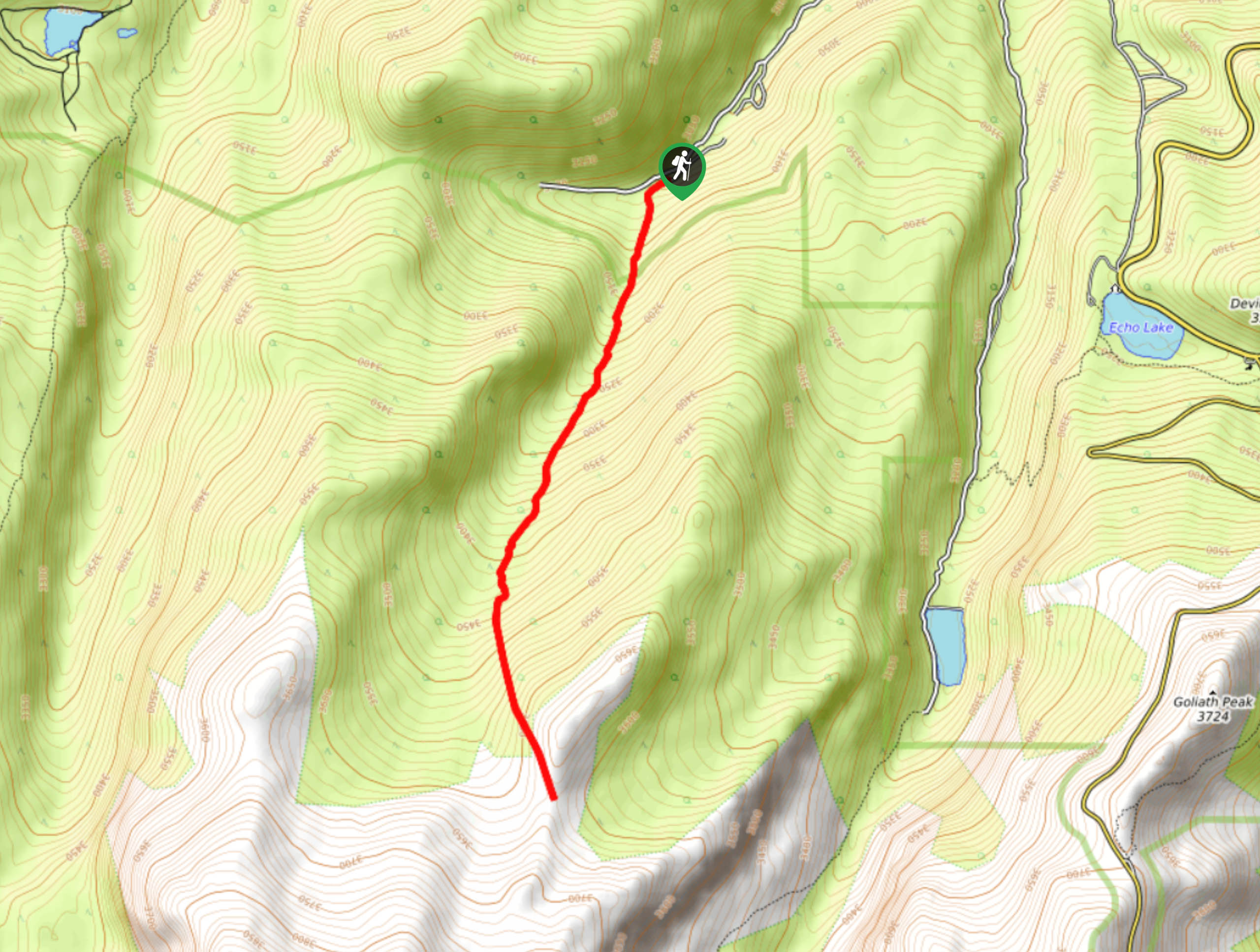
The South Chicago Creek Hike is located off Hefferman Gulch Road.

About
| Backcountry Campground | Dispersed Backcountry Camping, restrictions apply. |
| When to do | Year-Round |
| Pets allowed | Yes - On Leash |
| Family friendly | Older Children only |
| Route Signage | Poor |
| Crowd Levels | Low |
| Route Type | Out and back |
South Chicago Creek Hike
Elevation Graph
Weather
South Chicago Creek Hike Description
Hike through the Mount Evans Wilderness on the Chicago Creek Trail. Trek up to the overlook where views of the surrounding peaks and alpine lakes below await you. This primitive trail does require some navigation and trailblazing. We recommend bringing along the trail GPS to help you maneuver the unmarked sections of the path. As you travel up the forested valley, we can almost guarantee that you will see some wildlife, be it moose, elk or a bear. Enjoy these majestic creatures from a distance but do snap some pics! This wonderful day excursion is manageable for most hikers, but it is worth noting that it climbs all the way to the lookout, so your legs will be feeling it.
Lace up those hiking shoes and grab your water, it’s time to head out into the wilderness. From the trailhead, follow the South Chicago Creek Trail southwest. From the parking lot this trail will guide you below the treeline. Hike up the steep grade before the incline becomes increasingly gradual. Trek up the aspen and pine mixed forest and keep an eye out for wildlife. Climb up the route and enjoy the meditative ambiance that the South Chicago Creek creates. Hike along the babbling creek as you gradually ascend the ridge. Eventually, you will summit the timberline and views of the mountainous landscape will overwhelm you.
From the rocky ridge, notice the Chicago Lakes below in the south and Gray Wolf Mountain over the ridge. Revel in the grandeur of the mountain cirque and see fellow adventurers hiking below. When you are ready, simply retrace your footsteps all the way back to the parking lot.
Similar hikes to the South Chicago Creek Hike hike

Hankins Pass Hike
The Hankins Pass Hike is a quintessential adventure across the Lost Creek Wilderness. The hike demonstrates the diversity of the…

Miller Gulch Loop Trail
The Miller Gulch Loop Trail is a scenic meadowland adventure in the Pike National Forest. Hike through grassy meadows laden…

The Castle Hike
The Castle Hike is an exciting adventure up the steep, forested terrain to The Castle Rock. From atop the summit,…
Comments