
Wildcat Canyon Trail
View Photos
Wildcat Canyon Trail
Difficulty Rating:
The Wildcat Canyon Trail is an outdoor excursion that all sorts of outdoor enthusiasts can enjoy. Shared with mountain bikers and OHV’s, this adventure down to the rocky canyon offers something for everyone. Travel the dirt path down to a stunning overlook of the South Platte River and Wildcat Canyon.
Getting there
The Wildcat Canyon Trailhead is located off Goose Creek Road.

About
| Backcountry Campground | No |
| When to do | Year-round |
| Pets allowed | Yes - On Leash |
| Family friendly | Older Children only |
| Route Signage | Average |
| Crowd Levels | Low |
| Route Type | Out and back |
Wildcat Canyon Trail
Elevation Graph
Weather
Wildcat Canyon Hike Description
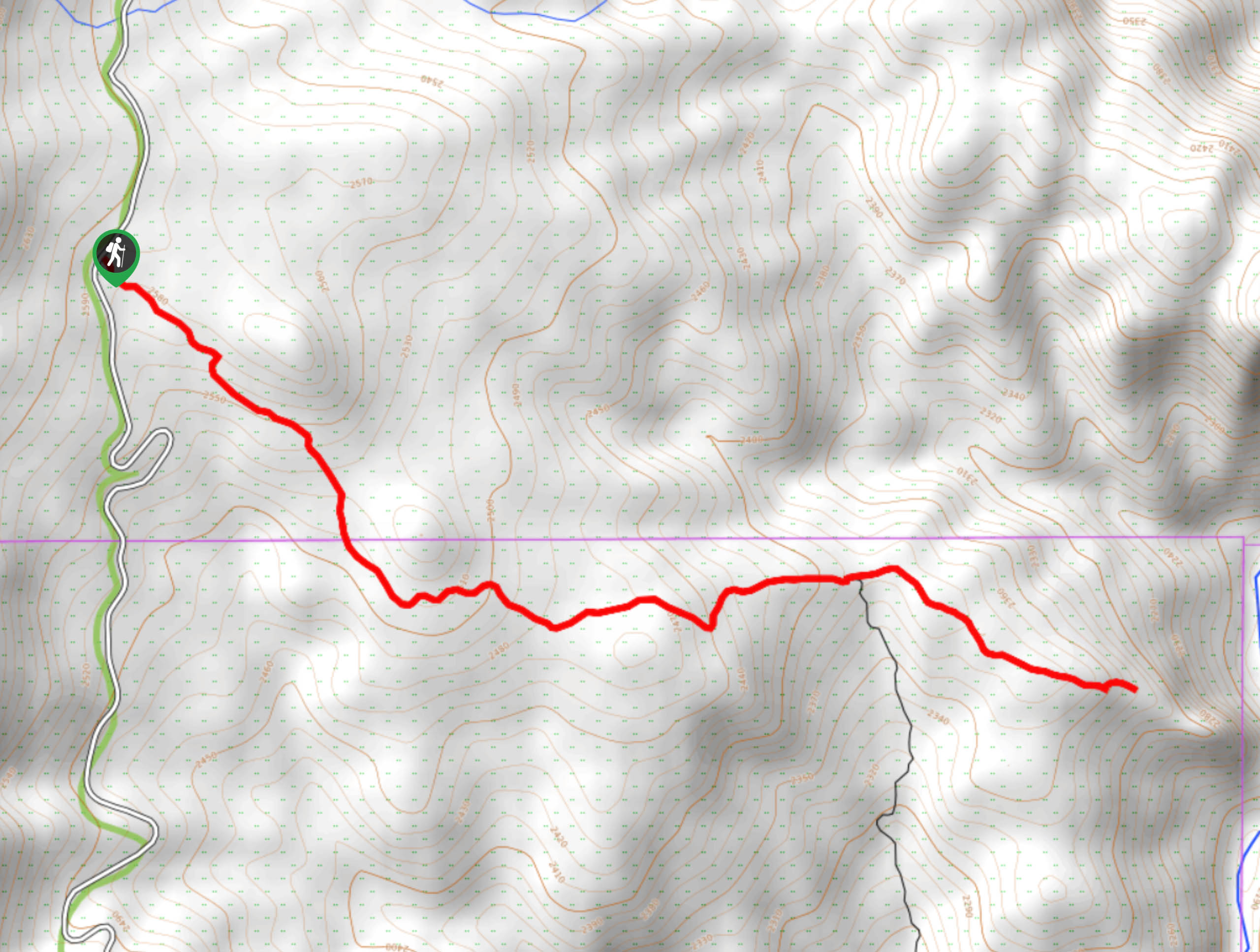
Drive it, bike it, run it or hike it; the Wildcat Canyon Trail is a thrilling outdoor adventure. Located just outside the Lost Creek Wilderness, this trail is secluded. Hike along the desert-esque trail down into the valley dotted with few trees. Note that the route is almost entirely exposed, so wear sunscreen and pack plenty of water on warm summer days. Though steep in sections, this trail is easily manageable by hikers of almost all skill levels. Though the terrain is mild, it can be easy to get off track. Bring along the trail GPS to ensure you are trekking along the correct route. It is also worth noting that this excursion lives up to its name, and there are often cat tracks left behind in the dirt. Exercise caution and be mindful of the wildlife.
Park prior to the gate off Goose Creek Road if you are hiking the trail. When you are parked, track southeast down the Wildcat Canyon Trail. Hike down the exposed path lined with a few lodgepoles and down into the valley. Track along the meadows and enjoy the expansive views of the surrounding mountainous landscape. Eventually, you will confront a junction, veer left, staying on the Wildcat Canyon Trail. Continue hiking, and you will meet your turnaround point. From here, enjoy panoramic vistas of the Wildcat Canyon and South Platte River below.
Revel in the grandeur of the stone cliffs that flank the running river below. Enjoy the sights of the Canyon and retrace your steps along the route back to the car park when you are ready.
Similar hikes to the Wildcat Canyon Trail hike

Hankins Pass Hike
The Hankins Pass Hike is a quintessential adventure across the Lost Creek Wilderness. The hike demonstrates the diversity of the…

Miller Gulch Loop Trail
The Miller Gulch Loop Trail is a scenic meadowland adventure in the Pike National Forest. Hike through grassy meadows laden…

The Castle Hike
The Castle Hike is an exciting adventure up the steep, forested terrain to The Castle Rock. From atop the summit,…
Comments