
Loch Lomond Loop Trail
View Photos
Loch Lomond Loop Trail
Difficulty Rating:
The Loch Lomond Loop Trail is a stunningly scenic circuit trail around a bunch of alpine lakes hemmed by the craggy peaks that sit atop the Continental Divide. This stimulating path is a perfect adventure for the whole family to get out into the wilderness. Lace up your sneakers and head out on the Loch Lomond Loop.
Getting there
The Loch Lomond Loop Trail is at the end of the Loch Lomond Road.

About
| Backcountry Campground | Dispersed Backcountry Camping, see rules and regulations. |
| When to do | June-September |
| Pets allowed | Yes - On Leash |
| Family friendly | Yes |
| Route Signage | Poor |
| Crowd Levels | High |
| Route Type | Circuit |
Loch Lomond Loop Trail
Elevation Graph
Weather
Loch Lomond Loop Hike Description
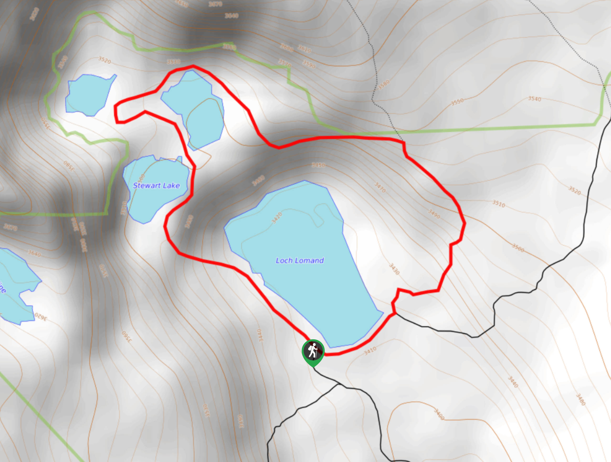
The Loch Lomond Loop Hike is a sight for sore eyes. Hike around the crystalline alpine lakes and visit the marmots that hide amongst the rocks. Enjoy the scenery of the small alpine waterfall and the vistas of the Continental Divide as you hike the primitive trail. We recommend using the trail GPS to ensure you remain on the right track. Nevertheless, this adventure is one for the books! It is worth noting that the road up to the trailhead is rough and rugged. It is suggested that only 4×4 vehicles adventure this road. If you do not have a vehicle with high ground clearance, park at the lower gate off Stewart Road and hike in. Note that the second gate closes seasonally, so if you visit in the off season, you will have no choice but to hike in.
Hike the Loch Lomond Loop Trail and admire the vistas of the shimmering lakes and forested landscape below. This circuit can be completed in either direction, but we prefer to hike it clockwise. From the trailhead, hike northwest along the shore of Loch Lomond Lake. Revel in the crystal-clear waters and notice Lake Caroline in the west. Continue trekking along the primitive route and you will soon pass Stewart Lake. Track around the lake and the trail will guide you past Reynolds Lake on the right. Travel along the ridge as the path guides you northwest towards Ohman Lake. At this point, the route will begin to curve northeast and lead along the ridge above Loch Lomond Lake.
Eventually the path will return you back to the trailhead and car park. Before taking off try your hand at some trout if you have your permit and fishing rod. Make sure to admire the grandeur of the Continental Divide that towers above before heading out.
Similar hikes to the Loch Lomond Loop Trail hike

Miller Gulch Loop Trail
The Miller Gulch Loop Trail is a scenic meadowland adventure in the Pike National Forest. Hike through grassy meadows laden…

The Castle Hike
The Castle Hike is an exciting adventure up the steep, forested terrain to The Castle Rock. From atop the summit,…

Rutherford Trail
The Rutherford Hike is a charming nature walk in Georgetown Colorado. This secluded trail is a wonderful adventure the whole…
Comments