Fall River Lake Trail
View Photos
Fall River Lake Trail
Difficulty Rating:
A hike around a stunning crystalline lake? Yes, please! The Fall River Lake Trail is a wonderful adventure in the wilderness that hikers of all skill-levels will enjoy! Contrary to the name, you can enjoy this excursion year around, though the changing foliage in the fall does add a little je ne sais quoi.
Getting there
The Fall River Lake Trail is located at the end of Rainbow Road in the James Peak Wilderness.

About
| Backcountry Campground | Dispersed Camping at Designated Spots around the Lake |
| When to do | April-October |
| Pets allowed | Yes - On Leash |
| Family friendly | Yes |
| Route Signage | Poor |
| Crowd Levels | Moderate |
| Route Type | Circuit |
Fall River Lake Trail
Elevation Graph
Weather
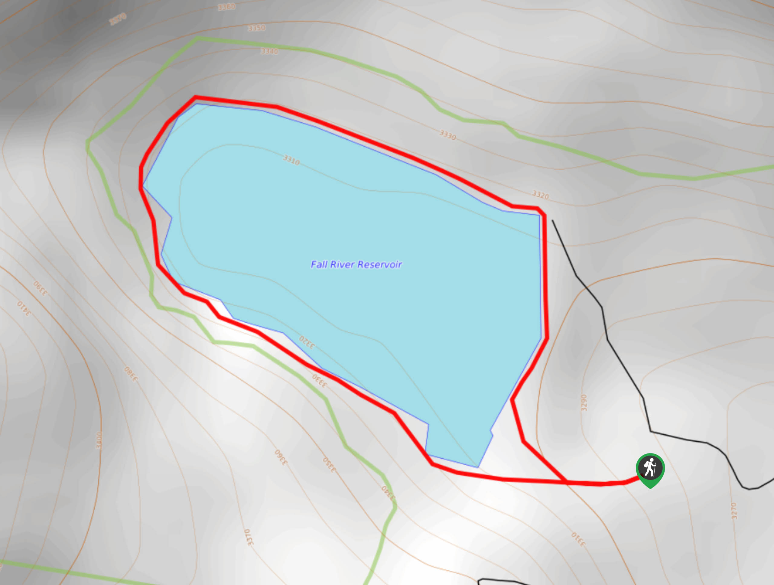
Fall River Lake Hike Description
The Fall River Lake Hike is a wonderfully scenic short nature walk that hugs the shoreline of the Fall River Lake. This trail is very primitive so you may have to bushwhack and find your own path! Worse comes to worse, follow the lake’s edge the entirety of the way around! Additionally, the last section at the road to the trailhead is not paved and it is washed out in areas. A 4×4 vehicle with ground clearance should have no issue but drive the road at your own risk. If you don’t feel comfortable driving all the way to the trailhead, park alongside the paved area and walk in. If you have a permit, grab your fishing rod! The Fall River Lake is a popular fishing destination.
Embark on your hike around the Fall River Lake Trail from the trailhead at the end of Rainbow Road. The loop can be completed from either direction, but we recommend heading counterclockwise. From the road take the trail east and begin walking along the eastern shoreline. Hike along the path as it mildly undulates and crests the north ridge of the lake. As you walk you will eventually intersect with Fall River. Maintain along the path as best you can as you begin to curve southwest.
Track along the shoreline and you will be able to see Chinns Lake in the west when there is a break in the trees.Continue along the route until it veers east again, guiding you back to your car.
Similar hikes to the Fall River Lake Trail hike

Rutherford Trail
The Rutherford Hike is a charming nature walk in Georgetown Colorado. This secluded trail is a wonderful adventure the whole…
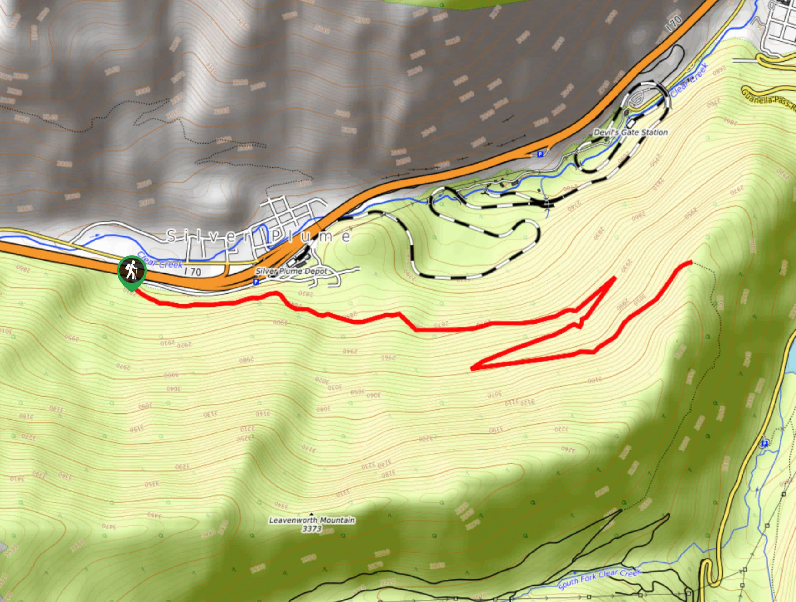
Pavilion Point Hike
The Pavilion Point Hike is an awesome adventure that the whole family can enjoy. Near Silver Plume Train Depot, kids…
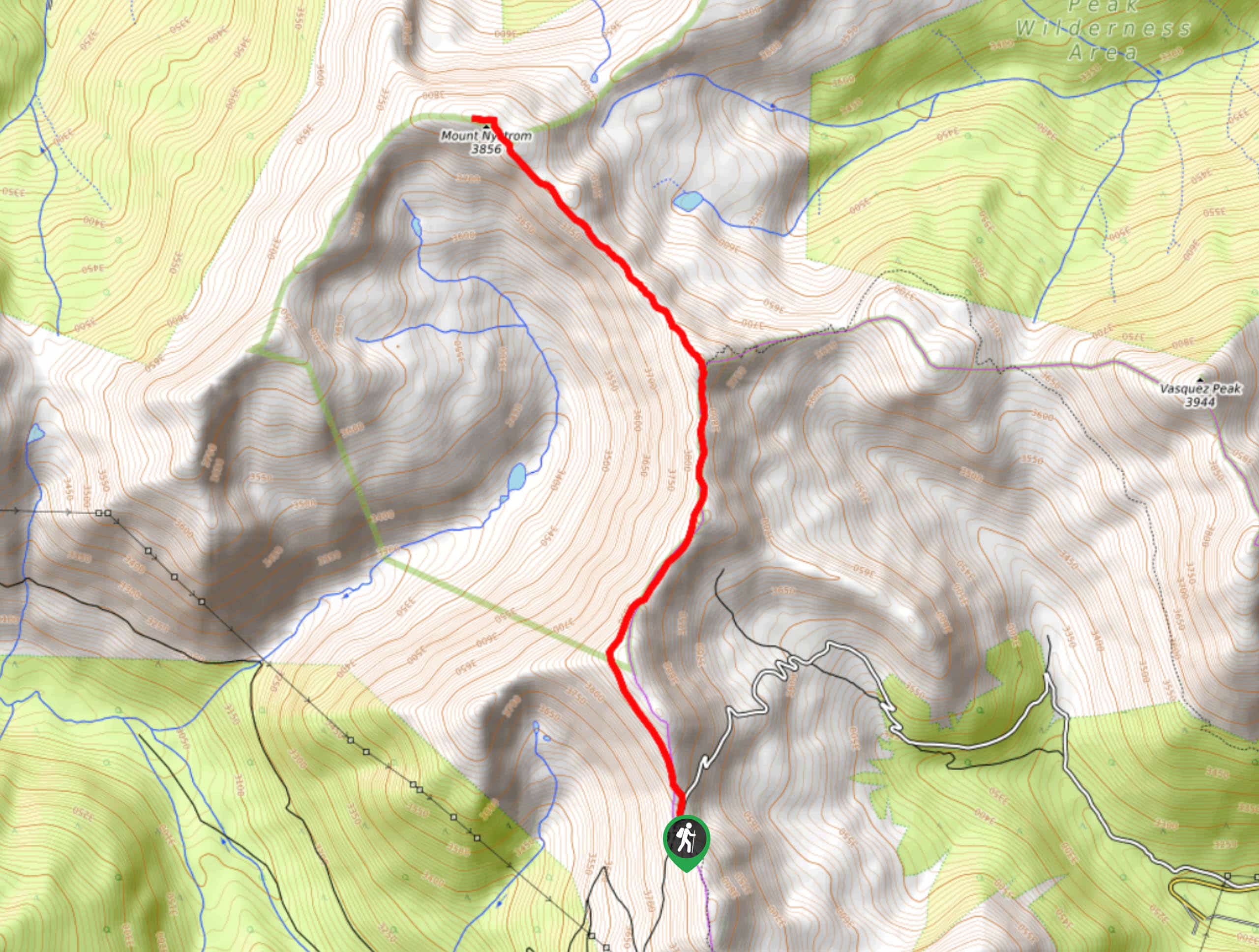
Mount Nystrom Trail
The Mount Nystrom Trail is an exciting adventure above the clouds. Hike the exposed path to the summit and enjoy…
Comments