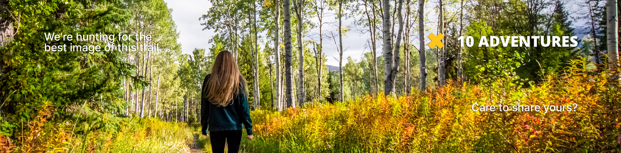
Cheesman Canyon Hike
View Photos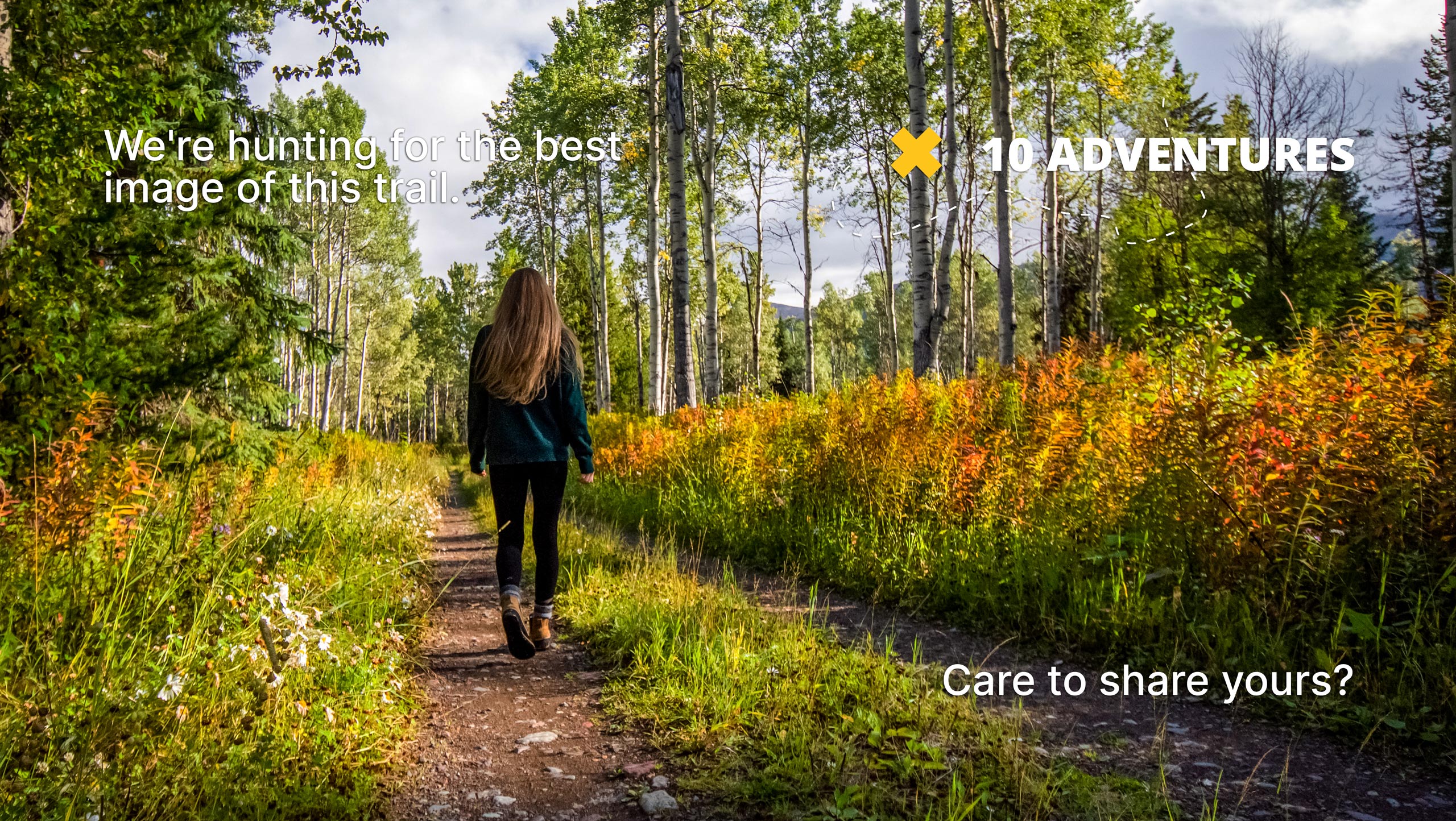
Cheesman Canyon Hike
Difficulty Rating:
We know what you are going to ask, only because we asked too. No, the Cheesman Hike does not lead you on a cheese tasting tour up the canyon, disappointing we know. But don’t turn your nose up just yet, this path makes up for the lack of snacks in riverside views. Follow the curves of the South Platte River and enjoy the tranquil sights of anglers fishing the picturesque waters. If you enjoy forested hikes, then you’ll like the Cheesman Canyon Trail.
Getting there
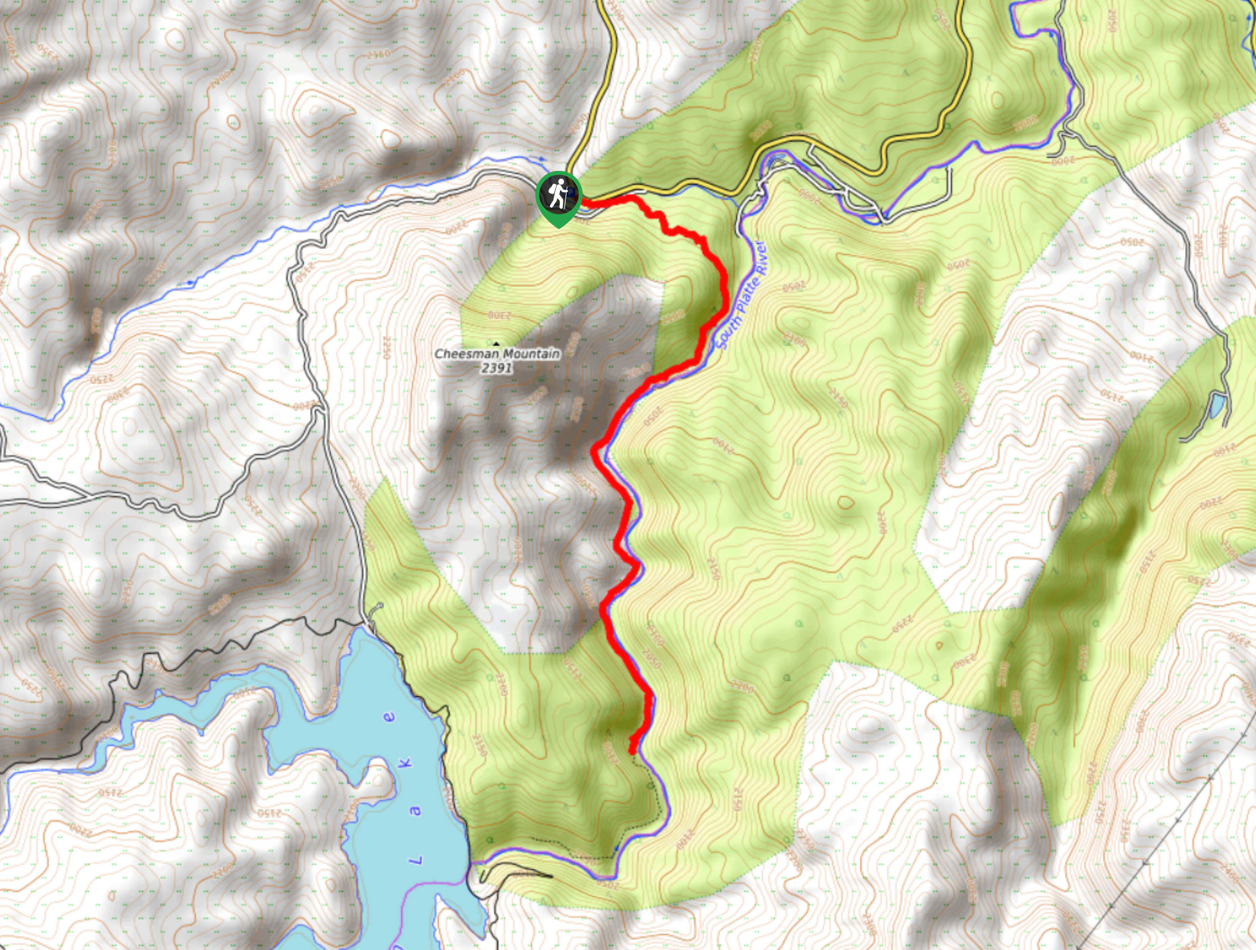
Depart on your adventure up Cheesman Canyon from the trailhead off Country Road 126.

About
| Backcountry Campground | No |
| When to do | Year-round |
| Pets allowed | Yes - On Leash |
| Family friendly | Older Children only |
| Route Signage | Poor |
| Crowd Levels | High |
| Route Type | Out and back |
Cheesman Canyon Hike
Elevation Graph
Weather
Cheesman Canyon Hike Description
Follow the beautiful Cheesman Canyon up the South Platte River. This serene hike is one of the most popular trails in the Pike National Forest, and we completely understand why. This trail is enjoyed by hikers and fisherman alike, so the small parking lot fills up fast—we recommend heading out in the morning to secure a spot! Morning hikes are better anyway, right? As you hike along the riverbanks, be mindful of the peaceful fisherman and watch your step! The rocky trail can be very slippery and dangerous. Mind your footing and do your best to stay on the trail. Additionally, the path can be tricky to follow in places, follow the trail GPS, and if worse comes to worst, follow along the river’s edge until you meet the route again. Note that the riverbank is ridden with poison ivy, so long pants are a must!
Tranquility and ambiance are two things I promise this trail will deliver. Be lulled by the sounds of the running river and enjoy the stunning scenery that is the Cheesman Canyon. Over many decades the South Platte River has worked hard to carve out what is the stunning rocky canyon. Notice the impressively smooth granite boulders that line the running river and the tall fir trees that tower over the banks. We love that this trail can be enjoyed year-round by adventurers and fisherman alike. Next time you find yourself in Denver, drive less than 1.5 hours into the wilderness and hike the Cheesman Canyon Trail.
Embark on your adventure up Cheesman Canyon from the parking lot and trailhead. Track east along the Cheesman Canyon Trail and cross the Wigwam Creek and Wigwam Creek Road. Here, the trail will begin to slightly curve south as it guides you into the woodlands. Hike along the forested path as you gradually climb up a ridge before dropping down into the canyon.
Once you descend into Cheesman Canyon, hike along the west side of the South Platte River. This section of the path will be fairly shaded as you hug the shore of the river. As the route weaves out of tree coverage, the path becomes less explicit. Do your best to follow the trail GPS or carefully navigate the rocky river’s edge until you find the path. Be wary of slippery rocks and feel free to stop and dip your toes into the inciting clear waters.
Go along the path as it guides you back into the woodlands. The trail continues to hug the curves of the South Platte River as it winds back and forth. Stay on the path and keep your eyes out for wildflowers in the warmer months. Continue hiking the route until the trail GPS ends. This is your turnaround point.
If you still have some gas in the tank, continue hiking along the river’s edge and ascend the ridge to Cheesman Lake. This will add some mileage to your excursion, but it’s a wonderfully scenic lakeside. When you are ready to return, retrace your steps all the way back to the parking lot.
Trail Highlights
South Platte River
The South Platte River is a renowned fishing river in Colorado. A tributary of the Platte River, the South Platte River served as a water source for the Great Plains long before the development of the city of Denver. In 1905, a dam was erected between the Cheesman Reservoir and the South Platte River. At the time, it was the world’s tallest dam. Since then, the South Platte River below the dam has become one of the hottest fishing destinations in the area, earning it the title of a “gold medal western trout river”. Thousands of fly fishermen flock to the South Platte River yearly to fish the abundant waters.
Insider Hints
If you choose to hike this trail in the winter, poles and snowshoes or microspikes are a must!
Bring your fishing pole and try your hand at some trout along the way.
Arrive early to ensure you get a parking spot.
Stay overnight at the Lone Rock Campground just down the road!
Similar hikes to the Cheesman Canyon Hike hike

Hankins Pass Hike
The Hankins Pass Hike is a quintessential adventure across the Lost Creek Wilderness. The hike demonstrates the diversity of the…

Miller Gulch Loop Trail
The Miller Gulch Loop Trail is a scenic meadowland adventure in the Pike National Forest. Hike through grassy meadows laden…

The Castle Hike
The Castle Hike is an exciting adventure up the steep, forested terrain to The Castle Rock. From atop the summit,…
Comments