
Lookout Mountain Hike
View Photos
Lookout Mountain Hike
Difficulty Rating:
Lookout Mountain really does live up to its name, trust us. Hike up the quintessential Colorado woodland path to the impressive Lookout Mountain summit. From the overlook, revel in the expansive views of the mountainous landscape, see the Mummy Range, Este Park, and Fort Collins from atop the peak.
Getting there
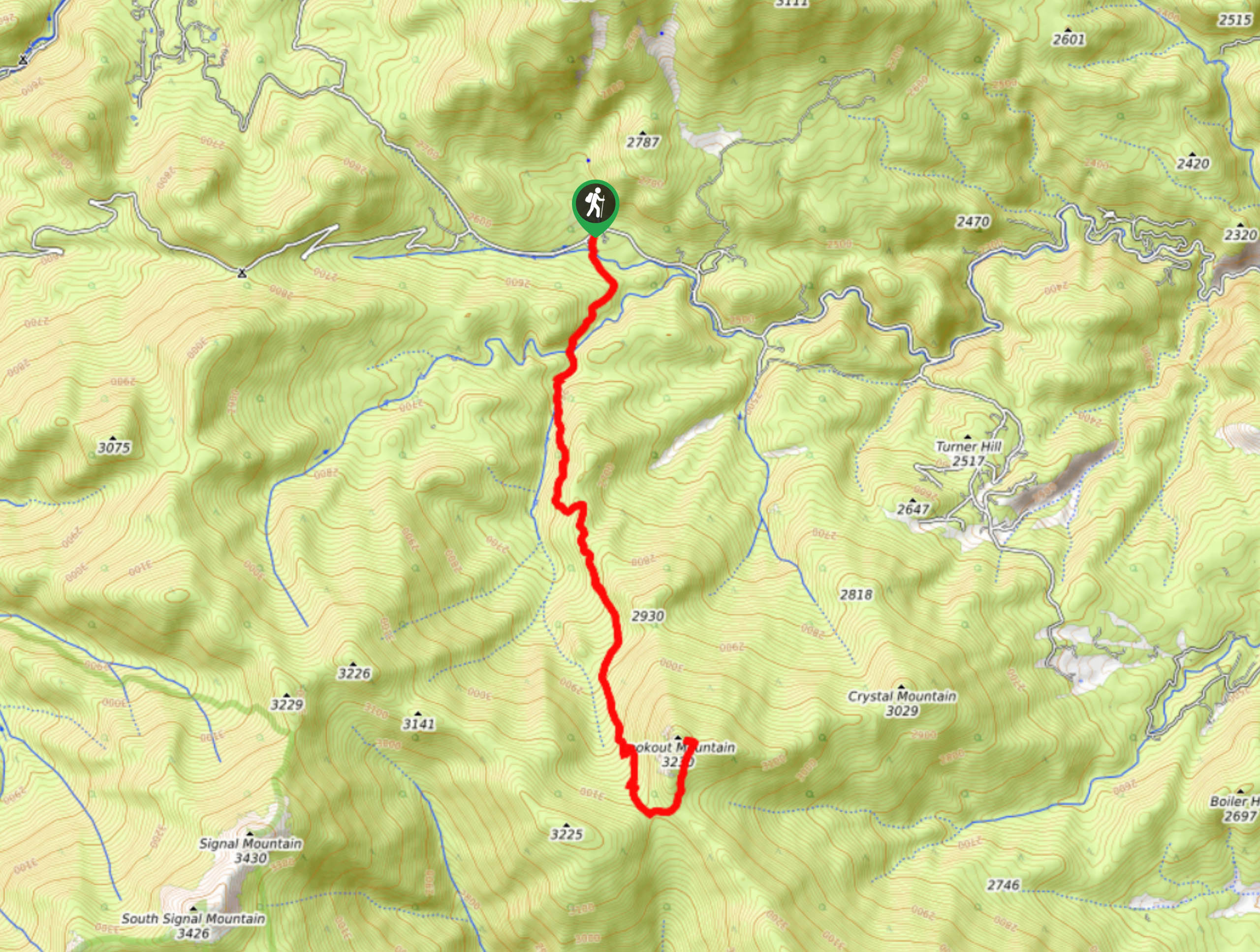
The Lookout Mountain Hike departs from the Donner Pass Trailhead off Buckhorn Road.

About
| Backcountry Campground | Dispersed Backcountry Camping, restrictions apply. |
| When to do | June-November |
| Pets allowed | Yes - On Leash |
| Family friendly | Older Children only |
| Route Signage | Average |
| Crowd Levels | Moderate |
| Route Type | Out and back |
Lookout Mountain Hike
Elevation Graph
Weather
Lookout Mountain Hike Description
The Lookout Mountain Hike and summit provides those who conquer the steep terrain to the summit with unforgettable views. Lookout Mountain rewards adventurers with breathtaking panoramas of the Front Range, Continental Divide, nearby cities and the forested valleys below. This trail is no walk in the park, ensure you are prepared to ascend the gradually inclining trail all the way to the mountain’s summit. We promise it is well worth the effort, but the progressive elevation gain will inevitably tire your legs. Pack plenty of water and prepare for snow as you ascend the route to the summit.
Embark on your adventure along the Lookout Mountain Trail from the Donners Pass Trailhead. Take the Donners Pass Trail and you will quickly intersect with Box Prairie Creek. Hike along the path and you will eventually cross over Elk Creek before encountering a junction. Here, stay straight on the Donners Pass Trail. Ascend the rocky, wooded path as it guides you along a creek and to another intersection. There are several routes at this intersection, so make sure to stay on the Donner Pass Trail. As you ascend the path the steepness will intensify as you climb the rocky, exposed ridge up to the summit. At the next two junctions, stay left and you will be diverted onto the Lookout Mountain Trail.
Climb the rocky path to the summit of Lookout Mountain. Admire the panoramic vistas of the surrounding wilderness and Rocky Mountain Range. Refuel and rehydrate before commencing your descent. When you are ready, backtrack along the path all the way to the trailhead and parking lot.
Similar hikes to the Lookout Mountain Hike hike

Hankins Pass Hike
The Hankins Pass Hike is a quintessential adventure across the Lost Creek Wilderness. The hike demonstrates the diversity of the…

Miller Gulch Loop Trail
The Miller Gulch Loop Trail is a scenic meadowland adventure in the Pike National Forest. Hike through grassy meadows laden…

The Castle Hike
The Castle Hike is an exciting adventure up the steep, forested terrain to The Castle Rock. From atop the summit,…
Comments